Contract for Annual Bathymetric Survey of the River Hamble
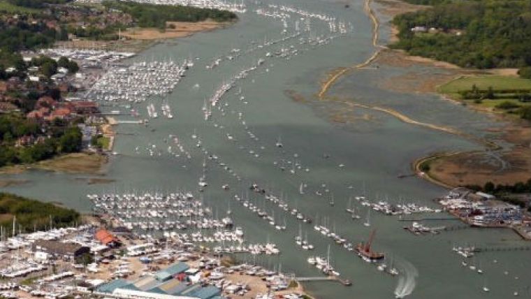
ABP Marine Environmental Research (ABPmer), UK, has been contracted by the River Hamble Harbour Authority to undertake its 2015 annual bathymetric survey. The survey is carried out to help the River Hamble Harbour Authority to maintain its knowledge of the water depths within the river and to capture any morphological changes that might be occurring over time.
ABPmer has been undertaking hydrographic surveys of the river annually since the 1990s. The survey site nominally covers the area from the harbour entrance to the tidal reaches at Curdridge and Botley.
Different sections of the river are surveyed on a rolling programme ensuring that all areas of the Harbour Authority’s jurisdiction are covered at least every 5 years. The decision on which stretch to be surveyed in any one year is determined by the requirements of the Hamble Harbour Master.
The surveys were originally carried out in the early summer months, however over the years, as the numbers of vessel movements have increased during this period they have been undertaken on spring tides during the autumn equinox. Surveying at this time of year provides a clearer waterway within which to work and enables the area of survey coverage to be maximised with access to the river margins as well as the main channels.
ABPmer provides the Hamble Harbour Master with paper charts and sends the data to the UKHO for inclusion in their Admiralty Chart No. 2022.

Value staying current with hydrography?
Stay on the map with our expertly curated newsletters.
We provide educational insights, industry updates, and inspiring stories from the world of hydrography to help you learn, grow, and navigate your field with confidence. Don't miss out - subscribe today and ensure you're always informed, educated, and inspired by the latest in hydrographic technology and research.
Choose your newsletter(s)


