News
ArcGIS for Maritime: Bathymetry 10.3 Adds Features
Esri, headquartered in the USA, has released ArcGIS for Maritime: Bathymetry 10.3, adding features such as the support for point feature classes.
Some of the added options are:
- Custom spatial reference: Users can specify which spatial reference they want to work in when creating their BIS.
- Skipping steps: Through the Manage BIS Settings Dialog, users can now disable certain steps of the Add Bathymetry Process to speed up their day-to-day work. This is particularly useful for users with a large amount of datasets registered in their BIS.
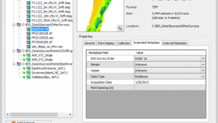
- New Add Bathymetry dialog: The Add Bathymetry Dialog window has had a major update! The interface has undergone an extensive upgrade, making it even more intuitive to large amounts of load bathymetric data and metadata. Alongside the familiar collection, extended and internal metadata fields, a new field has also been added to accommodate the BIS’s support of point feature classes.
- Removing datasets from the BIS: There is a new feature that allows users to remove a dataset that doesn’t currently belong to a surface model from a BIS.

Value staying current with hydrography?
Stay on the map with our expertly curated newsletters.
We provide educational insights, industry updates, and inspiring stories from the world of hydrography to help you learn, grow, and navigate your field with confidence. Don't miss out - subscribe today and ensure you're always informed, educated, and inspired by the latest in hydrographic technology and research.
Choose your newsletter(s)


