Dredging Point-cloud Software
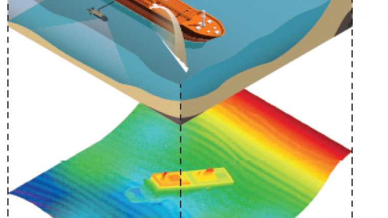
Charting underwater structures, soils and project progression using GPS, sonar, single and multibeam systems produces a huge amount of data that needs to be analysed. Vast project areas can be analysed with the Point Cloud package by Pythagoras that includes user-friendly drawing, calculation and design tools and 3D visualisation of large point-cloud files and vector data.
Datasets coming from total stations, GPS instruments, laser scanners, mobile mappers, UAV and drones, single and multibeam systems and other CAD and GIS software packages can be handled and processed. Calculating volumes, contour lines, cross sections, profiles, terrain models and exporting machine control datasets meet day-to-day and high-quality reporting requirements. Pythagoras Point Cloud software has been developed to answer to hydrographical survey and design needs.
Pythagoras Dredging Solution from Pythagoras on Vimeo.

Value staying current with hydrography?
Stay on the map with our expertly curated newsletters.
We provide educational insights, industry updates, and inspiring stories from the world of hydrography to help you learn, grow, and navigate your field with confidence. Don't miss out - subscribe today and ensure you're always informed, educated, and inspired by the latest in hydrographic technology and research.
Choose your newsletter(s)


