Icebreaker Collects Opportunistic Data Underway
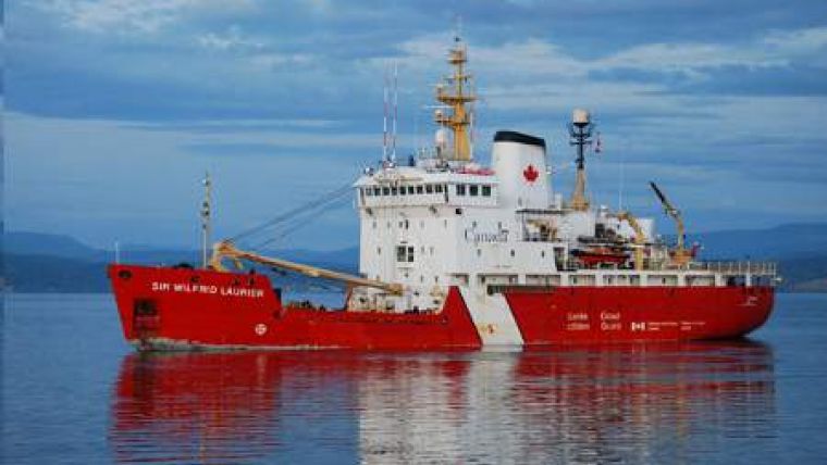
While on passage from the Canadian west coast to the arctic, Department of Fisheries and Oceans (DFO) scientists from the Institute of Ocean Sciences (IOS) in Sidney, British Columbia were able to collect dozens of high-quality 400m CTD profiles across the Pacific Ocean without stopping or slowing the icebreaker CCGS Sir Wilfrid Laurier.
The researchers are among the latest groups to use the Oceanscience UnderwayCTD system for this type of profiling challenge. Each year, scientists from IOS travel to the arctic on board the Laurier and are able to conduct science while in transit. However, slowing or stopping the ship to conduct science activities is often not possible; and as a result, most research has to be done while underway. That's where the latest Oceanscience profiler comes in.
The DFO scientists have traditionally used expendable CTD (XCTD) probes, launched from the Laurier while slowing the ship to about 9 kts, from its typical transit speed of about 11kts. While easy to deploy, the expendable probes do not match research-grade oceanographic instruments in accuracy and resolution, and are not ideal as a tool to monitor subtle changes and variability in the temperature and salinity fields of the North East Pacific, associated with climate change and moving fronts.
During the 2011 trip, the Oceanscience UnderwayCTD replaced the XCTDs and offered several advantages. According to DFO scientist Svein Vagle, the UnderwayCTD allowed to obtain calibrated, high-resolution data; something that was not possible with the earlier use of XCTDs. Also an advantage for us was the fact that by using the Underway CTD, we had no significant consumables cost, and we found it was actually faster to use this completely recoverable profiler system than a one-off expendable probe. An additional bonus was the fact that we ended up doing the casts at normal cruising speed, resulting in no extra time needed to get the profiles and no impact on ship operations. On the route from Canada to the Aleutian Islands across the Pacific, Underway CTD profiles were collected roughly every 6 hours with the operation completed in about 25 minutes for each 400m vertical profile. The data have given us the best and most detailed picture of the Polar Front available to date; this feature surrounds the Subarctic Zone in the center of the Gulf of Alaska Gyre. It is a result of lower surface stratification combined with winter cooling and storms to create an approximate 100 m deep water mixed layer. In the summer, the remnant winter mixed layer can be seen as subsurface temperature minimum near 100m.
After crossing the Aleutian Island chain, the cruise plan called for conventional stations for shallow water sampling and CTD profiling. The UnderwayCTD was used while in transit between these fixed stations to obtain yet more valuable temperature and salinity profiles.

Value staying current with hydrography?
Stay on the map with our expertly curated newsletters.
We provide educational insights, industry updates, and inspiring stories from the world of hydrography to help you learn, grow, and navigate your field with confidence. Don't miss out - subscribe today and ensure you're always informed, educated, and inspired by the latest in hydrographic technology and research.
Choose your newsletter(s)


