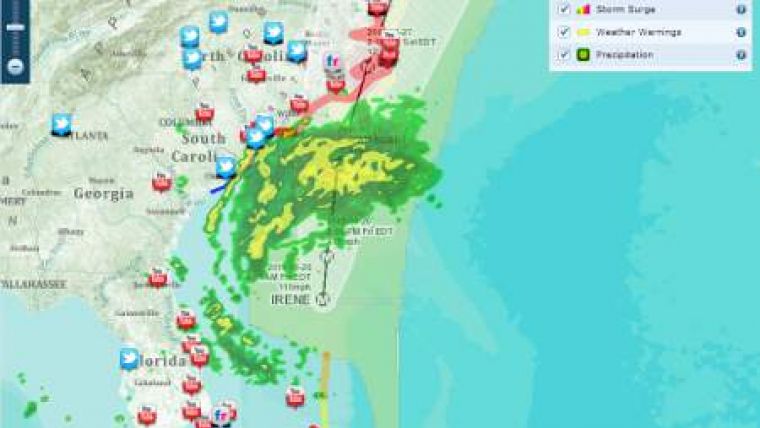
Live Hurricane-Tracking Map
Esri has created a mash-up of the hurricane Irene. The data is displayed close to live and displays various aspects of the weather including storm surges, active hurricanes and precipitation.
Following the tradition of Esri, the interactive map includes tweets marked Irene, Youtube videos and images on Flickr.

Value staying current with hydrography?
Stay on the map with our expertly curated newsletters.
We provide educational insights, industry updates, and inspiring stories from the world of hydrography to help you learn, grow, and navigate your field with confidence. Don't miss out - subscribe today and ensure you're always informed, educated, and inspired by the latest in hydrographic technology and research.
Choose your newsletter(s)


