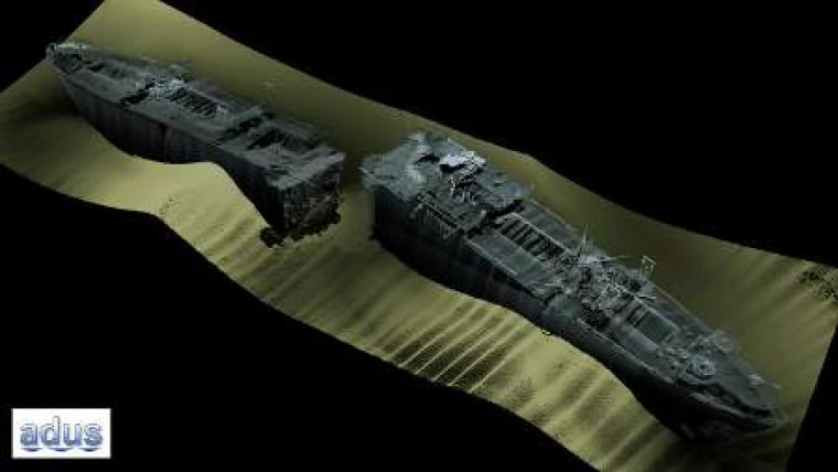
Seventy New Wrecks Found off Cornwall
The UK Maritime and Coastguard Agency (MCA) held its annual CHAS (Civil Hydrography Annual Seminar) on 24th February, where many images were shown of wrecks that had previously not been surveyed. The record for largest number of new wrecks must go to the survey of the North Devon and Cornish coasts, previously marked as 'unsurveyed' on charts, where some seventy new wrecks were found. The morning was taken up with reports of the last season’s surveys by the survey companies concerned: Marin Mätteknik, NetSurvey, Gardline Geosurvey and Fugro OSAE.There were New shoals were also found, the most significant of which was a depth difference of about 4m off the entrance to Scalloway Harbour in the Shetland Isles. The survey plans for the next few years were then outlined, and these seem not to have suffered too much in the current climate of austerity.
A common thread to the event was one of data sharing. Where possible, the MCA works with other government bodies, so surveys are specified to meet the needs of the Hydrographic and scientific communities, and data is shared between departments. Presentations were made about the MEDIN and EMODNET programmes, aiming to ease finding out what data is available. MEDIN are the marine front end for the UK’s INSPIRE work, and they are also encouraging departments to make their data available free of charge to users under the Open Government licence – a welcome move instead of the 'pay twice' approach generally taken to access government data in Europe. The Irish INFOMAR project’s presentation was interesting in how they are adding value to the survey data for specific user groups, and making the data available free of charge through their web site.
There was a lively discussion about the TeamSurv project, using crowd sourcing to gather survey data. Although not claiming to be nearly as accurate as multi-beam surveys, some voiced concerns that politicians would want to adopt this approach instead of the much more expensive multi-beam surveys, and some objected to a crowd-sourcing approach on principle. More constructively, others could see its benefits as a low-cost means of monitoring depth changes to trigger a full multi-beam survey, as well as its use in areas which are unlikely to benefit from a multi-beam survey, whether that is off the beaten track areas in the developed world, or developing countries that do not have the resources for a multi-beam survey.
Finally, there were presentations from other government departments who engage in Hydrographic surveys, reporting on the work they were carrying out. This included the British Geological Survey, Joint Nature Conservation Committee, Channel Coastal Observatory (expanding to cover all of England and Wales), and Natural England.
Copies of presentations made at the seminar, and also the MCA’s 2011 Civil Hydrography Programme, will be made available on the MCA’s web site in due course.

Value staying current with hydrography?
Stay on the map with our expertly curated newsletters.
We provide educational insights, industry updates, and inspiring stories from the world of hydrography to help you learn, grow, and navigate your field with confidence. Don't miss out - subscribe today and ensure you're always informed, educated, and inspired by the latest in hydrographic technology and research.
Choose your newsletter(s)


