Spectacular Positioning for MBARI Epedition
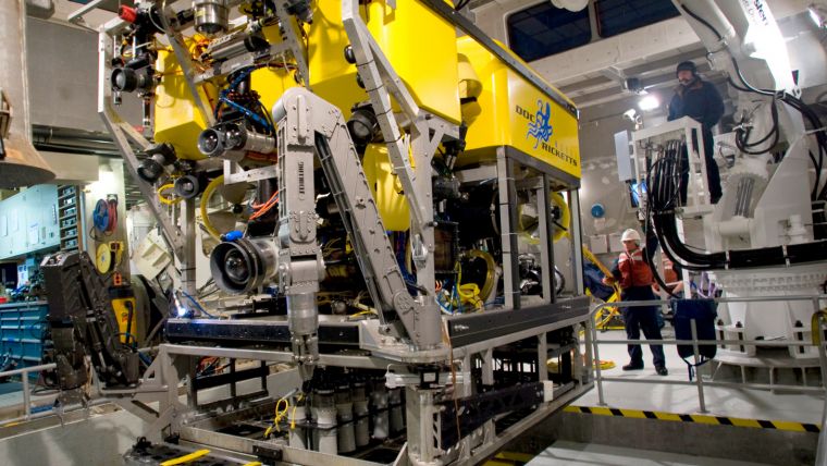
ROV tracking technology supplied by Sonardyne Inc. in Houston, USA to the Monterey Bay Aquarium Research Institute (MBARI) provided performance during an expedition to study recently discovered deep sea hydrothermal vents in the Gulf of California. Installed on MBARI’s Western Flyer research vessel, the Ranger 2 USBL system was used to track the position of the ROV Doc Ricketts as it dived down 12,500 feet (3,800 metres) to the seafloor and flew around the Pescadero Basin vent field, collecting video and samples for analysis.
Despite the challenging conditions created by the vents spewing out super-heated seawater and suspended solids, the Ranger 2 provided three-metre accuracy at that depth and stability of positioning.
MBARI have been users of Sonardyne’s original Ranger 1 USBL technology since 2000, when a system was first fitted to the Western Flyer. During that time, it has supported a wide range of expeditions off the California coast where water depths rapidly reach beyond 13,000 feet. However, it was noted that on occasions, multi-path signals reflecting off the vessel’s twin hulls and noise from ROV thrusters, could interfere with transponders signals coming from great depths.
Upgrade
As part of the upgrade, the Western Flyer was fitted with Sonardyne’s deep water optimised HPT 7000 USBL transceiver. Co-located with it on the vessel’s deployment pole was Lodestar, Sonardyne’s premium grade motion sensor – a configuration referred to as Optimised USBL. This integration achieves a tightly compensated solution and allows the positioning accuracy obtainable from Ranger 2 to be maximised.
The MBARI research project to investigate the Pescadero Basin vent field included repeated dives in April 2015 by the ROV Doc Ricketts to accurately map the site and gather samples which have subsequently been shown to contain both carbonate minerals and hydrocarbons. During the missions, the positioning repeatability of the Ranger 2 was shown to be just a few metres, performance that enabled MBARI’s ROV pilots to save time by flying directly to points of interest.
Commenting on the success of the project, Knute Brekke, Chief ROV Pilot for MBARI said that during the entire length of the project in the Pescadero Basin, the acoustic tracking enabled the researchers to return to scientific sites of interest repeatedly with three-meter accuracy, well within visual range of the ROV cameras using Sonardyne’s Ranger 2 USBL system.
Image: Spectacular positioning results for MBARI’s Doc Ricketts ROV was achieved using Sonardyne’s Ranger 2 USBL system.

Value staying current with hydrography?
Stay on the map with our expertly curated newsletters.
We provide educational insights, industry updates, and inspiring stories from the world of hydrography to help you learn, grow, and navigate your field with confidence. Don't miss out - subscribe today and ensure you're always informed, educated, and inspired by the latest in hydrographic technology and research.
Choose your newsletter(s)


