The New IHO S-102 Standard
Charting a New Frontier for Bathymetry
Soundings and contours are the only official way data producers can push bathymetric information to the wide hydrographic community. The introduction of the S-102 standard for bathymetry will enable many possibilities within the community of bathymetry users. Liaising with the International Hydrographic Organization’s (IHO) TSMAD working group, the Canadian Hydrographic Service (CHS) and the US Naval Oceanographic Office (NAVO) led the development and practical testing of this revolutionary standard, officially called the Bathymetric Surface Product Specification S 102. In partnership with IIC Technologies, GeoNet Technologies, and CARIS, CHS created one of the first prototypes of S 102 datasets, using the CARIS Bathy DataBASE software suite. A portfolio of 86 high-definition bathymetric charts was subsequently produced within a few weeks, successfully validating a specification that will potentially change the manipulation of bathymetric data we’ve known for years.
In shallow-water, ships navigation and manoeuvring commands precautions and decisions made with the best information available and usable in a secure manner. In these circumstances, the most recent details of the bottom shape are usually considered essential. A three dimensional ‘picture’ of the bottom would meet this requirement, and this is exactly what is meant by High-Definition Gridded Bathymetry (HDGB).
The grid bathymetry can be described as a Navigation Surface (developed by Shep Smith) or a Digital Terrain Model (DTM) of the seafloor in the form of regular rectangular meshes. By its nature, the resolution or the density of bathymetric data collected usually varies according to the depth range, and it would be arguable to fix a quantitative value to the term high definition for bathymetry. In spite of this, the concept of HDGB used in this article is simply defined as a much higher resolution than what is available on the charts. For the source bathymetry coming from a multi-beam system the resolution can be similar to the insonified footprint. For digitised legacy data this can be the equivalent of a field sheet density.
The existing tools to process and manage bathymetric data generate and combine grid datasets that are used for chart compilation and contour generation. Such grid datasets of bathymetry can also be a product by itself, created for different usage like hydrodynamic modelling, spatial data analysis with GIS, coastal management with land DTM, or marine navigation.
To develop a HDGB product for navigation CHS adopted a collaborative approach where navigators and software manufacturers were informed of the intentions and consulted for specifications of a future product. For the consultation, prototype datasets were produced and made available in a simple format for experimentation and trials. The work of the IHO Transfer Standard Maintenance and Application Development working group (TSMAD) on the new Geospatial Standard for Hydrographic Data (S-100) was promising and CHS decided to use it. S-100 is a framework standard for the registration, maintenance and capture of hydrographic geospatial data and product specifications. It is based on the international ISO 19000 series of geographic standards, and it is flexible. CHS and NAVO worked together to draft and propose a product specification for grid bathymetry based on previous work done by the Open Navigation Surface group. The standard is named Bathymetric Surface Product Specification and identified as S-102.
At the 3rd HSSC meeting in November 2011, the IHO TSMAD invited the Hydrographic Services and Standards Committee (HSSC) to approve the final draft of S-102 and instruct the IHB to submit it to Member States for their endorsement. Subsequently, the IHO circular letter 10/2012 requested the Member States to review and consider the draft edition of S-102 which is available on the IHO website.
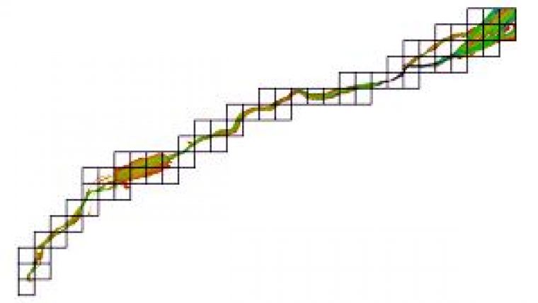
To partition HDGB coverage, to allow unambiguous dataset exchange and to facilitate the updates, CHS intends to implement a systematic tiling scheme with three levels of resolution. Each tile is comprised of 1000 by 1000 grid cells, the level 1 (harbour) is 0.02º x 0.02º, the level 2 (coastal) is 0.1º x 0.1º, and the level 3 (overview) is 1º x 1º. For the low and mid latitudes, the orientation of the tiles fit the meridians and parallels with an origin based on a round number in latitude and longitude. Figure 1 shows an example of the tiling scheme.
Production of Datasets for Trials
In January 2011, CHS contracted IIC Technologies and GeoNet Technologies to produce a portfolio of 86 HDGB datasets based on a draft version of the IHO S-102 product specification. Developing a uniform, high-definition bathymetric surface for the St. Lawrence River between ports of Quebec and Montreal was the key goal for the project. In addition, as this was the first attempt to produce a large number of datasets based on this new product specification, the project provided an ideal opportunity to validate the feasibility of S-102 production in practice.
The main requirements for the portfolio included creating seamless data coverage with a final surface grid resolution of 0.0001º (approximately 8 metres) divided into 0.1º x 0.1º tiled datasets. The final bathymetric surface needed to be created by integrating a variety of source datasets available for the area, ranging from sparse sounding sets to much higher resolution grid data for channels, while also using ENC-derived high-water lines along with the corresponding drying spot values. The intention behind using all available source data was to integrate all information in a complete dataset, capable of significantly enhancing the information already available on the ENC cells. Similarly the project required the deliverables to be provided in multiple formats including CSAR (CARIS Spatial Archive), BAG and 32-bit GeoTiff files to cater to a variety of potential end-users.
The production processes consisted of four main stages: source data assessment and preparation, point data processing, surface data integration and conflict resolution, and final product surface extraction and export. During the first stage all source data was assessed and prepared for production. CARIS S-57 Composer and BASE Editor were used to create all auxiliary components, such as the tiling scheme, coverage, and breakline vector layers. The same tools were also used to cut all data sources into individual data tiles to facilitate their efficient processing. During stage two the XYZ point data was loaded into BASE Editor and used to build a TIN model which was enhanced by the addition of the high-water-based breakline vector layer. Subsequently, a high-resolution bathymetric surface was interpolated from the TIN models for each dataset. During stage three the additional high-definition surface data available for channels was merged with the product surface data created in stage two. This was achieved by using rule-based conflict resolution tool available in BASE Editor. In the final stage the coverage polygon was used to extract the final product surface, effectively facilitating a complete river bank to river bank data coverage. Thereafter BASE Editor was used to export CSAR and BAG deliverables and CARIS Easy View was used to export 32-bit GeoTiff rasters. Figure 2 illustrates the key stages of the data production process used during the project.
All project goals were successfully achieved and the required portfolio of 86 HDGB datasets was efficiently produced, confirming the feasibility of HDGB data production using the currently available CARIS production tools.
Generation of S-102 Bathymetry Grids
As described above, the interpolated grids from the point data are combined with the high-definition grids from the ship channel to produce the final grids for each cell, in the CSAR format, which are then exported to the desired carrier format of the grid. The draft S-102 standard follows the principle of separating the ‘carrier’ from the ‘content’ which means that the encoding of the grids will be flexible. Following that principle, the CARIS software tools provide choices for export formats. At the time of this S-102 prototype work, the choices were:
• 32bit Floating Point GeoTIFF format. This option for a carrier format is available from the GDAL open source library (weblink 1). The 32bit floating point option is used so that the depth values can be encoded without loss of precision.
• BAG format. At the time, the CARIS Bathy DataBASE (BDB) v3.1 supported BAG v1.3. The support for BAG format is possible through the API provided by the Open Navigation Surface Working Group ( 2) of which CARIS is a participant. Since then, BDB has been updated to support BAG v1.4. CARIS is currently working with the ONSWG on BAG v1.5, which will be supported when finalised and released.
Metadata
Adjusting this production line to match the coming S-102 standard is going to require the creation of metadata that is compliant with the S-102 profile. The details of the S 102 metadata profile are still being developed but many aspects of the content are already known. Fortunately, this area has received significant attention over the past two years at CARIS with the creation of the metadata profile for the CSAR format that is compliant with the ISO 19115 / 19115-2 standards and using XML encoding from ISO 19139. Drafts of the S-102 standard indicate that its metadata profile will share many of the same elements that are already being populated in exported CSAR metadata XML files.
The drafts of S-102 metadata profile indicate that most of the core metadata elements in the profile, each of which will be identified as mandatory, conditional or optional, will be selected from these ISO 19115 metadata packages.
Evolution of CARIS BDB and S-102 Software Tools
In the period since these prototype S-102 gridded products were produced, the software tools have evolved which could improve the workflow even further. For example, the Warp function, which has been available since BDB 3.2, can transform a gridded surface to a new coordinate system and/or re-sample the surface onto a new grid resolution. This could save steps in turning what started out as projected bathymetry in grid resolutions of metres on the ground, into unprojected grids at the appropriate decimal degree resolutions with one function.
The next step in the evolution of software tools for S-102 production will be the creation of a new Export to S-102 procedure that addresses the following all in one function:
• Take a CSAR grid as input which has been prepared with the correct coordinate system and grid resolution.
• Select an option for the output ‘carrier’ format of the gridded bathymetry. (e.g. GeoTIFF, BAG, and others as required)
• Optionally apply a tiling scheme which will cut the input grid into the desired tiles of specified width/height in decimal degrees.
• Apply a defined naming convention to the output tiled files.
• Generate an accompanying XML metadata. This metadata could then be used by data producers to populate a metadata catalogue web service
S-102 Gridded Bathymetry on the Web
The CARIS web mapping solution, Spatial Fusion Enterprise (SFE), supports the discovery and dissemination of high-definition bathymetry through the Internet using OGC, Open Geospatial Consortium (weblink 3), standard formats. S-102 bathymetric datasets residing in the CARIS BDB database as CSAR grids are requested by SFE through a specialised bathymetry web service. The CSAR format was designed with the optimisation required for web distribution of this type of data in mind. OGC requests are made from any OGC capable client. The SFE Server handles the OGC request and returns the relevant information residing in the bathymetry database. SFE currently supports the OGC WMS, WMTS or WCS services for bathymetry data: it is the WCS (Web Coverage Service) that provides download capabilities for the grids including options for the format to be received from the download. Efficient browsing and simple query capabilities are increasingly being provided through the use of WMTS (Web Map Tile Service) which is a variant on the traditional WMS (Web Map Service) protocol which chunks data into image tiles. These tiles are cached on initial draw meaning that the next time an image request is made the tile is drawn from cache rather than by going back to the database.
Use of S-102 for navigation
With S-102 it will be easy for hydrographers to provide navigators with HDGB datasets very rapidly to enrich and update the information of their ENCs. Partitioned into standardised regular geographic cells, the provision of updates becomes easy by just supplying an entire new cell dataset with the new bathymetry to the users who then just supersedes the tile.
A possible way to use HDGB for navigation is to put the S-102 data in the background with an overlap of S-101 without the display of S-101 soundings, depth areas and contours. Figure 3 shows such usage.
But electronic chart systems manufacturers can do more than just displaying it. The HDGB can be used: to generate safety contour on the fly; to compute the available water column by the addition of water level (tidal data) on top of the bathymetry; to calculate a dynamic under keel clearance; etc.
The exploitation of HDGB in an innovative way is left to the users and the software industry. The CHS and its partners wish to involve them at an early stage of design to consider feedback from the users’ communities.
Conclusion
The IHO S-100 framework standard represents a step foreword for electronic navigation products and services. This flexible standard is a building block to rethink the way hydrographic organisations (HO) can deliver their official data and services. This S-102 experiment clearly showed how modern tools and standards will enable quick delivery of rich bathymetric information. It’s time to take a step ahead and test these datasets with users. This year the focus will be on getting the ECS and ECDIS manufacturers involved in exploring the possibilities of S-102.

Value staying current with hydrography?
Stay on the map with our expertly curated newsletters.
We provide educational insights, industry updates, and inspiring stories from the world of hydrography to help you learn, grow, and navigate your field with confidence. Don't miss out - subscribe today and ensure you're always informed, educated, and inspired by the latest in hydrographic technology and research.
Choose your newsletter(s)


