Fugro Delivers Surface Current Data
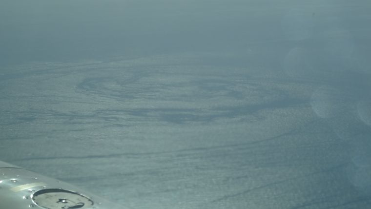
Fugro and its technology partner Areté Associates have successfully delivered near-real-time, synoptic, surface current data to characterise loop current and loop current eddy conditions in the US Gulf of Mexico during a period of intense current conditions. Over the course of the five-month programme, Fugro surveyed currents over a distance of more than 125,000 kilometres using the remote ocean current imaging system (ROCIS) which was deployed on its first operational project in the US Gulf of Mexico.
ROCIS is the first commercially available system of its kind and represents a step change in technology for mapping surface current conditions over a wide area of ocean for current-sensitive offshore operations.
Camera Technology and Positioning Systems
Optimising recent advances in remote sensing and aerial survey, Fugro and Areté Associates developed a system that uses a combination of digital camera technology and highly accurate positioning systems, together with advanced algorithms, to derive surface currents from wave spectra measurements. It can be installed on a suitable survey aircraft, together with an inertial navigation system augmented by Fugro’s Starfix satellite positioning system.
Current data are reviewed in real-time on board the aircraft, providing continuous assessment of data quality and the location of strong currents. Within an hour of the aircraft landing the system produces a ‘quick-look’ map of the currents over the area while processed data files are available a few hours later. During the programme ROCIS data supported day-to-day operational planning and enhanced the accuracy of 3D hydrodynamic current forecast modelling.
Wide Area High Resolution
The key technical benefits of ROCIS are the near-synoptic, wide area, high resolution, high integrity surface current measurements that allow sub-mesoscale circulation to be measured and monitored. During a four-hour flight the system can survey ocean currents at 250m intervals over a track of 900-1,100 kilometres. To map currents over a similar distance using traditional methods would take a combination of four vessels 24 hours. Given sufficient daylight hours, two ROCIS flight missions can be conducted each day.
ROCIS services can be provided to single or multiple clients to monitor offshore current conditions over specific locations or a broad area. The system can also provide support in emergency situations such as oil spill and search and rescue, as well as in oceanographic research programmes.
Fugro and Areté Associates are working on further development of the ROCIS system and services, including the use of expendable probes and the incorporation of additional airborne sensors. In 2016 Fugro will add a second ROCIS unit to further enhance its support of offshore operations.
ROCIS is showcased in the 2016 #AskFugro programme.


