Teledyne PDS 4.1 Introduces Visual Project Management and Setup
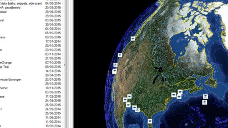
Teledyne PDS 4.1 software features Visual Project Management and Setup. It includes a user interface which provides a visual presentation of the survey tracks on the world globe. When zoomed in on, it will appear as a flat plane to be viewed in detail showing the GPS tracks data and the extent of the projects. Project information is available on the world globe or in the projects list.
Any data type that can be visualised, for instance grid models, charts, and guidance types, can be selected and viewed with one click of the mouse. The selected data type will be used automatically in the applicable views throughout the Teledyne PDS applications. Teledyne PDS 4.1 furthermore provides 2D and 3D visualisation, and the Control Center has been optimised to be more intuitive for maritime operations.


