Found 28 results
Sort by

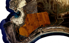
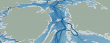
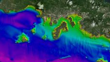
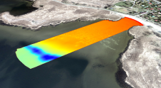
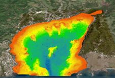
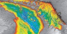
The role of satellite-based mapping in hydrography

By harnessing capabilities of advanced satellite technology and ever-evolving data analysis, satellite-based mapping (including satellite-derived bathymetry, SDB) offers an efficient, extensible and cost-effective method for mapping water properties, underwater topography...

Read more

Introducing the Denmark Depth Model

The Denmark Depth Model (DDM) is a digital bathymetric model covering Denmark’s exclusive economic zone (EEZ). It was developed based on hundreds of bathymetric survey datasets and historical sources and...

Read more

FarSounder Joins NOAA as a Trusted Node

FarSounder is the most recent company to join the International Hydrographic Organization’s Crowd-Sourced Bathymetry (CSB) initiative by becoming a “trusted node” with the NOAA. This project enables mariners to voluntarily...

Read more