The evolution of Dutch hydrography
Given the Netherlands’ geographical location, it is unsurprising to find it has a long tradition of hydrography. The lowland, often below sea level, forms a delta where major rivers from...

Given the Netherlands’ geographical location, it is unsurprising to find it has a long tradition of hydrography. The lowland, often below sea level, forms a delta where major rivers from...
The field of geodesy is undergoing a revolutionary change. The developments of the last few decades have altered the views and work of professional surveyors, researchers and developers immensely, think...

How do you perceive prospects in the hydrographic surveying industry in 2024, compared to the past couple of years? When contemplating the hydrographic sector holistically, which areas of investment do...
The intertidal zone, where coastal wetlands provide the first buffer to storm energy and sea level rise, has not traditionally been a focus of geodetic surveying. However, the increasing vulnerability...
All over the world, surveyors are opting for UAV technologies to advance coastal mapping services. VBW Weight GmbH from Germany and RASA Surveying from the Philippines are professional service providers...

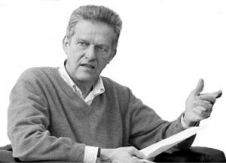
Ephraim Friedli is an engineering specialist at Axpo Power AG, where he is responsible for bathymetric measurements in the Hydro & Biomass division. He previously worked as a scientific assistant...
This site uses cookies. By continuing to use this website, you agree to our Cookies Policy. Agree