Found 552 results
Sort by

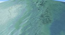
The role of satellite-based mapping in hydrography

By harnessing capabilities of advanced satellite technology and ever-evolving data analysis, satellite-based mapping (including satellite-derived bathymetry, SDB) offers an efficient, extensible and cost-effective method for mapping water properties, underwater topography...

Read more

Narcisa Pricope

Narcisa Pricope is an associate vice president for research in the Office of Research and Economic Development at Mississippi State University and a professor in the Department of Geosciences. Prior...

Read more

Teledyne Geospatial announces CARIS OnDemand

Teledyne Geospatial has announced that CARIS software, globally preferred by national mapping and charting agencies, survey companies, port and waterway authorities, oil and gas companies and academic institutions, will now...

Read more

Lidar in surveying & mapping

Lidar, short for Light Detection and Ranging surveying, represents a sophisticated measuring system leveraging the power of light. Widely recognized for its versatility, Lidar is extensively applied in diverse fields...

Read more