The evolution of Dutch hydrography
Given the Netherlands’ geographical location, it is unsurprising to find it has a long tradition of hydrography. The lowland, often below sea level, forms a delta where major...
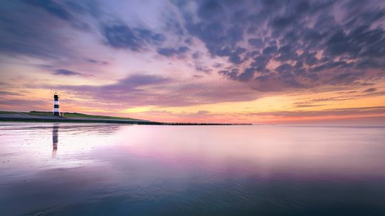
Given the Netherlands’ geographical location, it is unsurprising to find it has a long tradition of hydrography. The lowland, often below sea level, forms a delta where major...
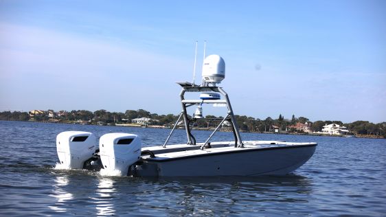
In an era of great power competition, unmanned maritime systems (UMSs) have begun to take centre stage and are now on an accelerated development path for reasons that are clear. Li...
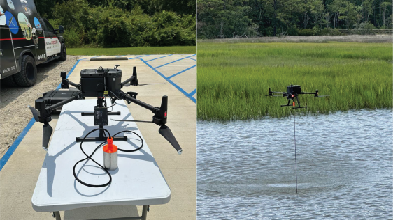
In the quest to unravel the mysteries beneath our planet’s water bodies, topobathymetric technologies emerge as a beacon of innovation. Among them, Lidar (light detection and...
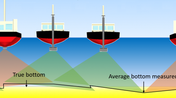
IHO standard S-44 is often used (or misused) to specify the quality of a hydrographic survey. While it is a useful tool, it is easy to misinterpret. One ‘misuse’ is to...
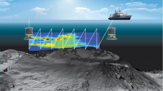
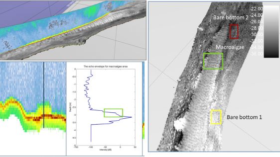
The nearshore and offshore regions running from the shallow coastal shelf to the intertidal zone are dramatic, tempestuous and extremely complex environments that offer the potenti...
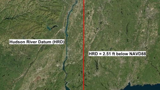
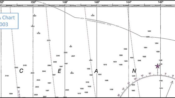
A fixed low water reference plane, Hudson River Datum (HRD), was adopted as chart datum for certain portions of the Hudson River to approximate mean low water when river levels are...
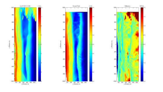
The applicability and reliability of a video monitoring system used to predict rip currents at a Dutch beach have been investigated in more detail, including the testing of additio...
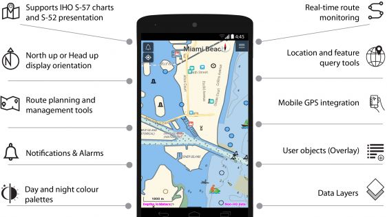
NaAVIC is a free and downloadable electronic voyage application that goes beyond the traditional Electronic Chart System (ECS) app whereby the data, including the ENC information,...
NOAA’s Marine Chart Division (MCD) is currently revising production efforts using an ‘ENC-first’ approach to provide seamless and tiled geographic coverage. Curre...
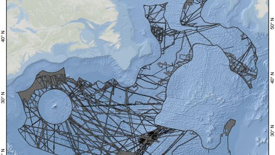
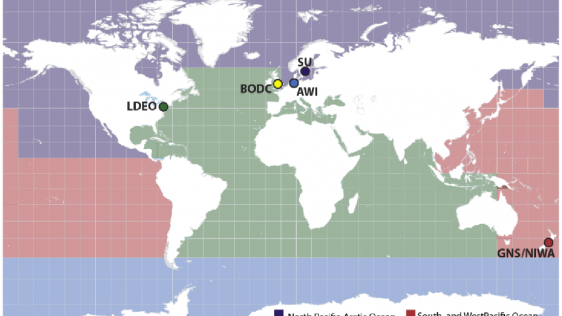
Mapping the world’s oceans is a tremendous task that would benefit from a prioritization strategy. In this article, an in-depth presentation of one such approach is given: GI...
France and Ifremer have long been involved in the discovery and study of deep-sea mineral resources and their associated ecosystems. With a rather unique position in the marine res...
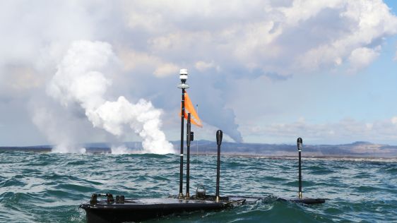
The Kilauea volcano eruption on Hawaii’s Big Island has captivated the world. The images broadcast each day convey the power of the molten lava flowing from the Kilauea volca...
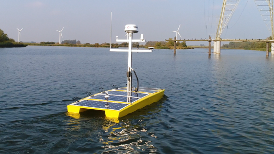
The Dutch government is currently focusing on autonomous technologies. Autonomous cars can already be found on Dutch highways and now Rijkswaterstaat (The Ministry of Infrastructur...
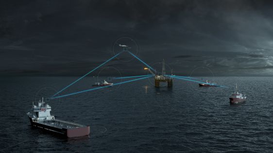
By providing vessel-to-vessel and vessel-to-shore communication independent of satellite or cellular networks, the Maritime Broadband Radio (MBR) system from Kongsberg introduces p...
Hydrographic Offices have realised that bathymetric data is not sufficiently represented in Electronic Navigational Charts (ENCs). A few aspects of this topic have already been tou...
While 70% of the Earth is covered by water, very little of it has been surveyed so far (Mars, Venus and the Moon are better surveyed). The techniques for doing so have ch...

Electronic charts with greater scale and bathymetric content than any hydrographic office’s ENC (equivalent to a paper nautical chart) are not a novelty for many ports around...
What does ‘hydrography’ really mean? IHO defines hydrography as a description of the physical features of the ocean in support of different marine activities. A recent...
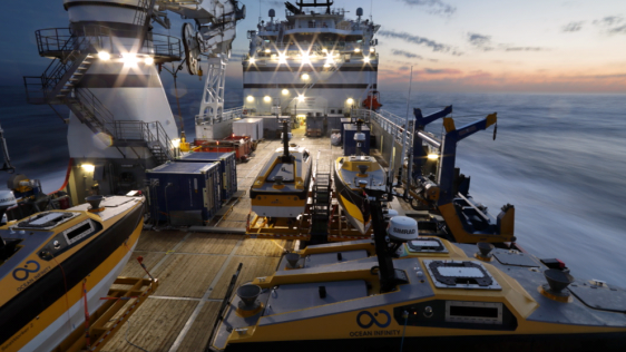
Ocean Infinity’s seabed mapping campaign commenced in the summer of 2017. The Ocean Infinity team is made up of individuals from multiple disciplines, who have gained vast ex...
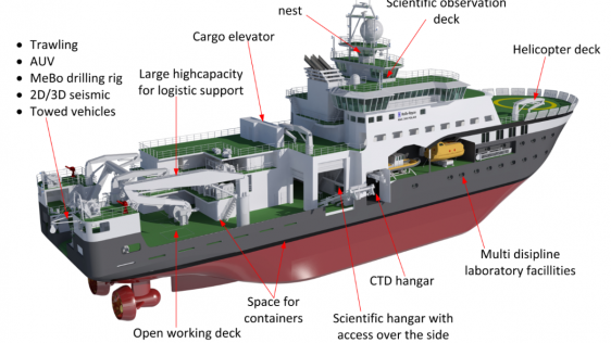
Norway is a maritime country with a very long coastline. It is also very much a polar nation, with 80% of its sea territory and 45% of its land mass north of the Arctic circle. It...
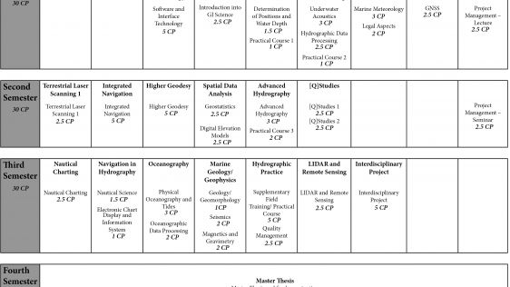
A hydrographic education programme has been offered in Hamburg for more than 30 years. The programme was first offered in 1985 as an addition to an existing programme in general su...
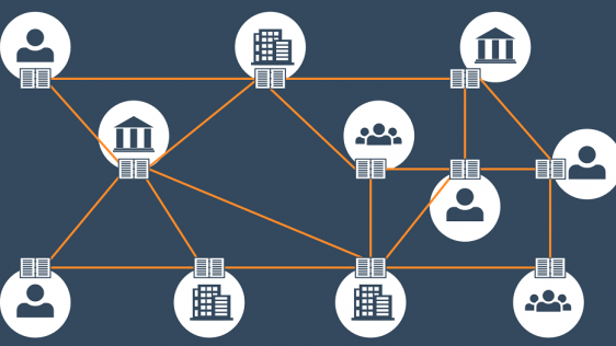
Blockchain technology can potentially change the process of compiling sea charts. Since not all of us are acquainted with terms like ‘blockchain’ and ‘distributed...
Despite countless days of surveying at sea, we have still mapped less than 20 percent of the world’s oceans. It is time to get organised, according to Rear Adm Shepard M. Smi...
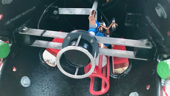
For many years, the GeoSwath system from Kongsberg GeoAcoustics has provided an efficient simultaneous swath bathymetry and sidescan seabed mapping solution with accuracies that me...

This site uses cookies. By continuing to use this website, you agree to our Cookies Policy. Agree