The position of bathymetric sensors in hydrographic education is beyond discussion, as bathymetry is, was and will continue to be the bread and butter of the hydrographic surveyor. Bathymetric sensors...
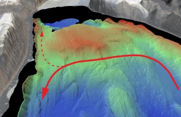
An understanding of the interplay between glaciers and the ocean is needed to improve sea-level rise projections. Seafloor mapping is critical in this pursuit, particularly where the ice sheets of Gre...
In an era of environmental challenges and economic uncertainties, nations are earnestly seeking innovative ways to stimulate economic development, improve public safety and enhance the quality of life...
On 24 January 2023, the European Union declared the Galileo High Accuracy Service (HAS) operational for testing, and it is scheduled to become fully operational in 2024. This free signal adds precise...

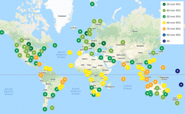
Experts are extremely concerned about the temperature of the Pacific Ocean, as the sea surface temperature this year was the warmest since satellite measurements began. This can have major consequenc...
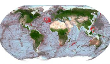
Delving into the mysteries of the planet’s final frontier – the ocean – has long captivated human curiosity, with the origins of ocean exploration dating back to 5,000 BC. But even today, the oc...
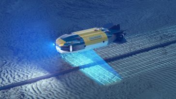
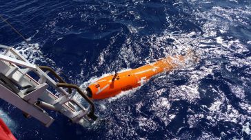
Combining AUV and ROV capabilities in a modular, hybrid unit improves functionality, while subsea docking technology expands the operational window of such a vehicle, allowing it to carry out multiple...
Some 290 shipwrecks lie in the Belgian part of the North Sea alone, with probably more than 1,000 in the entire North Sea, many of them silent witnesses to the two world wars. Until recently, the envi...
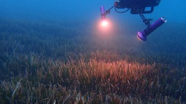
The ocean plays a crucial role in mitigating climate change, yet we lack detailed information on over 95% of the seafloor. This article explores planblue’s solution to accelerate time-to-data and th...
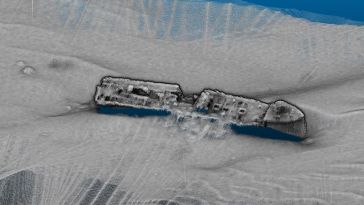
Fugro has utilized its cutting-edge hydrographic technology in Australia to locate the final resting place of the Montevideo Maru, which sank in 1942 with more than 1,200 people on board. The sinking ...
Rapid technological advancements in AI, machine learning and automation urge the offshore industry to keep up to date with innovations and use them to make data acquisition and data processing more ef...
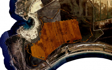
This article presents a novel methodological approach to understand and assess the suitability of airborne Lidar bathymetry for the automatic classification and mapping of the seabed. This solution a...
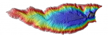
Unmanned surface vehicles (USVs) are increasingly being used for the mapping and management of shallow-water environments such as lagoons, rivers and estuaries, due to their economic and ecological be...
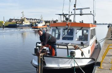
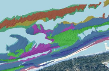
The acquisition of bathymetric and sidescan data is essential for the Swiss energy company Axpo to maintain its hydropower infrastructure, especially as debris that glaciers dump into Switzerland’s ...
This site uses cookies. By continuing to use this website, you agree to our Cookies Policy. Agree