Renewable energy and the pivotal role of hydrography in offshore development take centre stage in a captivating interview with Professor Ed Hill, chief executive of the National Oceanography Centre (N...
Shipwrecks are an integral part of our underwater landscape. According to UNESCO, there are three million wrecks worldwide, and these create various marine spatial planning challenges. To address thes...
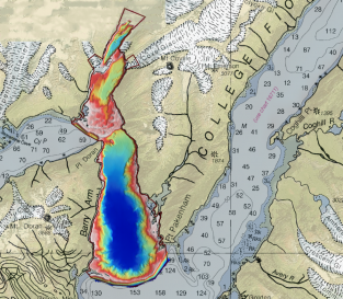
Alaska’s history of devastating landslides and tsunamis creates challenges in assessing communities’ risk without water depth data at the base of unstable slopes. To address this, the US Geologica...
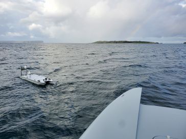
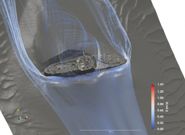
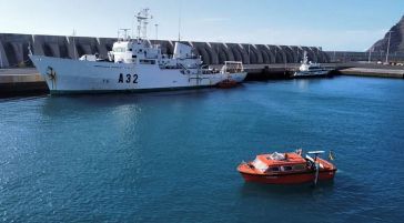
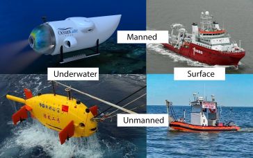
As the world’s reliance on offshore energy sources grows, the use of unmanned surface vehicles (USVs) emerges as a promising solution for safeguarding vulnerable offshore platforms. This article exp...
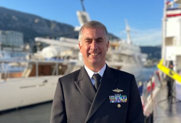
Hydro International interviewed RDML Benjamin Evans, director of NOAA’s Office of Coast Survey. Evans is responsible for overseeing the mapping and charting of all US coastal waters, as well as repr...
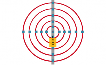
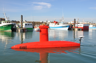
Underwater positioning with USBL can be accurate in favourable environments. However, it’s often perceived as less precise than land-based positioning. Maintaining high accuracy during mobilization ...
In many places around the world, data clearly shows a rise in sea level. In low-lying coastal areas, even small increases when coupled with high tides and storm surges can have devastating consequence...
The implementation of the new IHO hydrographic geospatial standard for marine data and information, the S-100 product family, presents significant challenges that require coordination between the IHO,...
Seabed 2030 is rapidly approaching its ultimate objective of mapping the entire seabed within seven years. To achieve this goal, the project is actively seeking donations of both public and private da...
Amid new climate policies, the global energy transition is in full swing. This is leading companies and organizations to take a variety of measures to make their business operations more sustainable. ...
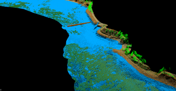
As part of a Catalan government project to improve the management of its marine environment, ICGC cooperated with Field to use airborne Lidar bathymetry (ALB) to survey the Catalan coastal zone. The r...
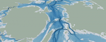
The Denmark Depth Model (DDM) is a digital bathymetric model covering Denmark’s exclusive economic zone (EEZ). It was developed based on hundreds of bathymetric survey datasets and historical source...
The life of a hydrographic planner used to be easy: you had a survey vessel from which (at least in nautical cartography) you deployed a number of survey boats (often sloops) with a simple sensor suit...
Much remains unknown about the benthic ecosystem that the blue economy depends on, and improved benthic habitat mapping is key to the sustainable development of the blue economy. While remote sensing ...
This site uses cookies. By continuing to use this website, you agree to our Cookies Policy. Agree