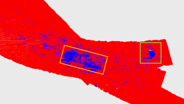
The mysterious Black Sea has many secrets yet to be discovered. This research presents the results of the biggest UXO survey project performed on the Romanian Black Sea coast after World War II, using...
The US space agency NASA has successfully pushed the asteroid Dimorphos out of its original orbit in the universe, according to a recent announcement. The space rock was hit 11 million kilometres from...
Electrification and the transition to a green economy are rapidly accelerating the demand for metals and rare earth minerals. As this demand cannot be met by recycling existing metals, a number of lan...

As Korea officially commemorates Hydrography Day, the Hydrographic Society of Korea (HySK) has acted as a link between industry, academia and research for the past ten years. The Republic of Korea has...
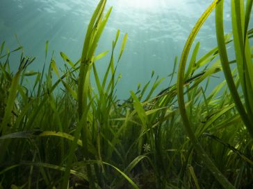
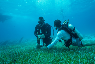
A new, non-invasive method to measure and monitor seagrass biomass on the seabed around England’s south-west coast has been successfully demonstrated this year as part of a collaborative project sup...
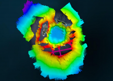
The Tonga Eruption Seabed Mapping Project (TESMaP) is a collaborative mission to discover the undersea impacts of the January 2022 eruption of the Hunga-Tonga Hunga-Ha’apai volcano. Using their coll...
Since the 1970s, remote sensing has increasingly been used to conduct underwater surveys. Several methodologies are employed in hydrographic surveying, from direct techniques such as probing rods to m...
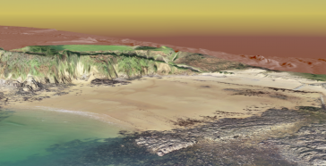
To understand coastal change and anticipate what our future coast will look like, scientists carry out regular field surveys in the form of beach profiles and digital elevation models (DEMs). Until no...
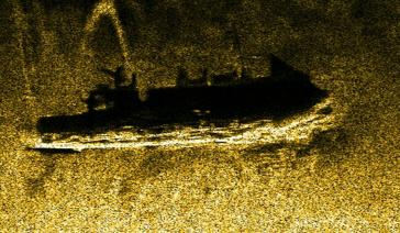
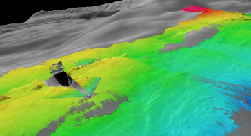
Manually examining the seafloor for objects such as wrecks requires a great deal of time and labour, both at sea and in the office. As time is a limited and costly factor, the industry is constantly s...
Aside from being able to monitor water depths, the most recent multibeam echosounder sonar (MBES) systems can also simultaneously record the reflected intensities from different seafloor surfaces. Wit...
Hexagon is working with Beneath The Waves, a conservation NGO, to help protect marine environments in the Bahamas. Using bathymetric airborne Lidar solutions, researchers are able to map, study and qu...
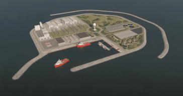
The Danish government is building an energy island in the North Sea, 80 kilometres off the coast, with the aim of accelerating the energy transition. The ambition is that the island becomes a role mod...

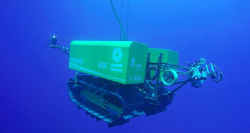
The transition to autonomous marine operations is a promising process in full swing. The advantages of carrying out hydrographic or oceanographic tasks autonomously weigh heavily against the tradition...
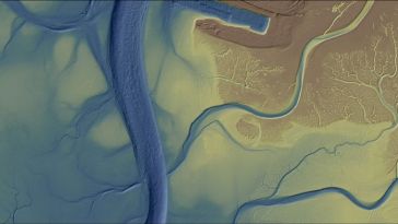
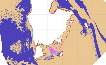
Morro Bay, a shallow coastal estuary located near San Luis Obispo, California, supports an abundance of wildlife and is home to a vibrant outdoor community. However, changes – such as sedimentation...
This site uses cookies. By continuing to use this website, you agree to our Cookies Policy. Agree