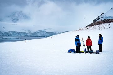
Capturing and measuring the environment in the Arctic and Antarctic is a particularly challenging job. The area of interest is often covered by a thick blanket of snow and ice, while extreme temperatu...
Most people working in hydrography know very well that better ocean data can be used to inform a variety of decisions, from storm preparedness to helping develop the blue economy. But could we do more...
Uncrewed vehicles, both surface and airborne, are increasingly being used for hydrographic surveying. While the technology of data acquisition using these platforms is generally known, the fusion of t...
It is almost impossible these days to imagine geoinformation without GNSS, and most geodetic services have switched to GNSS to maintain their geodetic reference network rather than using traditional o...
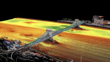
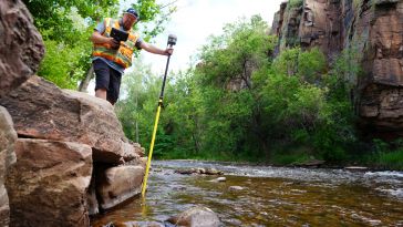
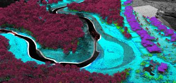
Two Hungarian companies designed a three-step data collection workflow to overcome the challenges in this urban surveying project in Hungary, which included the use of UAVs and remote-controlled boats...
In recent years, terrestrial and extraterrestrial ocean research have increasingly joined forces to merge expertise and technical solutions in the exploration of marine systems on Earth and in space. ...
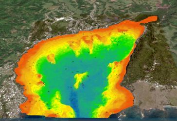
The national land agency in Jamaica has integrated satellite-based hydrography to benefit from time efficiencies, cost savings and improved safety as part of its hydrographic programme in support of t...
When looking to buy hydrographic processing software, it is important to establish the requirements in order to find the best software for the job at hand. The users’ technical skills, the type of d...
Artificial intelligence (AI) first came to light in the 1950s, when the ability of a machine to undertake an operation and adapt to changing conditions without human input was skirting the edges of sc...
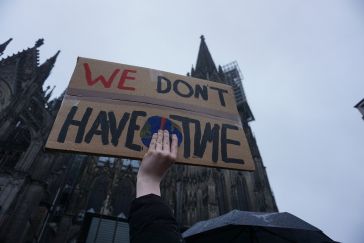
In 1972, The Limits to Growth saw the light of the day, a report published by the Club of Rome. The message: to keep the Earth liveable, we must control economic growth. To think that this was half a ...
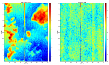
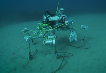
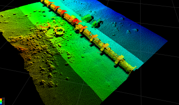
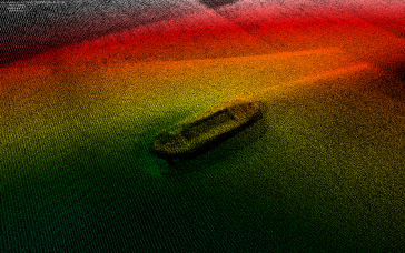
Seafloor pipelines are a critical infrastructure for oil and gas transport. Timely inspection is required to verify their integrity and determine the need for maintenance, as failures in these pipes m...
In this edition of our Q&A series with leading experts from the hydrographic industry, Paul Seaton of Fugro shares his thoughts on a variety of topics, such as key market trends, technology drivers an...

In this interview, Harald Sternberg, Professor of Hydrography and Geodesy at HafenCity University, shares his thoughts on the key market trends, technology drivers and challenges, and the impacts of C...
 Hydro International Theme Weeks
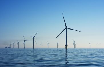
No matter which form it takes, energy is a basic necessity. Here, we focus on the survey requirements for installing windfarms, commissioning and decommissioning platforms, and laying pipelines and ca...
This site uses cookies. By continuing to use this website, you agree to our Cookies Policy. Agree