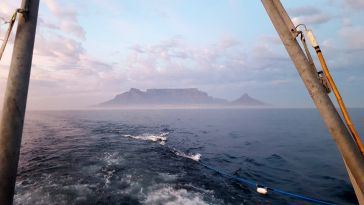
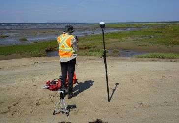
SHOM – the French national hydrographic service – is planning to replace most of its aging seagoing assets in the near future and, in this context, a four-week sea trial took place in Brest, on th...
As the informed readership of Hydro International knows, the oceans sustain the planet. And, while there are many drivers of the changes to the Earth’s climate that now pose an existential threat to...
To achieve the aggressive goals of Seabed 2030, uncrewed survey systems must be used to augment more traditional ocean mapping efforts, particularly on the high seas. In addition to providing a much-n...
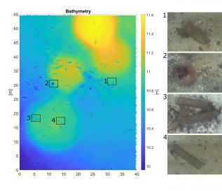
The South African Council for Geoscience recently launched an initiative to optimize marine geophysical data collection in South African waters. The main aim of the initiative is to produce marine off...

Crewless aerial mapping was recently chosen when surveying the Faroe Islands. For the small team, labour savings provided one advantage of a UAV-based approach. Another benefit was that clear skies ar...
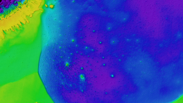
The detection of unexploded ordnance (UXO) in the sea is a demanding task. UXO survey data is acquired using a set of different sensors in different configurations and can span large areas. To make su...
Hydrospatial could be described as that portion of geospatial knowledge infrastructure that addresses the hydrosphere, and hydrospatial technologies support navigation, economic development, stability...
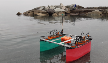
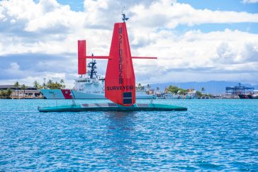
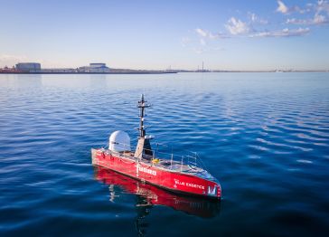
SWAMP (Shallow Water Autonomous Multipurpose Platform) is a new autonomous surface vehicle (ASV) whose design and development form the foundation for an innovative class of highly modular and reconfig...
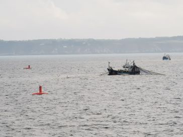
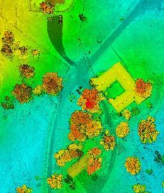
Coastal areas are highly dynamic environments that are subject to diverse pressures, both anthropogenic (e.g. urban development, fishing, habitat modification) and natural (e.g. storms, erosion, flood...
During the life cycle of offshore wind farms (OWFs), operators must maximize the uptime of wind turbines to generate as much energy as possible. As OWFs are constructed further from the coast, mainten...
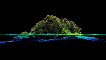
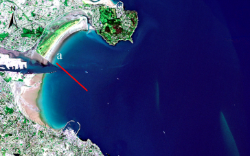
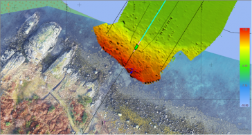
RIEGL tested the performance of its topobathymetric airborne laser scanning system in a transition zone context along the French Mediterranean coast. Initially planned as a UAV survey, tests were cond...
XOCEAN has completed 35 cable inspection surveys using a combination of uncrewed surface vessels (USVs) and uncrewed aerial vehicles (UAVs) between the Scottish mainland and Western Isles. There was a...
As the demand for elevation data continues to rise, it is important that users match the level of reliability, accuracy and resolution of the data to their specific application to arrive at an appropr...
This article presents a participative geomatics project with the goal of increasing southern Québec’s coastal communities’ ability to map and monitor changes in their coastal environment. Capacit...
This site uses cookies. By continuing to use this website, you agree to our Cookies Policy. Agree