Brussels Goes into Hydrography
EMODnet to Link Hydrographic Data of European Waters
A first prototype of the new and ambitious European Marine Observation and Data Network (EMODnet) will be launched in 2010. Hydrographic data will be an integral part of this large data infrastructure. The European Commission’s Directorate-General for Maritime Affairs and Fisheries is developing an architecture, together with stakeholders, to make data obtained by public funds available for large communities of scientists, researchers, industry and the general public.
An ambitious new project with opportunities for European businesses in hydrography and other maritime and offshore operators is underway. It is called the European Marine Observation and Data Network (EMODnet). The EMODnet data architecture links available hydrographic data and metadata of European seas and makes them public, as part of the overall Marine Knowledge Structure. Readily available, seamless hydrographic data, or more precisely bathymetric data, together with geological, chemical and biological data will reduce costs for marine operators, open new opportunities for small businesses to offer services based on these data and reduce uncertainty on the state of our seas and oceans. A beta version of EMODnet will be available this year while the final version needs to be ready in 2011.
The project, initiated by the European Commission, aims to deliver reliable observations and data for scientists, regulators and commercial bodies. This should contribute to quality decision making and sustainable development of the European maritime economy in Europe, across member state boundaries. Eddy Hartog, head of the Unit for Maritime Policy, Atlantic and Arctic Ocean and Outermost Regions (MARE) comments on the need for this development : "All kinds of data are stored in many places in many ways. That is not a bad thing in itself, and we do not want to force anybody into a rigid framework, but we want to open up all these resources that are now scattered around Europe. The European Commission sees this as an essential step in realising the potential of an important resource. Important because our life on land is becoming increasingly dependent on the marine systems surrounding us." Hartog adds that ecosystems and habitats do not stop at political boundaries. Changes in the hydrographic charts of the Tyrrhenian Sea could have an impact on our understanding of the circulation and ecosystem functioning of the entire Mediterranean. Campaigning at an EU level can contribute towards a common approach to data assembly and distribution.
Principles
An expert group has been assigned by the European Commission to endorse basic design principles for EMODnet including collecting data once, using it many times, developing standards across disciplines, processing and validating data at sea basin and European level, building on existing efforts of data communities, putting in place a user-driven decision-making process, accompanying data with statements of ownership, accuracy and precision and recognising that marine data is a public good and therefore discourage prohibitive cost-recovery pricing from public bodies. "If it has been publicly paid for, the data should be available free of charge" is a basic principle of the European Commission, says Hartog. A number of publicly funded institutions that currently generate revenue from services based on these data may need to face the challenge of increased competition.
EMODnet has been built on existing EU legislation including the INSPIRE Directive which obliges the member states to adopt and implement measures for the sharing of data sets and services between its public authorities for use by public tasks. INSPIRE specifies the common standards that enable this sharing.
Economy
Professionals in the business-to-business environment are the main target group of EMODnet. It is believed that improving access to marine environmental data will stimulate the economy in the European Union. Hartog: "We anticipate that new value added services will appear, provided by smaller or new companies that did not have access to all the data or had to pay prices that made the final product uncompetitive." In a public consultation, representatives of businesses were amongst those complaining about the status quo and endorsing the principles for a new architecture.
EMODnet started off with a scientific focus, but in the course of the first phase of development, the focus has shifted towards stimulating the economy. In 2009, an Impact Assessment based partly on an American study showed that a less fragmented data architecture could lead to 25% cost savings for existing users of data. Other economic benefits included the creation of new services based on marine data and the reduction of uncertainty of ocean processes. For instance, better estimates of future sea-level rise will allow better preparation of sea defences. "Teams of scientists and engineers from all over Europe are collaborating on this ambitious project. In the future, once the benefits become clearer, we expect that commercial companies may open up some of their data holdings to wider use."
The public are not the main target user group for EMODnet. However, it is expected that a number of independent providers will develop services for the public based on data from EMODnet. Furthermore, the European Atlas of the Seas, which is being developed to create a better awareness of the sea, may take some data layers from EMODnet.
Structure
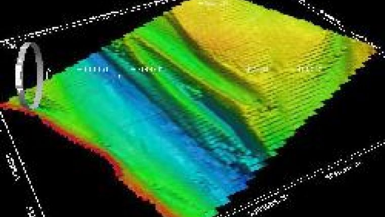
Hydrography is one of the fields integrated in EMODnet, the others being geology, chemistry, biology and broad scale habitats. Within the field of hydrography the data concerning water depth in 500m grid, water depth in vector with isobaths on a scale of at least one to one million, coastlines and underwater features will be included, while gaps on the map will be filled with GEBCO data. The project, under supervision of the Directorate-General Mare , is supported by a number of organisations, including Maris and ATLIS (Hydroteam) from The Netherlands for data management and IT expertise, IFREMER from France, the Spanish Institute for Oceanography (IEO-ES) and the National Oceanography Centre Southampton (NOCS), as well as research institutes and the Geological Survey and SHOM and participating hydrographic offices from Ireland and France. Data being used in the pilots come from the hydrographic offices of Germany, Norway, Denmark, The Netherlands and Belgium.
Fears and Obstacles
A new network with bathymetric and hydrographic data of the major seas surrounding Europe, could raise some eyebrows: is this a new Super Hydrographic Office? Will this make hydrographic offices extinct? Is the EU taking over? "No", says Hartog: "We are definitely not going to create a super HO. We couldn't even service it, if we wanted to. But let me be clear, we do not want to. One of our aims though is, to make hydrographic offices work together in a better, more efficient way by sharing best practices." The head of the responsible maritime unit recognises that there is some anxiety amongst national agencies that are dependent on value added products based on privileged access to data. But he says that it is much more important to see to it that the economy grows and to create opportunities for more companies to enter the market. However, these concerns have been recognised so the initiative is proceeding cautiously, one step at a time. The results of the ongoing small scale preparatory actions will be assessed before taking any decision on the final form of an operational system.
Studies have been carried out on the hurdles and obstacles faced by the initiative including intellectual property rights of some publicly funded data. Technical challenges include the updating as new surveys are made. But Hartog is clear about the prospects: "The benefits for the European economy, the citizens, policy and decision making and the marine environment justify the effort we spend in facing these challenges."

Value staying current with hydrography?
Stay on the map with our expertly curated newsletters.
We provide educational insights, industry updates, and inspiring stories from the world of hydrography to help you learn, grow, and navigate your field with confidence. Don't miss out - subscribe today and ensure you're always informed, educated, and inspired by the latest in hydrographic technology and research.
Choose your newsletter(s)


