COAST-MAP-IO
A Hydrography-based Contribution to Tsunami Preparedness in the Indian Ocean
One of most tragic aspects of the devastation caused by the 26 December 2004 tsunami is that many of the lives lost could have been spared, had warning systems and preparation for such events been adequate. Affected countries have since then undertaken remarkable efforts to ensure that such a tragic failure will not be repeated. A strengthened capacity to collect accurate bathymetric data is a fundamental aspect of many countries’ preparedness for tsunamis and other ocean-based extreme events. Here we describe the COAST-MAP-IO project of the Intergovernmental Oceanographic Commission, which is contributing to the development of this capacity in the Indian Ocean region.<P>
View Larger Map
The IntergovernmentalOceanographic Commission (IOC) of UNESCO (United Nations Educational, Scientific and Cultural Organization) is unique as an intergovernmental organisation with over 40 years of experience co-ordinating the tsunami warning system in the Pacific Ocean, which naturally led to its key mandate in co-ordinating the rapidly developing warning system in the Indian Ocean.
Bathymetric Data
In many tsunami-affected countries, one of the main impediments to accurate prediction of tsunami inundation has been the lack of adequate coastal bathymetric data. It remains a key input for tsunami modelling and is one of the critical sources of uncertainty affecting model results. Although bathymetric surveys are expensive affairs, they must be updated continuously since changes result from both natural and man-made causes. In remote areas with no human impact, and where natural processes are largely stable, bathymetry can be updated over long timescales; some bathymetric charts from five decades ago are still largely usable. However, in coastal areas with high population densities, unplanned constructions tend to alter bathymetry rapidly with a resulting impact on the shoreline. It is these areas that have a high risk of impacting human lives. Bathymetry therefore needs to be updated continuously so that model predictions accurately reflect the onshore impacts, both in direction and intensity. Only then will it be possible to prepare robust coastal zoning and evacuation procedures that are based on sufficiently accurate estimations of risk.
For this reason, strengthened capacity to collect accurate bathymetric data is a fundamental aspect of many countries’ preparedness for tsunamis and other ocean-based extreme events, such as storm surges. COAST-MAP-IO is contributing to the development of this capacity in Bangladesh, Comoros, Kenya, Madagascar, Maldives, Mauritius, Mozambique, Myanmar, Seychelles, Sri Lanka, Tanzania and Thailand (see Figure 1).
Indian Ocean
The focus of COAST-MAP-IO is to increase the capacity of countries to collect and use bathymetric and topographical data to support management of tsunami risk in coastal areas.
The key objectives are to:
- enhance available expertise to locally produce accurate bathymetric and topographic maps on either side (–200 to +50m) of the high-tide line
- provide the capacity to model tsunami arrival, run-up and inundation in coastal areas
- transfer the necessary skills to use bathymetric and terrestrial data sets in developing targeted maps and services (e.g. flooding maps, determination of setback lines, coastal ecosystem mapping and zonation for coastal users) to national disaster management and preparedness agencies.
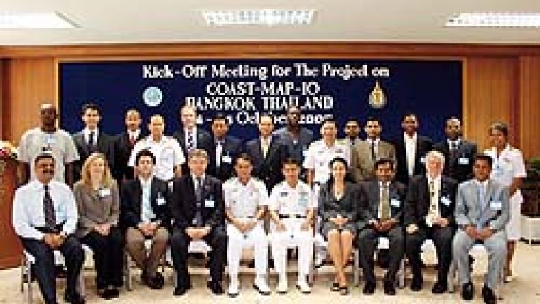
The project began in March 2007 with assessment missions in nine of the countries (Figure 2). Information was collected about key partners, their priorities and needs, and their existing capacities and data. The delegates then met in Bangkok in October 2007 to determine the project work plan.
In March, June and September 2008, advanced training took place on bathymetric data acquisition, processing and management and the use of multi-beam for shallow water areas (Figure 3). This was followed by training on the management of bathymetric and topographical data, their use for map construction with GIS and other tools, and the development of digital elevation models and hydrodynamic models for tsunami inundation simulation (Figure 4). In the coming months, disaster management agencies will be trained in the use of hazard and risk maps for tsunami-proof coastal planning, evacuation procedures and general preparedness against ocean-based hazards.
Key Challenge
As the sense of urgency driven by the tragedy of 26 December 2004 inevitably ebbs, both in affected and donor countries, sustainability becomes an increasingly relevant challenge. This is particularly so in countries with many other urgent issues that claim both public attention and government resources. There is a danger that many of the benefits resulting from the outpouring of aid that followed the tsunami will not be sustained in the long term, in particular for preparedness.
The project was conceived in recognition of the fact that the tsunami-affected countries have the required capacity for their reconstruction and preparedness process. It follows the core principles of co-operation and capacity development of the IOC – country driven and issue based – and meets the prerequisites for national ownership and relevance of activities. Ownership and relevance are necessary for sustainability.
Sustainability
To improve the chances of sustainability, an avenue explored in COAST-MAP-IO is to develop interests in, and benefit from, better coastal bathymetry and inundation modelling capacity. These activities have been co-ordinated with other IOC co-operative activities in many countries. This is especially true in the Western Indian Ocean, where the IOC has partnered a strong self-drive to develop modelling capacity. The interest in modelling in these countries was motivated by more routine applications than extreme-event preparedness, such as the use of hydrodynamic simulations for conception of coastal construction or navigation (e.g. ports, sewage or power plant outflows). Such applications require capacities very closely related to those needed to collect and use bathymetric data for mapping risk in the coastal zone. The IOC’s experience in marine technical co-operation is that routine use of data and data streams considerably increase the likelihood of sustainability, as national organisations and scientists will find knowledge acquisition and equipment maintenance a worthwhile investment.
COAST-MAP-IO is part of an important IOC programme, Integrated Coastal Area Management. Accurate coastal bathymetry is required in order to plan coastal development with due consideration for all users of coastal spaces and, in turn, the impact of coastal development on coastal bathymetry. Unplanned impacts include, for example, shipping authorities engaging in dredging or construction without accounting for downstream impacts on both erosion and accretion.
Future Challenges
COAST-MAP-IO is addressing a crucial need and contributing to safer lives in coastal areas of the Indian Ocean. It is our belief that the project’s conception and execution will allow participating institutes to nurture the technical skills that the project is focused on. The regional collaborations that were fostered will flourish and continue to provide mutual benefits in the long term. The road to greater safety of coastal communities from marine hazards is long and laborious, as was painfully evident in 2008 with cyclone Nargis. Many Indian Ocean countries have, however, shown their determination to advance. UNESCO will proudly continue to partner them in their endeavour, and invites other willing organisations to join the journey.
Acknowledgements
The Italian Ministry of Foreign Affairs, the Kingdom of Norway, IHB, INHO, INCOIS, TECHAWI, ESRI, CARIS have generously supported COAST-MAP-IO.?
Further Reading
Borrero, J.-C., Sieh, K., Sieh, M. and C.E. Synolakis, 2006: Tsunami inundation modeling for western Sumatra. Proceed. Nat. Acad. Sci. (PNAS), 103(52), 19673–19677.
Dalrymple, R.A., Grilli, S.T. and J.T. Kirby, 2006: Tsunamis and challenges for accurate modeling. Oceanography, 19(1), 142–151.

Value staying current with hydrography?
Stay on the map with our expertly curated newsletters.
We provide educational insights, industry updates, and inspiring stories from the world of hydrography to help you learn, grow, and navigate your field with confidence. Don't miss out - subscribe today and ensure you're always informed, educated, and inspired by the latest in hydrographic technology and research.
Choose your newsletter(s)


