Coastal Region High- resolution Seabed Mapping and Geophysical Survey
Osiris Projects
Osiris Projects are market leaders in coastal shallow water high-resolution seabed mapping and geophysical survey. Established in 1997, Osiris Projects remains independent and able to react to the changing demands within this niche sector of the UK and Northern Europe marine survey market, ranging from inland waterways to full scale multi-parameter seabed mapping projects covering many hundreds of square kilometres of coastal seabed. Osiris Projects are anticipating the delivery of their specialised new survey vessel: Bibby Tethra.
Osiris Projects are still located on the Wirral, northwest England, and have steadily grown and now operate from purpose-built facilities, employing nearly 50 people. Since inception, Osiris Projects has owned and operated its own survey vessels, successfully completing over 500 marine-based contracts throughout the UK and Northern Europe. Osiris Projects currently own and operate four dedicated survey vessels suitable for 12-hour operations and one dedicated 26.5m survey vessel suitable for 24-hour operations.
A brand new, purpose-built multi-purpose, 24-hour survey vessel has been delivered in April 2011. Osiris Projects originally operated within a niche market, providing surveys within the nearshore environment, which are too shallow for large, deep-draughted vessels to work," says director Jim Walters.
"Our smaller vessels are able to reach remote sites quickly at speeds of up to 25 knots, whilst retaining the ability to carry out detailed survey work at nominal speeds of around 4 knots - essential for good data quality. As the company has grown, our vessels have become larger and increasingly capable, with the ability to work in deeper waters, further offshore."
Core Business
A team of professional and dedicated staff provide a broad range of experience and expertise covering the disciplines of hydrography, engineering geophysics, maritime archaeology, marine geotechnics and engineering geology. Led by new members to the management team, focusing on operations, sales & marketing and in-house technical skills & competency, Osiris Projects is transitioning to a more diverse business structure. The management philosophy is based upon the competence, dedication and commitment of the staff, and encourages an organisational culture of learning and development. With team members often offshore, this commitment is essential in building a level of trust and independence, overseen and developed by project managers. The company continues to recruit talented graduates from relevant fields of research.
Osiris Projects operate a documented ISO9001-2008 accredited Quality Management System for the provision of hydrographic & geophysical survey services and work within a well-defined, responsible environmental policy. Osiris Projects also operate a documented Health & Safety Management System which is in line with the requirements of ISO18001 Occupational Health and Safety standards, full ISO18001 accreditation is being worked towards in 2011. Osiris Projects have recently been re-audited, achieving >95% scoring for Category B2 certification from UVDB / FPAL for our Health & Safety Management System.
The company has built up a wealth of expertise in offshore wind and in 2010 passed the milestone of 50,000km geophysical data acquisition within the UK wind farm sector. Clients include many blue chip companies such as Shell UK Exploration & Production, Centrica, ENi, EOG Resources, EON, DONG Energy, RWE nPower, National Grid, EDPR, BHP Billiton, Tarmac, Cemex, SSE, Airtricity and many others.
Looking Forward
Osiris Projects' recent move to new facilities has provided it with space to streamline the well established data-processing and reporting services as well as to develop the CAD/GIS competencies. The arrival of the new, multi-role, vessel in early 2011 clearly demonstrates that Osiris Projects is a strong partner for clients focused on end products, as well as having proven engineering skills to assemble and integrate detailed sensor suites for multi-sensor surveys.
One Platform, a Multitude of Capabilities Bibby Tethra
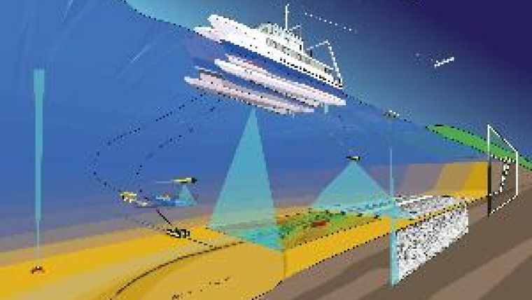
In the near future, the company expects to increase its workload in the Southern North Sea, with increased opportunities generated by the new survey vessel. Offshore renewables is a niche market, tucked between small boat shoreline surveys and traditional large-scale Oil & Gas offshore activities, that is fast requiring very capable coastal survey vessels and expertise. At 27.5m LOA, the semi-swath catamaran Bibby Tethra has been designed for this role; exceptional stability and seakeeping, able to operate up to 150 miles offshore but able to access small ports and harbours, Dynamic Positioning (DP1) Bureau Veritas AM/AT, economical and infinitely controllable diesel electric & pump-jet propulsion, Bureau Veritas (BV) classification - unrestricted navigation, fitted with state of the art high accuracy multi-beam echo sounder and position and orientation sensors as well as winches, an A-frame and 3 moonpools.
Technological Developments
With a focus on quality data, Osiris Projects prides itself on operating with the very latest technology and innovations, and has invested heavily in the latest Motion Referencing Systems. "Technological advances in the marine survey field have quickened over recent years, mainly due to advances in computer speeds and memory capacities, together with rapid advances in software technology," explains Walters. "It is vital for a survey company to keep up with hardware and software advances." Osiris Projects' agreement with RESON ensures the latest offerings in hardware, firmware and software from the company for the next five years, effectively future- proofing the core systems.
"Osiris Projects is working hard to secure a successful future for the business and its employees. This includes a clear business growth strategy, with identifiable opportunities in the next five to ten years. The move to our new premises and investment in company-wide training endorses our aim of remaining market leaders and the supplier of choice for seabed mapping and geophysical survey" says Andy Mcleay, managing director.

Value staying current with hydrography?
Stay on the map with our expertly curated newsletters.
We provide educational insights, industry updates, and inspiring stories from the world of hydrography to help you learn, grow, and navigate your field with confidence. Don't miss out - subscribe today and ensure you're always informed, educated, and inspired by the latest in hydrographic technology and research.
Choose your newsletter(s)


