Designing a New Way to Deliver Marine Weather Data
S-100 Universal Hydrographic Data Model for Informational Overlays
Mariners rely on many sources of information during daily operations to ensure their safety at sea. Nautical charts and weather information are critical and can sometimes lead to life-changing decisions. The ways in which navigation and weather data is created, disseminated and displayed by mariners are drastically different, which has made integration of this information difficult in the past. NOAA and the Brazilian Navy Hydrographic Center are working together to develop a new methodology and international standard that will allow weather forecasts and analysis to be displayed like navigational charts: as an overlay on Electronic Chart Display and Information Systems (ECDIS).
As the maritime industry becomes more high tech, bridge electronics will tend to become increasingly integrated. Bridge electronics integration reduces ship operational costs and increases situational awareness, promoting safety at sea. Since the mid-1990s, the International Maritime Organization (IMO) has led an e-Navigation programme to integrate useful information into a single display for mariners. ECDIS is the only equipment on the bridge that provides an overall view of all navigational sensors simultaneously with nautical charts. Displaying multiple information feeds on one screen enhances the navigating officer’s situational awareness. ECDIS modules currently available to the maritime community are limited in the data sources they can display, but visualising weather information directly on the ECDIS display will be possible in the future using the S-100 Universal Hydrographic Data Model.
International Collaboration
Marine weather forecasting has evolved significantly over the last 20 years due to advances in computing power and space-borne remote sensing. Despite the change in forecasting technology, the way the information is disseminated to mariners remains unchanged. Ships at sea rely on radio voice broadcasts, VHF text broadcasts and radiofax transmissions for accessing weather forecasts. Now that roughly half of the large commercial vessels at sea have internet access, it is time to start developing the next generation of weather forecast products that can leverage satellite internet communications.
The Joint WMO-IOC (World Meteorological Organization – Intergovernmental Oceanographic Commission) Technical Commission for Oceanography and Marine Meteorology (JCOMM) made ECDIS weather overlay products a priority in 2012 and designated the National Oceanic and Atmospheric Administration’s (NOAA) National Weather Service (NWS) as the project lead. The Brazilian Hydrographic Office recognised the importance of delivering life-saving weather information via ECDIS and joined the project in 2014. This started a partnership to develop the S-412 Weather Overlay, a marine weather forecast product format compliant with the future S-100 hydrographic model.
To launch the international collaboration, Brazil sent a visiting scientist to work at the NWS Ocean Prediction Center (OPC) in College Park, Maryland. LCDR Cesar Reinert B. de Morais, an oceanographer from the Brazilian Navy Hydrographic Center, spent four months working side-by-side with OPC personnel to advance the S-412 Weather Overlay specifications development as part of the Brazilian Navy’s ’Science Without Borders’ programme.
Cooperation and collaboration on S-412 doesn’t end with Brazil and the United States. Creating a set of standards and technical specifications to display weather information in electronics primarily designed for displaying navigational charts requires teamwork and support from both the marine weather and hydrographic communities. Experts on both sides of the table are necessary to define the meteorological needs of mariners and how the information can be portrayed by the same means as features on Electronic Navigational Charts (ENCs). Input is also needed from private companies that create ECDIS units to assist with final feature portrayal and data transmission.
Creating an international marine standard that complies with the S-100 charting framework is an immense task. This standard must meet the needs of the international maritime community not only now, but for several decades into the future. Developing the S-412 Weather Overlay standard reaches far beyond compiling and defining features and their numerous attributes. In some ways, the technical aspects of its development might be the simple part of the project. One of the first challenges encountered concerned determining what information to incorporate into the S-412 Weather Overlay.
Each country provides slightly different products and services. In order to meet the demands of the mariner, the international community must reach a consensus on the form and contents of the final product. This includes using a standard set of nomenclature and symbolisation, despite the slight differences found between most countries’ products. All features and their attributes passed several review and comment periods by members of the JCOMM Expert Team on Maritime Safety Systems (ETMSS). Edits and revisions of the features and specifications will continue throughout the development of the standard. In addition to the semantic challenges, the development of the Weather Overlay must also factor in technological challenges. For many countries, developing a system that outputs digital geographically referenced weather features will require a significant effort.
Weather Information for Mariners
Adding informational overlays into ECDIS was not possible until the development of S-100, the Universal Hydrographic Data Model. S-100’s predecessors were hard-coded, static models, but the new model is dynamic, allowing new specifications written in machine readable code to be added to the ECDIS. The flexibility inherent to S-100 will allow S-412 and other informational overlays to provide valuable information to mariners, oceanographers, meteorologists, researchers and students.
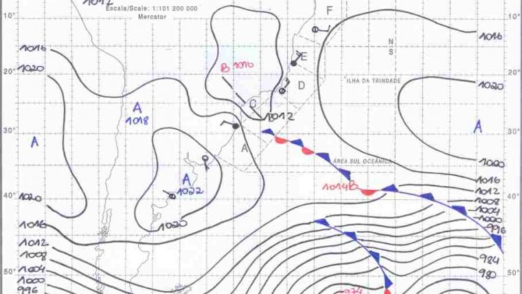
The features portrayed in the S-412 Weather Overlay are designed to replicate and enhance the radiofax charts used today by mariners. A series of point, curve and area features will mimic the internationally accepted symbols commonly found on surface analyses and marine weather forecast charts. Some of these features include high and low pressure centres, locations of hurricanes and typhoons, isobars (atmospheric pressure) and frontal features. Weather symbols will be familiar to mariners, but having them displayed in ECDIS will allow much more information to be presented as opposed to the legacy radiofax paper print outs. The features captured in the S-412 Weather Overlay portray both atmospheric and oceanographic information: wave heights and other critical sea state information will be available to mariners in this new product.
S-412 Technical Development
To date, 40 objects and 80 attributes comprise the draft feature catalogue and have been peer-reviewed through JCOMM’s Expert Team on Marine Safety Systems, an international working group that supports international marine safety, Search and Rescue, and pollution emergency response. The group facilitates international cooperation and the review of technical implementation of services for international maritime emergency response. The portrayal rules are now being developed for the features that will comprise the S-412 Weather Overlay. Development is currently focusing on 13 features most commonly used on international marine forecast charts. The remaining features will be developed after these original 13, which will allow data testing to begin before the entire portrayal catalogue is completed.
Scalar Vector Graphics (SVG) and eXtensible Markup Language (XML) files are being used to define how the points, curves, and surfaces will be represented on an ECDIS. Like navigational charts, the features are being designed to have different day, dusk, and night colour palettes so weather information can be accessed by mariners on the ship’s dark bridge at night. Official marine forecast and analysis products created using the S-412 specifications will be produced by the countries responsible for the international METAREAS, the different areas of responsibility for marine weather warnings maintained by the WMO. The ISO/EIC 8211 format will be used to transmit these forecasts, keeping file sizes low and data accessible to vessels at sea with limited bandwidth.
Future Developments
Over the coming years efforts will concentrate on completing the portrayal catalogue and creating test data. NOAA expects to generate test datasets using the Advanced Weather Interactive Processing System – II (AWIPS-II), the software package the National Weather Service uses to generate forecast products. As data is tested, more technical details will be added to S-412’s product specifications, including parameters such as how large coverage areas may be and the limits to S-412 file sizes.
The team is focused on having a set of specifications and products ready for display on ECDIS by 2018. To meet this goal, further international, inter-agency, and intra-agency cooperation is essential. This project is a prime example of a diverse community coming together despite distance, boundary and resource challenges to complete a common goal and advance the use of digital data in maritime forecasting.
Acknowledgements
Many thanks are due to NOAA’s Julia Powell, Colby Harmon, and Joseph Sienkiewicz for their support and subject matter expertise during the S-412 development to date.
More Information
- IHO Universal Hydrographic Data Model (January 2010) available for free download at http://www.iho.int/iho_pubs/standard/S-100/S-100_Version_1.0.0.zip
- Information technology - Specification for a data descriptive file for information interchange (ISO/IEC 8211:1994) available for download at http://webstore.ansi.org/RecordDetail.aspx?Sku=ISO/IEC%208211:1994&PageType=1

Value staying current with hydrography?
Stay on the map with our expertly curated newsletters.
We provide educational insights, industry updates, and inspiring stories from the world of hydrography to help you learn, grow, and navigate your field with confidence. Don't miss out - subscribe today and ensure you're always informed, educated, and inspired by the latest in hydrographic technology and research.
Choose your newsletter(s)


