Global Navigation Satellite Systems
A Status Update
In this feature the current status and future development of four Global Navigation Satellite Systems (GNSS) are briefly presented. These four systems are the American Global Positioning System (GPS), the Russian Glonass, the European Galileo and the Chinese BeiDou Compass. All four systems offer, or will offer, civil navigation services (publicly open), as well as restricted access navigation services, which means for GPS, Glonass and most likely for Compass as well, military services. The European Galileo system will offer so-called Publicly Regulated Services (PRS) for use by the government.
The basic principle of satellite navigation – referred to as standalone positioning, or single point positioning – consists of measuring, with a receiver on or close to the Earth, distances from three satellites to the receiver, each time by observing the travel-time of the radio signal, as transmitted by the satellite. Three distances, to objects or points with known position coordinates – the satellites – allow us to determine the position of the user receiver, geometrically, in three dimensions. To this end, the ground segment of the system, typically consisting of stations all over the world, of which the position coordinates have been accurately established, and using the radio signals transmitted by the satellites as well, determines the positions of the satellites, predicts them ahead, and uploads the information to the satellites, so that they can relay this information to users all around the world.
One complication remains. The user receiver is typically not equipped with an accurate clock, such as an atomic standard (which the satellite does have on board). When the user receiver clock is ahead, the measured distances are systematically too long, but all by the same amount. This problem is overcome by observing – simultaneously – at least a fourth satellite. With four distances, to satellites at known positions, the user receiver can determine its three-dimensional position, and its clock offset with respect to the system time as well. The resulting position accuracy lies in the order of 5-10 metre (with GPS), under favourable circumstances, which is an open sky, and no tall obstacles, such as buildings, blocking the view.
High Accuracy Positioning
Standalone positioning offers an accuracy at metre level at best. And this is clearly not sufficient for professional high-end applications as surveying and hydrography. As many of the error sources, like satellite orbit and atmosphere, affect measurements made by receivers relatively close together much in the same way, high-accuracy applications call for relative positioning. The position of the user (or rover) receiver is determined with respect to a so-called reference receiver (typically on a location with known position coordinates), or even a whole network of reference receivers. In this way, and by using also the much more precise carrier phase observations, the position accuracy can be improved to decimetre-level and even centimetre-level. Carrier phase cycle ambiguity resolution is the key to this high accuracy.
Global Positioning System (GPS)
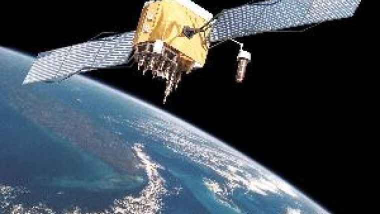
The Global Positioning System (GPS) has been developed by the US Department of Defense (DoD), and is operated by the US Air Force (USAF). The first satellite was launched in February 1978. Various generations of GPS satellites are Block I, II, IIA, IIR, IIR-M, and currently IIF (see Figure 1). The first block IIF satellite was launched in May last year, and set healthy in August. Eleven more block IIF satellites are scheduled to be launched. Third generation GPS (block III) satellites are scheduled from 2014 onwards.
The ground-segment of GPS originally consisted of five stations (worldwide), and one at Cape Canaveral. In the meantime, six ground-stations have been added. The US Coast Guard is the primary point of contact for civilian users: website 1.
GPS is fully operational, currently with 31 satellites in orbit (11 IIA, 12 IIR, 7 IIR-M and 1 IIF), instead of the nominal 24 constellation. Figure 2 shows the number of active GPS satellites in orbit as a function of time, since February 1978, up until today. So far, in a constellation with more than 24 satellites, typically newer satellites fly in tandem, side by side, with older satellites (which are more prone to failure in the near future), resulting in – from a geometric point of view – effectively a 24 satellite constellation. In January 2010, the US Air Force began repositioning GPS satellites, as a transition to what they call a 24+3 constellation. This policy change was driven at least in part by the desire to improve satellite visibility for US and allied military operations in Afghanistan and Iraq, where mountainous terrain can hamper signal coverage for troops on the ground. The transition will be completed by June this year.
Newer GPS satellites offer additional signals, and these are of particular interest to professional, demanding users. GPS is a dual system, serving both military and civilian applications. The original set-up offers signals on two radio frequencies (L1 and L2) for military applications, whereas there is only one for civilian applications (the L1-signal). Through so-called codeless and semi-codeless measurement techniques, however, also civilian receivers can deliver dual frequency measurements. But the measurements on the L2-frequency are typically subject to more noise, and tracking is less robust than on L1. Starting with the block IIR-M satellites, and later with the IIF’s, also an L2-signal with a civilian code (L2C) is transmitted (currently from 8 satellites in orbit). Practically, this means that L2-performance is becoming similar to L1-performance. A full constellation (24 satellites) transmitting this additional (L2C) civil signal is expected around 2016. The traditional military signals on L1 and L2 (on which civilian dual frequency receivers currently rely through semi-codeless measurement techniques) will be provided at least until 2020.
Starting with the block IIF satellites (currently the first one in orbit), an additional high-performance civil signal is offered, on a separate frequency, namely L5. Figure 3 shows a snapshot of data recently collected in Delft (January 2011), to this particular block IIF satellite. The graph shows the pseudorange code measurement noise together with multipath effects, in metres, in blue, as a function of time. The noise – in terms of standard deviation – is below the 10cm level for the L5 code, at mid and high elevation. The green line shows the satellite elevation angle; a full pass was observed from horizon to nearly directly overhead, back to horizon.
The L5-signal targets high-precision and integrity applications. Both the L1 and L5 signal are located in aeronautical frequency bands (whereas the L2 is not), and this will allow for dual frequency ranging and positioning in aviation. A full constellation with 24 satellites, transmitting also on L5, is expected to be reached around 2019.
Glonass
The GLObal Navigation Satellite System (Glonass) was built by order of the Russian Ministry of Defence. The first satellite was launched in October 1982. Since Autumn 2003, second generation satellites (Glonass-M) are being launched. The latest launch of three satellites in December 2010 failed. Third generation satellites (Glonass-K) are expected from this year onwards. They will offer civil signals on three frequencies.
The ground-segment of Glonass is limited, mostly to stations within Russia. The point of contact for Glonass is the Russian Space Agency: website 2.
Glonass has had a difficult time; it reached a constellation with 24 satellites in 1996, but went down to only 6 satellites in 2001. Since then, the system has been steadily rebuilt, and currently Glonass is close to full operational capability. It has 23 operational satellites, next to two non-functional spares, and another with a recent navigation payload failure.
The signals of Glonass are set up differently. Whereas GPS satellites transmit all on the same carrier radio frequency, but with a different binary code per satellite (a principle referred to as Code Division Multiple Access, CDMA), Glonass satellites transmit on slightly different radio frequencies (known as Frequency Division Multiple Access, FDMA). This has implications on receiver (front-end) design, and on handling the carrier phase cycle ambiguities in the data processing.
The new generation Glonass (K) satellites will also transmit CDMA signals, next to traditional FDMA ones. The provision of CDMA signals by Glonass, will, from the user equipment and software perspective, allow for a much simpler integration of Glonass with the other GNSSs.
Galileo
The Galileo system is being developed by the European Commission (EC) and the European Space Agency (ESA). Two prototype satellites have been launched so far, GIOVE-A in December 2005 and GIOVE-B in April 2008. The next step is to launch four satellites, expected this year, and next year, for the In-Orbit Validation (IOV) of the system. A contract for 14 operational satellites was awarded in January 2010. These satellites should fly by 2014. The award of a subsequent 18 satellites has – so far – been left open. With the full constellation, Galileo should have 30 satellites in orbit (27, plus 3 active spares). For the final Full Operational Capability (FOC) of Galileo a date of 2016 has been mentioned.
The ground-segment of Galileo will consist of a worldwide network with about 40 stations. Useful websites on Galileo are website 3 of the European GNSS Agency and of ESA: website 4.
BeiDou-Compass
The BeiDou (Compass) Navigation Satellite System is being developed by the Chinese government (Chinese National Administration of GNSS and Applications, CNAGA). The first Medium Earth Orbiting (MEO) satellite was launched in April 2007. The system currently has seven satellites in orbit (with several launches last year). Plans call for seven more satellites to be launched by 2012, leading to a 14-satellite constellation providing a regional service for the Asia-Pacific region. According to plan, the system will consist of 27 satellites, supplemented by five geo-stationary satellites, and three inclined geo-synchronous satellites, making a total of 35 satellites by 2020. A website has been launched (5), to date only in Chinese.
The release of the Interface Control Document (ICD) for Compass is still pending. This document provides all relevant signal details, and is typically the basis for a receiver manufacturer to build equipment.
Outlook
With four Global Navigation Satellite Systems fully operational by the end of the decade, users on Earth can enjoy signals, at multiple frequencies in the L-band of the Electro-Magnetic (EM) spectrum, from 1.1 to 1.6GHz, from over 110 satellites. There should then be, on average, about 30 satellites in view above a 10 degrees elevation, anywhere on Earth.
With these systems offering ranging signals in similar radio frequency bands, there are no major hurdles in designing and manufacturing multi-GNSS receivers, or rather, to produce a single user receiver, which can do all four of them, GPS, Glonass, Galileo and Compass.
Specifically GPS and Glonass are developing to triple frequency systems, and also Galileo and Compass are planning to offer signals at 3 frequencies. Ranging at multiple frequencies allows the user to handle ionospheric errors based on the measurements themselves, and typically enhances the capability to resolve the carrier phase cycle ambiguities.
Studies have shown that ambiguity resolution over long baselines is enhanced when going from dual to triple frequency ranging, though the improvement is rather marginal. On the other hand, a large number of satellites simultaneously in view may allow for practical and reliable Real-Time Kinematic (RTK) GPS over short baselines (typically 5-10km), using just single frequency (and hence less costly) equipment instead.

Value staying current with hydrography?
Stay on the map with our expertly curated newsletters.
We provide educational insights, industry updates, and inspiring stories from the world of hydrography to help you learn, grow, and navigate your field with confidence. Don't miss out - subscribe today and ensure you're always informed, educated, and inspired by the latest in hydrographic technology and research.
Choose your newsletter(s)


