This is how live transmissions from the deep are done
Exploring the world’s most unknown and least protected ocean
Live transmissions from unexplored regions deep below the Indian Ocean have underlined the role that reliable, high-speed broadband is playing at sea in expanding knowledge and promoting a more sustainable future.
Increasing our knowledge of the marine fauna that populates the depths and the physical systems governing ocean behaviour is essential for a scientific community seeking to better understand climate change and assist political strategies to protect the underwater environment.
The remote setting creates challenges for scientists in what are increasingly collaborative endeavours, involving multi-disciplinary teams that are disparately located. Furthermore, researchers often use advanced instruments that have never before been deployed in the field; if something goes wrong, troubleshooting can be a drawn-out and frustrating process.
Decent communication
Until recently, a major aggravating factor has been the lack of decent communication when a research vessel is situated at a remote oceanic outpost. However, advances in satellite infrastructure and the associated onboard equipment such as antennas and terminals mean ships can now communicate in real time, allowing shore-based partners to follow the excitement of a mission as it happens.

The extent to which connectivity can transform science missions at sea is abundantly clear in the Nekton Mission, which among other things is marrying communications with innovations in AI and Big Data to accelerate exploration and conservation of the Indian Ocean – the world’s least explored and least protected marine zone.
Baseline of marine life
The initial expedition in the First Descent series took place off the Seychelles in 2018. Despite having an ocean territory of 1.37 million square kilometres, little research has been undertaken beneath scuba depth (30m). A primary goal of the expedition – and those to follow – is to help establish a baseline of marine life and measure the state of the ocean, with particular focus on the bathyal zone (200m to 3,000m) – depths richly populated with fish and other marine fauna.
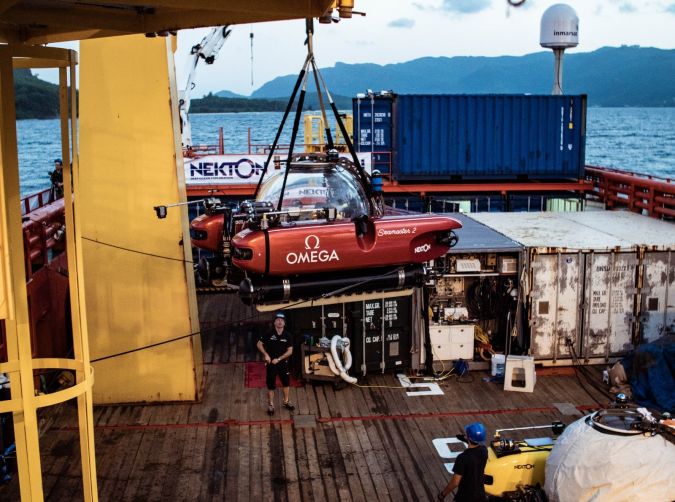
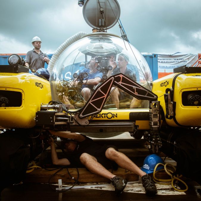
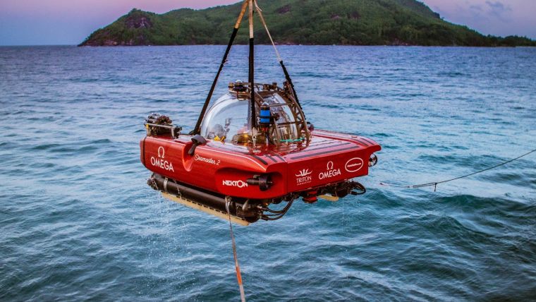
The submersibles and remotely operated vehicles involved in the Nekton Mission bristle with an array of research, sampling, survey and video technologies, including 15 different camera systems that will enable scientists to create the first 3D maps of newly discovered deep-sea ecosystems.
Live audio and video
Inmarsat’s Fleet Xpress maritime broadband service delivers enough performance and reliability to allow live audio and video streaming between vessels and the shore, important for both research and outreach activities. High throughput makes it easier to transmit and share large data sets, while the ability to deliver real-time updates matches expectations for the hyper-connected audiences of today, raised on accessing media on demand.

In fact, sharing footage taken from the subsea cameras in real time is an integral part of the project – and not just among fellow specialists. Images have been distributed live by media outlets, including Associated Press, along with a series of live subsea programmes produced by Sky News and Sky Atlantic. At one point, pictures were even beamed to the giant screens positioned above the concourses of London’s major railway stations, offering commuters a live ‘feed’ to events unfolding deep beneath the waves on the other side of the world.
How it works
Inmarsat’s VP for Offshore Energy, Eric Griffin, explains how the technology works. “The mother ship for the mission, Ocean Zephyr, was fitted with two high power SAILOR100 GX antennas supplied by Cobham SATCOM that were configured to run simultaneously. One was dedicated to getting broadcast quality images back to broadcasters, while the other was reserved for data transfer and operational communications.”
Today such outreach is vital. Effective engagement with the public often ranks highly in the mission statements of universities and research bodies, because public funding demands the demonstration of value-for-money to taxpayers. Again, for research tours that are privately funded, commercial sponsors can be keen to advertise by association.
Combined capabilities
“Cobham’s partnership with Inmarsat that provides FleetBroadband connectivity for the Volvo Ocean Race is perhaps the most recognized example of how our combined capabilities deliver outstanding results for any organization aiming to widen their reach and expand audience engagement,” says Matt Galston, senior director global market strategy and development at Cobham. “The Nekton teams use of Fleet Xpress and SAILOR 100GX high power terminals raises the bar, succeeding not only in audience growth but also in bringing the global scientific community right on board the ship, enabling real-time collaboration to improve mission outcome and better understand our constantly changing planet.”
But livestreams are also invaluable to scientists who cannot participate in person, whether due to restrictions on numbers, insufficient funds or time to go to sea. With a satellite-enabled link, everyone can watch. The enhanced connectivity can help the onboard team respond to the unexpected or unknown.
Empirical data
The fact is that empirical data remains the backbone of research, wherever the recipient is located. By allowing large volumes of raw data to be speedily shared among the scientific community, the high throughput of Inmarsat Fleet Xpress can help accelerate research. Shore-based research teams can then set about analysing the data while the mission is still underway, and report back to the ship if they spot something that merits follow-up.
“This is a real game changer,” comments Griffin. “Before the arrival of Fleet Xpress, scientists would seldom have the chance for real-time interaction. They wouldn’t get their hands on the data until after the ship returned home. If it turned out to contain something special, they would have to cross their fingers and hope it wouldn’t be too long before a return visit. That could be a wait of several years, and even then, the vessel might not head to exactly the same spot.”
Artificial intelligence tools
Meanwhile, the potential of the Nekton Mission continues to unfold. Nekton has teamed up with the University of Oxford to develop artificial intelligence tools, for example, to accelerate analysis and publication. Data will be made available through OCTOPUS – Ocean Tool for Public Understanding and Science – to provide a holistic and dynamic view of the changing state of the Indian Ocean, its biodiversity and human impacts.
Better connectivity can also increase participation. Improved real-time communication opens the door for experts from developing nations to join the scientific exploration of the oceans. In fact, promoting local engagement is one of the Nekton Mission’s broader objectives.
Opportunities for marine scientists
The project organizers made sure to create opportunities for marine scientists based in the Seychelles to participate in all aspects of the expedition. This eye to capacity-building is intended to foster the leadership, tools, skills, knowledge and networks needed to empower long-term sustainable ocean governance at a local level.
Together with data sets and research findings emerging from the expedition, this inclusive approach is intended to help the Seychelles implement a Marine Spatial Plan, which will see around one third of its national waters protected as part of building a sustainable Blue Economy. This is important because the way the Indian Ocean changes in the coming decades will profoundly affect the lives, livelihoods and well-being of the 2.5 billion people living in the region
Nekton and its missions
Nekton's Missions combine scientific research, capacity development, ocean governance and public engagement and all of this work is co-developed hand in hand with host nations. Nekton is an independent not-for-profit research institute working in collaboration with the University of Oxford and is a member of the Blue Prosperity Coalition. Web: nektonmission.org.

Value staying current with hydrography?
Stay on the map with our expertly curated newsletters.
We provide educational insights, industry updates, and inspiring stories from the world of hydrography to help you learn, grow, and navigate your field with confidence. Don't miss out - subscribe today and ensure you're always informed, educated, and inspired by the latest in hydrographic technology and research.
Choose your newsletter(s)


