Maritime Delimitation in the Singapore Strait
The Next Step for Indonesia, Malaysia and Singapore
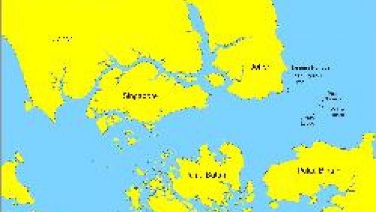
The long-standing sovereignty dispute between Malaysia and Singapore concerning the ownership of the islands/rocks of Pedra Branca, Middle Rocks, and South Ledge has been settled by the International Court of Justice (ICJ). These three features are located at the eastern entrance to the Singapore Strait and have been subject of dispute between the two states for almost three decades (see Figure 1).
On 23 May 2008, the International court of justice (ICJ) ddetermined that sovereignty over Pedra Branca, the largest feature, rests with Singapore whilst Malaysia holds sovereignty over Middle Rocks. Interestingly, the Court did not specifically determine ownership of South Ledge, which is a Low Tide Elevation (LTE, see below). However, it can be logically assumed to be under Malaysian sovereignty as Malaysia holds sovereignty over the nearest feature. This settlement by the ICJ is an important decision that is likely to affect the delimitation of maritime boundaries in the Singapore Strait involving Indonesia, Malaysia, and Singapore.
Maritime boundary delimitation
Pursuant to the United Nations Convention on the Law of the Sea (UNCLOS), a coastal state is entitled to several maritime zones including territorial sea (out to 12 nautical miles, M), contiguous zone (24M), exclusive economic zone (EEZ, 200M), and continental shelf (350M or more), the breadth of which are measured from baselines along the coast. Due to configuration of relevant coasts and, in particular, the proximity of coastal states to one another, it is impossible to find a situation where a coastal state can claim the full suite of maritime jurisdiction/zones without overlapping claims with its neighbours. Indonesia is a good example of this with ten neighbouring states. For such overlapping entitlement, maritime delimitation is required (see Figure 2). However, maritime delimitation is not a straightforward process. Disputes concerning sovereignty over islands/rocks are one major cause of pending maritime delimitation.
Stepping beyond sovereignty dispute
To take a positive view, the legal certainty concerning sovereignty over Pedra Branca, Middle Rocks and South Ledge is an essential requirement of maritime division in the Singapore Strait. Delimitation can only be conducted with the absence of dispute concerning ownership over islands/rocks because claims to maritime jurisdiction flow from sovereignty over land territory. This is similar to the pending of maritime delimitation in the Celebes Sea between Indonesia and Malaysia due to the disputed Sipadan and Ligitan Islands located in the maritime area. Similarly, the dispute of the Paracel and Spratly islands involving several states in Asia-Pacific has also been holding those States from delimiting their maritime boundaries in the South China Sea. Only when the sovereignty over relevant islands is undisputed, can maritime delimitation take place. Therefore, the legal certainty of Pedra Branca, Middle Rocks, and South Ledge in the aftermath of the ICJ's decision has removed a major obstacle for Indonesia, Malaysia and Singapore to delimit their maritime boundaries in the Singapore Strait.
Another key factor related to maritime delimitation is the maritime security issue. Maritime delimitation is often conducted in order to establish stability in a certain region by clarifying each state's maritime belonging. Meanwhile, the Malacca Strait and the Singapore Strait, where Pedra Branca, Middle Rocks, and South Ledge are located, are considered as insecure areas with high level of navigational incidences. These incidences include, but are not limited to, hijacks, robbery, violent boarding, kidnap-for-ransom, boarding, and discharge of firearms. Therefore, security patrols need to be enhanced in the region with better collaboration among neighbouring states: Indonesia, Malaysia, and Singapore. Joint patrol is one of the options for the three. However, without certainty in maritime division, since maritime delimitation has not yet been completed in the region, security enforcement may be problematic. The certainty in territory ownership and maritime jurisdiction will motivate the efforts to maintain maritime security. Therefore, maritime delimitation, being one of the essential requirements in security maintenance, should be one of the top priorities on the agenda.
Together with legal certainty and security issues, economic considerations are also an important factor to be taken into account in maritime delimitation. This mainly refers to the use of a maritime area for transportation. In this regard, the Malacca and Singapore Straits are the most important shipping routes from the Indian Ocean to the South China Sea. More than 70,000 ships navigate through the straits per year, making them crucial waterways for global trade. Being busy straits, the two straits are also the sources of income for Indonesia, Malaysia and Singapore. Meanwhile, the decision concerning Pedra Branca, Middle Rocks, and South Ledge may, to an extent, enhance the number of shipping activities, since it can, generally, be seen as enhancement in ocean management in the region. More shipping activities require enhanced reliability concerning safety and administrative procedures and clarity regarding maritime division. Maritime division does matter since the passages conducted by ships need to acknowledge the state to which certain maritime areas belong. Therefore, maritime delimitation in the Singapore Strait becomes essential. This is another strong reason to accelerate the negotiations among Indonesia, Malaysia, and Singapore in relation to the delimitation of maritime boundaries in the Singapore Strait.
Technical Issues
One issue worth considering is the status of the aforementioned three features (Pedra Branca, Middle Rocks, and South Ledge). Whether or not each of those features qualifies as a status of island will define the maritime zones it is entitled to. An island, according to Article 121 of the UNCLOS, is a land area that is ‘naturally formed'; surrounded by and ‘above water at high tide' which is entitled territorial sea, contiguous zone, EEZ and continental shelf. If it is a rock that ‘cannot sustain human habitation or economic life of their own', it can only claim territorial sea (12M). For example, if Pedra Branca is only a rock based on the definition set out by the UNCLOS, then it is entitled only to territorial sea but not EEZ. On the other hand, a feature appearing only during low tide but submerged during high tide is called a Low Tide Elevation, which, according to the law of the sea (Art. 13 of UNCLOS), has different maritime entitlement compared to an island (see Figure 3). Accordingly, to assess whether or not a feature is an island or LTE, tidal observation is required. An observation on satellite images only, for example, is inadequate to determine whether a feature is an island/rock or LTE. In addition, hydrographic survey is also essential in defining baselines and basepoint, from which maritime zones are measured and boundary lines are constructed. Usually baselines consist of the low water line except where other types of baseline have been declared, for example Indonesia's archipelagic baselines connecting the outer edge of outlying islands within the archipelago.
Another technical issue is the use of geodetic datum. In an agreement between Indonesia and Singapore concerning the maritime boundary in the Singapore Strait (1973), a geodetic datum is not explicitly specified. A geodetic datum is a reference to which coordinates of position are expressed. Without a specific geodetic datum, coordinates of boundary points (latitudes and longitudes) are meaningless. Most importantly, this can bring difficulties in law enforcement. For instance, the absence of a geodetic datum in a maritime boundary treaty will make border patrol teams unable to locate actual boundary points/lines in the field. Accordingly, it is impossible for the authorities to judge whether or not a vessel/boat has committed offences by crossing into another State's waters. In the 2009 treaty, this geodetic datum issue was addressed by specifically defining a geodetic datum which is WGS84. This should also be the case for the future maritime boundary agreed by Indonesia, Malaysia and Singapore in the Singapore Strait.
The way forward
Indonesia and Singapore have signed two maritime boundary agreements in the Singapore Strait (1973 and 2009). These two segments of lines can ideally be elongated eastward to finalise maritime delimitation in the Singapore Strait. For this, three States must be involved: Indonesia, Malaysia and Singapore. The dispute settlement concerning Pedra Branca, Middle Rocks and South Ledge by the ICJ can ideally be an accelerating factor to the delimitation of maritime boundaries in the Singapore Strait. In doing so, the three states need to agree on legal and technical issues prior to conducting the delimitation. Some options of maritime delimitation in the Singapore Strait are depicted in Figure 4. The use of different baselines and types of maritime zones claimable by the three geographical features in the Singapore Strait are two main factors that may affect the boundary options. However, in reality, it will be up to the three parties to settle the final and binding maritime boundaries in the area, which may involve not only legal and technical issues but also other aspects. Ideally speaking, the government of Indonesia, Malaysia and Singapore have realised the importance of maritime delimitation in the Singapore Strait and have put it on their top-priority agenda for peaceful neighbouring relations in the future.
Acknowledgement
The author thanks Dr. Clive Schofield for his constructive comments on the draft of this article.

Value staying current with hydrography?
Stay on the map with our expertly curated newsletters.
We provide educational insights, industry updates, and inspiring stories from the world of hydrography to help you learn, grow, and navigate your field with confidence. Don't miss out - subscribe today and ensure you're always informed, educated, and inspired by the latest in hydrographic technology and research.
Choose your newsletter(s)


