Measurement for Offshore Wind Farms
NORCOWE
The Norwegian Centre for Offshore Wind Energy (NORCOWE) is a research centre with partners from science and industry. NORCOWE is part of the FME scheme, set up by the Research Council of Norway (RCN) to support development of environmentally friendly energy. Met/ocean measurements for offshore wind energy are a major topic within NORCOWE.
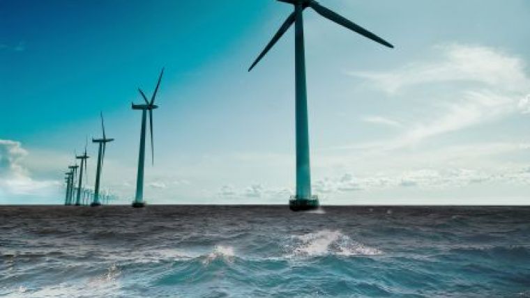
Offshore wind deployments have rapidly developed during the last decade. Both the size of the individual turbines and the extension and density of wind farms have increased and the sites have moved further offshore. These developments pose new challenges with respect to meteorological and oceanic measurements and modelling.
Over the last few years, several large turbines (6-8MW) have been introduced to the market. These turbines have a rotor diameter of 150 metres or more, and a tip height of at least 160 metres when installed at site.
The development of large turbines (5-10MW) implies that we need reliable information on the Atmospheric Boundary Layer (ABL) up to 250-300 metres. At this altitude all our well established surface-layer theories are no longer valid. Recent research shows that information on the wind field and stability (i.e. the temperature profile) over the whole ABL, including the capping inversion, is required to understand and predict wind shear and turbulence conditions in the lowest 300 metres. The situation is further complicated by the poorly understood air-sea exchange processes at the wave-atmosphere interface. These processes seem to modify the wind profiles and the turbulence structure under certain atmospheric conditions, resulting in non-monotonic or even inverted wind profiles.
There is a need for improved design basis to optimise turbine and foundation construction.
Currents, waves and turbulence parameters are important input for that purpose. Measurements focused on the determination of turbulent parameters are crucial for the estimation of structural loads.
Single turbine wake effects are the main factor in limiting the density of turbines in a wind farm, due to downstream power production losses as well as increased maintenance requirements. Wind turbine wakes are complex and highly turbulent structures with large spatial and temporal variability. The state of the art models are capable of predicting average position and extension of turbine wakes, but they still have large problems with representing the instantaneous structure and dynamics (e.g. meandering) that are crucial for accurate load and fatigue estimations. Consequently, there is a need for offshore measurements of wakes in combination with the sea state and the related air-sea exchange processes to understand and document the complex interaction of wakes with the wave-affected marine atmospheric boundary layer.
Observations, e.g. from satellites and model simulations, indicate that wind farm wakes can extend several tens of kilometres downstream. A more precise characterisation of wakes from large offshore wind farms is crucial in the planning process, in particular in the North Sea due to space restrictions.
NORCOWE initiated and realised the OBLEX-F1 campaign (Offshore Boundary Layer Experiment at FINO1) at the German research platform FINO1 to address some of the challenges. OBLEX-F1 started in May 2015 and is expected to last until June 2016. It is being carried out by Christian Michelsen Research (CMR) and the Geophysical Institute, University of Bergen (GFI/UiB) in close cooperation with other NORCOWE partners and German institutions and consortiums. See the NORCOWE website for a detailed description.
The key purpose of the campaign is to improve the knowledge of the marine atmospheric boundary layer with respect to the interaction of wind shear, turbulence and stability, the influence of air-sea interaction processes and to describe the structure and dynamics of wind turbine wakes and wake propagation offshore. The collected observational dataset will be used to validate and improve numerical models and tools for, among others, weather forecasting, marine operations, power performance and wind farm layout. Additionally, the campaign scope will cover research on motion correction techniques for floating sensor platforms.
In order to provide unique datasets for the study of boundary layer stability in offshore conditions, simultaneous measurements of wind, temperature and humidity profiles in the Marine Atmospheric Boundary Layer (MABL) are being taken. This is the first time a microwave radiometer has been installed offshore. By employing both microwave radiometer and Lidar remote sensing technology, we are able to map the boundary layer conditions continuously up to an altitude of several kilometres. Two scanning Lidar systems have been installed on the FINO1 research platform, enabling characterisation of both wind inflow conditions and correlated wake effects at the nearby Alpha Ventus wind farm.
Instruments measuring the currents, temperature, salinity, surface gravity waves and turbulence were deployed in June 2015. The focus is on the upper ocean turbulence characteristics in the presence of surface gravity wave-related processes. The oceanographic instrumentation at FINO1 will be deployed until October 2015.
In recent years we have seen the introduction of many new innovative measurement solutions based on remote sensing technology. Examples are Lidar anemometers, hydroacoustic doppler profilers and microwave radiometers. NORCOWE expects this development to accelerate as the core technology matures rapidly and size, power consumption and complexity of the instruments drops. Successful integration of remote sensing technology on robust platforms suitable for rapid and maintenance free deployment offshore is the key to meet the demand from the wind industry.
In particular floating Lidars are an important step forward to improve the wind resource assessment and to bring down site and resource survey costs. The pull from industry to develop better solutions in this area is exemplified by the commercialisation roadmap initiative launched by Carbon Trust. In addition to site surveys, such solutions will be of great value for improved forecasting of maintenance access windows and short term production planning.
NORCOWE expects further development and increased use of Remotely Piloted Aircraft Systems (RPAS) and unmanned ocean vessels of different size and endurance. Comprehensive met/ocean measurement platforms will likely also be more common in the future. The integration of different met/ocean remote sensing technologies on a single floating platform would enable simplified mapping of wind resource combined with collection of data for turbulence, wave, current and environmental conditions from a single deployment.

Value staying current with hydrography?
Stay on the map with our expertly curated newsletters.
We provide educational insights, industry updates, and inspiring stories from the world of hydrography to help you learn, grow, and navigate your field with confidence. Don't miss out - subscribe today and ensure you're always informed, educated, and inspired by the latest in hydrographic technology and research.
Choose your newsletter(s)


