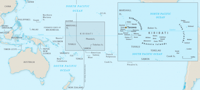
Navigating climate change: Kiribati’s efforts to address sea-level rise
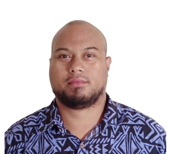
Interview with Tion Uriam, national coordinator for hydrography and charting, Kiribati
The impacts of climate change and sea-level rise on daily life in Kiribati and the Pacific region can also be felt in the hydrographic profession. In this interview, Tion Uriam, the national coordinator for hydrography and charting in Kiribati, emphasizes the challenges faced by Pacific Island nations and the importance of addressing root causes. Uriam discusses the challenges in obtaining support and resources for the Kiribati Outer Islands Transport Infrastructure Investment Project, and how initiatives like Seabed 2030 are helping to bring together countries and organizations to share resources and expertise. Kiribati is also working to educate and raise awareness about the significance of hydrography and the effects of climate change.
How has everyday life in Kiribati – and other countries in the Pacific – been impacted by climate change and sea-level rise?
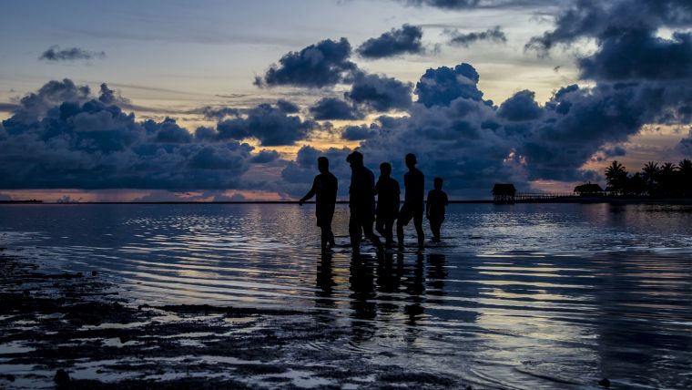
Climate change and sea-level rise have had a significant impact on everyday life in Kiribati and other Pacific Island countries. Rising sea levels have caused increased coastal erosion and saltwater intrusion into the freshwater lens. In our part of the world, we are experiencing the impacts of La Niña: with climate likely to have an impact on the ENSO cycle, La Niña means less rain for us. In fact, we have just recently experienced a heavy drought period. The islands in the Pacific face similar challenges, but at varying scales.
In your opinion, what is the most pressing challenge facing Pacific Island nations such as Kiribati on the topic of climate change and global warming, and how do you envision the country addressing this challenge in the coming years?
Pacific Island nations like Kiribati are facing a major challenge with climate change and global warming due to their vulnerability to rising sea levels and frequent natural disasters. These events are already having serious consequences for the people and environment of these islands. In Kiribati specifically, the challenge is largely caused by high population density and inadequate planning, which are affecting the two most crucial resources – land and water.
Tackling climate change and global warming is not something that can be done by Kiribati alone, but we can control how we use our land and protect our water. Although steps are being taken to adapt with modern measures, the root cause of the problem is still the high population and poor planning. Addressing these underlying issues is crucial to effectively dealing with the impacts of climate change.
What measures is Kiribati taking to adapt to these changes and to protect its coastlines and communities?
Our traditional way of life was characterized by its capacity for adaptability to environmental changes. The design of homes, for example, allowed for mobility and portability, and families acquired only sufficient resources for their daily sustenance. The implementation of measures to support adaptation in response to environmental challenges can be considered more as reactive, rather than proactive, in nature. Genuine adaptation entails the capability of survival in a constantly changing environment and growing population, which ultimately depends on effective resource management practices.
How is Kiribati working to maintain accurate and up-to-date hydrographic charts and maps of its waters?
The Kiribati Outer Islands Transport Infrastructure Investment Project (KOITIIP), an ADB and WB funded project, is currently focused on updating the charts of four islands in Kiribati. The goal is to use this work as a stepping-stone to gain support for mapping the rest of the islands in Kiribati and producing more nautical charts. The most recent data available is satellite-derived bathymetry that covers all 33 islands in Kiribati. We are also taking part in the Seabed 2030 initiative, which allows for the exploration of crowd-sourced bathymetry to map more of Kiribati’s waters. Vessels that frequently ferry between the islands carry single beam echosounders, effectively helping to map Kiribati’s waters through the collection of data.
What challenges does Kiribati face when it comes to conducting hydrographic surveys and maintaining accurate maps in the face of climate change and sea-level rise?
The current biggest obstacle is obtaining the necessary support to establish a sustainable programme. My department currently lacks the budget and manpower needed to undertake the work. The perceived value of producing maps and its potential contribution to Kiribati’s long-term socio-economic development plans is not yet clearly understood.
The phrase “we cannot manage what we can’t measure” is especially relevant in the context of Kiribati. Through KOITIIP, we aim to increase awareness of the importance of mapping and the potential benefits it can bring.
When it comes to the effects of climate change and sea-level rise, various models predict that Kiribati could be underwater in the coming years. These predictions are based on satellite-derived elevation data, which has a very low level of detail. Since many of Kiribati’s atolls are only three metres above sea level, more accurate predictions could be made by mapping the elevation at a higher level of detail.
How are technology and innovation being employed to improve hydrographic capabilities and address the impacts of climate change?
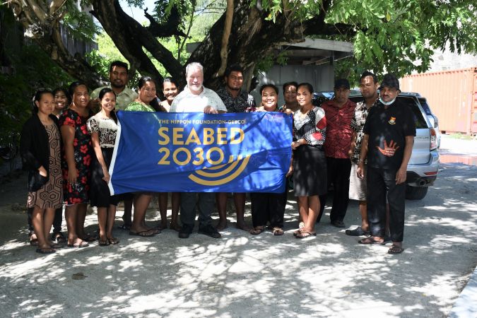
Affordability and access to technology are important factors in improving hydrographic capabilities and addressing the impacts of climate change in Kiribati. The cost of technology, both hardware and software, can be a barrier for small island nations like Kiribati. However, initiatives like the Seabed 2030 project, which seeks to map the world’s oceans by 2030, are helping to bring together countries and organizations to share resources and expertise. Additionally, open-source and low-cost technology solutions are becoming increasingly available, which can help to reduce the cost of technology and increase access to it. It’s important for Kiribati to find the most affordable and accessible technology solutions that meet their needs and capabilities.
How is Kiribati working to educate and raise awareness about the importance of hydrography and the impacts of climate change on its waters?
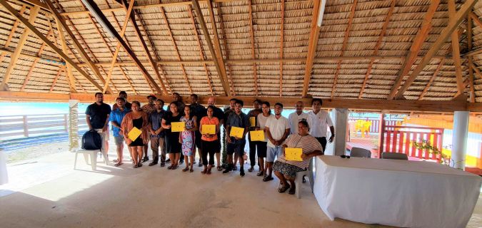
In order to educate and increase awareness on the significance of hydrography and the effects of climate change on Kiribati’s waters, workshops were conducted with representatives from various government departments. One of these workshops, held in November 2022, was in collaboration with our friends from the National Oceanic and Atmospheric Administration (NOAA), aimed at creating and engaging various stakeholders in developing a comprehensive action plan for managing geospatial data using the United Nations Global Geospatial Information Management Integrated Geospatial Information Framework (UNGGIM IGIF model). Recently, another workshop was conducted by Seabed 2030, resulting in the signing of a Memorandum of Understanding between my ministry (MICT) and Seabed 2030 on the sharing of data.
How do Kiribati and other Pacific Island nations work with international organizations and other countries to exchange knowledge and best practices in hydrography?
Kiribati collaborates with international organizations and other countries by exchanging knowledge and best practices in hydrography through various initiatives, such as workshops and conferences. Additionally, there is a mentorship programme through the South West Pacific Hydrographic Commission where individuals can receive guidance and support from experienced mentors. In this case, Dr John Nyberg has served as a mentor, providing valuable assistance and support.
Are there any other ways in which Kiribati and other countries in the Pacific are working to advance the field of hydrography and stay up to date with the latest technologies and techniques?
As I mentioned earlier, one way that Kiribati and other Pacific Island nations are advancing the field of hydrography is through participating in mentorship programmes. For example, Kiribati has participated in the South West Pacific Hydrographic Commission’s mentorship programme, where experienced hydrographers provide guidance and support to the next generation of hydrographers in the region. This type of programme allows for the exchange of knowledge and the sharing of best practices in the field, helping to ensure that countries in the Pacific stay up to date with the latest technologies and techniques in hydrography.
Climate change is one of the most pressing issues facing the world today. What steps do you believe need to be taken by industrialized countries to mitigate the effects of climate change and avoid worst-case scenarios?
There is a very simple answer to this that says it all: I think it’s important that we all do our part, as we are all in this together.
Do you have any final message or advice that you would like to share with the global hydrographic community, particularly regarding the challenges and opportunities facing Kiribati and other small island nations in the Pacific in the face of climate change and sea-level rise?
I truly am a firm believer in mentorship programmes: whether between individuals or organizations, we can benefit from learning from one another. Especially in our case, where we do not have the experience or expertise, a mentorship programme can be useful in bridging this gap.
About Tion Uriam
Tion Uriam is the national coordinator for hydrography and charting in the Marine Division of Kiribati’s Ministry of Information, Communications and Transport. He has a diverse academic background, including a diploma in Geospatial Science from the University of the South Pacific and a Bachelor’s of Applied Science in Surveying from RMIT University, and he also completed the GEBCO/Nippon Foundation Cat A programme at the University of New Hampshire. Uriam has over 15 years of experience working in the Kiribati government. He started as a GIS officer in the Ministry of Fisheries, then transitioned to become a land surveyor before his current position. As the national coordinator for hydrography and charting, he oversees the hydrography department – ensuring that Kiribati’s waters are safely chartered – and manages maritime safety and infrastructure development.

Value staying current with hydrography?
Stay on the map with our expertly curated newsletters.
We provide educational insights, industry updates, and inspiring stories from the world of hydrography to help you learn, grow, and navigate your field with confidence. Don't miss out - subscribe today and ensure you're always informed, educated, and inspired by the latest in hydrographic technology and research.
Choose your newsletter(s)


