NOAA Completes Multi-year Ocean Mapping Project off Olympic Coast
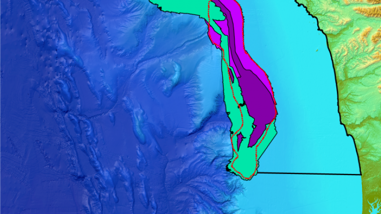
In September 2017, NOAA’s Integrated Ocean and Coastal Mapping Programme completed a multi-year ocean mapping project off the coast of Washington in Olympic Coast National Marine Sanctuary. This project grew out of a seafloor mapping prioritisation exercise led by NOAA’s National Centers for Coastal Ocean Science on behalf of the State of Washington in May 2015. The prioritisation exercise integrated the priorities of coastal stakeholders representing numerous federal and state (Oregon and Washington) agencies, coastal treaty tribes, and academic institutions to determine where to concentrate future survey efforts. One identified priority was the need for a better understanding of the bathymetry and habitats of Washington’s submarine canyons, particularly three offshore areas in need of enhanced data collection efforts.
Since then, a scientific team of experts has contributed to NOAA-led multi-disciplinary surveys of the offshore priority areas, utilising data collected by the NOAA ships Rainier and Okeanos Explorer, and E/V Nautilus and maximising other ocean mapping data provided by external sources in an effort to meet mapping goals established during the prioritisation exercise. The resulting survey efforts, which involved collection of swath bathymetry, acoustic backscatter, and water column data, will support coastal and ocean management activities as well as a wide variety of other applications, including to:
- Inform regulatory decisions on coastal development
- Provide benthic habitat mapping and seafloor characterisation for sustainable fisheries initiatives, and to help assess fishery stocks and critical spawning aggregation locations
- Better understand and manage shelf and canyon resources
- Aid in resolving multiple-use conflicts
- Advance research in determining chemical and biological contamination levels
- Support upcoming efforts to locate, assess, and characterize deep sea corals and sponges
- Locate and identify hundreds of previously unknown methane gas seeps along the shelf break
- Update NOAA nautical charts and products off the coast of Washington
As part of the mission, NOAA Ship Rainier acquired depth measurements and other hydrographic data throughout the entire project to update NOAA nautical charts including chart 18500 off the coast of Washington with corresponding electronic navigational charts (NOAA ENC®) US3WA03M and US3WA01M.
NOAA ships Rainier and Okeanos Explorer are part of the fleet of ships managed and maintained by NOAA’s Office of Marine and Aviation Operations, and operated by commissioned officers of the NOAA Corps (one of seven uniformed services of the United States) and civilian wage mariners. The E/V Nautilus is owned and operated by the Ocean Exploration Trust.

Value staying current with hydrography?
Stay on the map with our expertly curated newsletters.
We provide educational insights, industry updates, and inspiring stories from the world of hydrography to help you learn, grow, and navigate your field with confidence. Don't miss out - subscribe today and ensure you're always informed, educated, and inspired by the latest in hydrographic technology and research.
Choose your newsletter(s)


