Online Mapping Tool to Track Gulf Response
NOAA has launched a federal Web site meant to answer questions from a range of communities like hotel operators to fishermen and local community leaders, with clarity and transparency. It is a one-stop shop for detailed near-real-time information about the response to the Deepwater Horizon BP oil spill. The Web site incorporates data from the various agencies that are working together to tackle the spill.
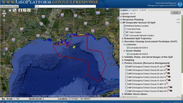
Originally designed for responders, who make operational decisions, to the oil spill disaster, the website integrates the latest data on the oil spill's trajectory, fishery closed areas, wildlife and place-based Gulf Coast resources such as pinpointed locations of oiled shoreline and daily position of research ships into one customisable interactive map.
The launch of the public site is designed to facilitate communication and coordination among a variety of users, from federal, state and local responders to local community leaders and the public, the site is designed to be fast, user-friendly and constantly updated.
Beyond NOAA data, the site includes data from Homeland Security, the Coast Guard, the Fish and Wildlife Service, EPA, NASA , US Geological Survey and the Gulf states. Agencies contribute data through the response data sharing mechanism within the command posts. This includes posting geospatial data on a common server, allowing access and use for multiple spatial platforms.
"This Web site provides users with an expansive, yet detailed geographic picture of what's going on with the spill; Gulf Coast fisherman, recreational boaters, beach users and birders will be able to become more informed," said Jane Lubchenco, Ph.D., undersecretary of commerce for oceans and atmosphere and NOAA administrator. "It's a common operational picture that allows the American people to see how their government is responding to the crisis."
Developed through a joint partnership between NOAA and the University of New Hampshire's Coastal Response Research Center, the site is a Web-based GIS platform designed specifically for response activities where it is necessary to coordinate with various federal, state and local agencies. The site will serve as the official federal source for map-based data.

Value staying current with hydrography?
Stay on the map with our expertly curated newsletters.
We provide educational insights, industry updates, and inspiring stories from the world of hydrography to help you learn, grow, and navigate your field with confidence. Don't miss out - subscribe today and ensure you're always informed, educated, and inspired by the latest in hydrographic technology and research.
Choose your newsletter(s)


