
Seabed 2030: The Final Sprint
The Nippon Foundation-GEBCO Seabed 2030 Project has just over nine years left to achieve its indispensable goal of the definitive, freely available map of the entire world ocean floor. The Project’s timeline is ambitious but vital – in 2019, we were warned that we only have 11 years left to prevent irreversible damage from climate change[1]. The United Nations Climate Change Conference (COP26) reminded us of the commitments that must be made on a global scale if we are to safeguard the future of our planet, and certainly Seabed 2030 is operating on that global scale.
Environmental Impact
Our oceans drive global systems that make the Earth habitable for humankind, with the UN even describing the oceans as ‘our planet’s life support’. Our rainwater, drinking water, weather, climate, much of our food, and even the oxygen we breathe, are all ultimately provided and regulated by the sea. But despite this critical dependence on the oceans, we still know so little about them, and the threats to our ocean environment continue to grow – much of which are caused directly by humankind. Heading the list are plastic pollution and the collapse of fisheries, acidification and ocean warming.
Having a complete map of the ocean floor will equip us with the information and knowledge we need to provide many of the solutions to these pressing challenges. When Seabed 2030 was launched in 2017, only 6% of the seabed had been mapped to a modern standard. Our dependency on the ocean hasn’t changed since then, but the need to ensure its sustainable management has become ever more apparent. Today, there’s been a notable increase in the amount of bathymetric data logged, with over one fifth of the entire seabed now mapped in the latest GEBCO grid. Since its launch, Seabed 2030 has supported the UN’s Sustainable Development Goal 14: ‘to conserve and sustainably use the oceans, seas and marine resources for sustainable development.’
Ocean Decade
The time remaining for Seabed 2030 to achieve its goal also coincides with the UN Decade of Ocean Science for Sustainable Development (2021-2030), which launched earlier this year with the aim to strengthen cooperation needed for the sustainable management of our oceans. Seabed 2030 was one of the first Actions to be officially endorsed as part of the Decade.
Seabed 2030 is aware of the monumental task ahead, but the Project is also certain that with global cooperation, a complete map of the ocean floor by the end of the Decade is achievable. With the ocean covering over 70% of Planet Earth, a complete map of the ocean floor can aptly be referred to as an international necessity – demanding international collaboration.
Collaborative Work
A complete map of the seabed is a vital tool which will enable us to make informed decisions – decisions that affect the entire human population. To this end, Seabed 2030 continues to enter into partnerships with various institutions and individuals in pursuit of its goal. This year also marked the first ever agreement between the Project and a government[2].
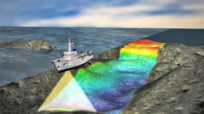
Working collaboratively towards a goal which is ultimately for the benefit of humanity is central to Seabed 2030 – every time a research vessel adds bathymetry data gathering to its mission, every time a ship takes a slightly altered course while in transit to survey an uncharted area, they are helping to fill in the gaps in the grid.
This year, Seabed 2030 will also be participating in the fourth Paris Peace Forum. The Project intends to use this platform to continue to raise awareness and inspire new partnerships to bring about impactful changes to the way in which the world is governed – and its resources managed. Over three billion people depend on the oceans for their livelihood, but less than 2% of national resource budgets are currently allocated for ocean science. COP26 and the Paris Peace Forum may act as catalysts for the changes that we need to make on a global scale and Seabed 2030’s progress, but it is the international community that can take it over the finish line.
[1] https://www.un.org/press/en/2019/ga12131.doc.htm
[2] https://seabed2030.org/news/new-zealand-government-signs-agreement-seabed-2030
A chartered surveyor, hydrographer and former Royal Navy officer, Jamie McMichael-Phillips has worked in a range of leadership roles from running his own marine data gathering missions to directing defence geospatial strategy and plans for the UK. Prior to joining Seabed 2030, he chaired the International Hydrographic Organization’s Worldwide ENC Database Working Group for over nine years.

Value staying current with hydrography?
Stay on the map with our expertly curated newsletters.
We provide educational insights, industry updates, and inspiring stories from the world of hydrography to help you learn, grow, and navigate your field with confidence. Don't miss out - subscribe today and ensure you're always informed, educated, and inspired by the latest in hydrographic technology and research.
Choose your newsletter(s)


