C-MAP Introduces Ultra-high-resolution Bathymetric Imagery
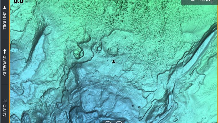
C-MAP, a leader in digital marine cartography and cloud-based mapping has released new C-MAP Reveal charts, featuring views of the seafloor. This cartography offers all the navigation data and capabilities of a C-MAP MAX-N+ card – plus ultra-high-resolution bathymetric imagery of select coastal and offshore areas, including the clearest views of structure, wrecks, isolated reefs and ledges between the contour lines.
Detailed Charts
The highly detailed C-MAP Reveal imagery replaces shaded relief data in selected areas with more accurate depth variations. Complete with vector data, these detailed charts include C-MAP HRB Coastal Data, Genesis layer social map data and satellite imagery that can be overlaid directly onto the charts. C-MAP Reveal is available for use on Lowrance, Simrad or B&G chart plotters, excluding Lowrance HOOK2 and Simrad Cruise.


