Citizen Mapping and Charting (part 2)
How Crowdsourcing is Helping to Revolutionise Mapping & Charting
Part 1 of ‘Citizen Mapping and Charting' described the concept of crowdsourcing with examples. From here part 2 will focus on maps and charts.
Everybody's a Map Maker
The applications mentioned in Part 1 all make extensive use of spatial data and use map applications to display their results. Some (such as website 1 and the AIR (Area's Immediate Reading) project website 2) use graphical displays that most public institutions could only dream about - clearly a benefit from having one or two design students on your team of volunteers. The crowd makes extensive use of maps for display purposes but perhaps the biggest development that the mapping community has to be concerned about is the creation of maps by the crowd. Teams of amateur map makers are forming ‘mapping parties' on weekends to gather road network data and compile them into very useful and credible street maps free for all to use.
The leader of this movement - although not the only one (another is at website 3) - is OpenStreetMap.org (OSM). OSM and its band of mappers have literally remapped the UK and much of Europe and are slowly working their way around the world with extensive mapping going on in India and North America. One has to view the website to see how extensive the coverage is and the level of detail captured. As of January 2009, OSM has more than 50,000 registered users and more than 5,000 map-making contributors each month - and the number is doubling every year (see Figure 2). That's an impressive number no matter how you view it. The software is of course OpenSource. The site also provides links to free software to help process the GPS ‘traces' that OSM participants acquire and compile them into recognisable road maps.
Ordnance Survey
The story involves one of the most highly respected mapping agencies in the world - the Ordnance Survey (OS). The OS has a long and varied history, and virtually anyone in the mapping business is aware of its capabilities, the high quality of its work and the contributions it has made to the mapping community through education, training and standards development. Unfortunately, these days it is also known for its fee structure for map data. In fairness to the OS, they have been re-created as a quasi-public/private sector trading company that must raise much of its revenue through the sale of its products. Nevertheless, many users see the OS as imposing onerous user fees and far too restrictive use policies on data that were acquired through tax funding. The end result was almost inevitable.
Map Updates
We cannot discuss the modern mapping environment without mentioning the biggest use of digital maps today - route guidance in automobiles. This market has grown to become a billion dollar business. The important part of this enterprise in the context of this article is the feedback on road changes from users. TomTom alone reports 5,000,000 map updates provided by its MapShare community by January 2009 (see Figure 3). Tens of thousands of users have clearly bought into the idea that if the map is in error, don't get angry - fix it.
The OpenStreetMap data, by and large, are used in navigation systems and as the backdrop for citizen activist websites. There have been several studies performed to test the quality of the OSM product in the UK, particularly against the official OS data. The OS data is often more accurate but it is hard to beat the up-to-datedness of the OSM product. It improves steadily and tracks changes in the city landscape at a rate that even civic institutions find hard to match. The OpenStreetMap data are in fact so good that the organisation has taken steps by entering trap streets to ensure that its data is not used in commercial systems.
I'm Really Worried
At turning points such as this, it is good to review how we got here in the first place. Usually, there is a reason why things are as they are. First, there was a very high cost to carry out base surveys both in time and money, and consequently their creation had to be sponsored by some organisation, usually the national government. Second, the work was conducted by a small number of specialists (surveyors, cartographers) with long learning curves necessary to achieve the level of expertise needed - meaning it was difficult for any other organisation to get involved or compete. That expense of limited resources meant that it only made economic sense to map items that were more or less constant through time. Furthermore, the capital cost of the essential heavy printing presses left the major map production work to public institutions. That, in turn, only encouraged large press runs. And from this it only made sense to maximise the number of users per product.
But now we live in a world where, apparently, many people are willing to do basic mapping functions for free as a hobby. Not only that, but the tools they use are easy to use and users catch on quickly. Evidence shows that they do a good job. They are also willing to map things that are here today and gone tomorrow. And there is little need for large heavy and expensive printing presses. Finally, many people clearly love the idea of built-for-purpose maps. The more specific the better, as the crowd is motivated by a cause.
Cyclists' Maps
Nowhere is community-driven mapping any more evident than in the number of map sites for cyclists. This is where we, in the marine mapping business, can gain a lot of insight. First off, cyclists are a well-defined community. They enjoy talking to other cyclists and they love to ride to new locations. Now, since cyclists must share the road with faster and heavier vehicle traffic there is a safety concern shared by all cyclists. So there is a common need to tell other cyclists how to navigate in their specific neck of the woods.
The cycling community is also well connected, technically savvy and environmentally active. It is no surprise then that the web is full of sites offering tips to cyclists about the best routes through a community (see Figure 4 and other example at website 4). These sites are examples of what is known as GeoWiki. Any user can change the map or its route recommendations in the traditional Wiki way. What is clever about these sites is the computational nature of choices for route finding.
Recreational Boaters
We in the marine mapping world have been largely sheltered from the OSM crowd. Perhaps it is that the nature of the nautical chart does not lend itself to easy re-mapping the way that land mapping does. After all, there aren't that many boaters with the kind of echosounding equipment we think is necessary to do the job. Nevertheless, we can see nascent crowdsourced seabed maps through OLEX and Piscatus (85), who use user-generated bathymetry to improve their sea floor images used in the fishing industry. So perhaps it is just a matter of time.
In fact, a large percentage of the recreational boating market does not really care about the specific depth of water at any specific point. Many simply care where the dangerous shoals are - or, in Mark Twaine's Riverboat voice, "where they ain't". What they do very much care about is any information other boaters could pass along about a specific voyage - including the equivalent of the ‘shortest, fastest and quietest'. If that is the case - and I do believe it is - then it really is only a matter of time before ‘wikinautica.org' is up and running.
Community Driven
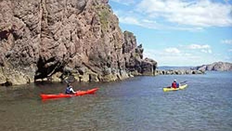
Sea kayakers, for example, are a group to strongly benefit from some community-driven Wiki action. Water depth is largely irrelevant to even the most heavily laden tandem kayak - it still draws less than 1 foot at best. Sea kayakers are far more interested in the effects of tidal currents in a region - an aspect that can really affect their safety. Similar to cyclists, sea kayakers rely on their fellow travellers to provide advice based on first-hand experience of sailing in an area; the nature of the currents, kelp beds to avoid, places to launch, beaches to camp on, etc. A Wiki-based chart would seem to be a good fit. OpenOceanMap.org in California provides a site with NOAA nautical charts marked with points at which sea kayaks could be launched.
Other pleasure craft would also benefit from a Wiki-based Coastal Pilot or Sailing Directions. It is the contribution of other sailors who regularly sail within the area that will have the most benefit, given its relevance to the size and nature of the craft and the up-to-datedness.
But surely maps made by professionals are vastly superior? In many ways they are, but:
Are they always up to date? Do they portray the map data in the most usable fashion for a specific use? Are they comprehensive enough for some users? Are they cheap to maintain?
Future Thoughts
Given the heavily regulated nature of commercial shipping, it might appear unlikely that any Wiki-based approach, free from the guiding hand of a national HO, could provide a benefit to the mariner. Having said that, it does seem at a minimum inefficient, if not foolhardy to not take advantage of the advice of fellow mariners about aspects of sailing in an area now that the technology is at hand to provide that advice. It is almost certain that some form of marine Wiki-based navigation device will be implemented, particularly after the next generation of mariners takes command. Given that scenario, it would be wise to begin experiments now, at least in the unregulated part of our industry.
We are shifting from top-down controlled production and distribution to bottom-up crowdsourced production and open-sourced distribution. Most importantly, we now have a generation of well-educated and knowledgeable citizens who have come together to develop their own sensors, conduct their own surveys, analyse their own data and publish it online, usually in real time to an open-access website that anyone can view. They include groups of enthusiasts, eager to share new map and navigation information with their fellow travellers to ensure they also have safe, enjoyable and incident-free journeys.
It's time to join the revolution!

Value staying current with hydrography?
Stay on the map with our expertly curated newsletters.
We provide educational insights, industry updates, and inspiring stories from the world of hydrography to help you learn, grow, and navigate your field with confidence. Don't miss out - subscribe today and ensure you're always informed, educated, and inspired by the latest in hydrographic technology and research.
Choose your newsletter(s)


