Costa Concordia: Rock Not Charted or Erroneous Navigation?
On the evening of Friday, 13th January 2012, the cruise liner Costa Concordia grounded near the Italian island of Giglio after hitting an underwater rock. This tragic event has raised various questions, including whether the ship was navigating too close to the shore and whether the rock was properly charted.
The vessel was in touristic navigation, passing by the picturesque island Giglio. This is a manoeuvre which is done from time to time. However, this time, the vessel approached the coast very close to the dangerous Le Scole reef area. The minimum distance to the shore usually is a couple of miles. Even inhabitants of the island remarked that the cruiseship appeared to be closer than usual.
According to several sources, the captain of the Costa Concordia has stated that the rock the ship hit was not charted. The vessel has a draught of 8.2m and was sailing approximately 300m out from the shore and the rocks. The area is said to be well-charted, and the place is used for diving and sailing which makes it well-known.
It is not completely clear where the Costa Concordia hit the rock. According to AIS sources, the vessel may have tried to navigate between two rocks with a depth of 10.3m.
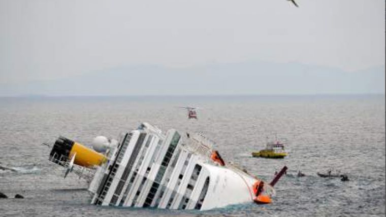
After the incident, the vessel navigated close to the shore, towards the harbour. When turning, the vessel listed to one side, which was critical in view of the shallow waters.
The position is not yet stable: on Monday, 16th January 2012, the Costa Concordia moved 9cm downwards. If this continues, due by bad weather for example, she may even slide from the rock, potentially to a depth of 100m.
ADDITION 18th JANUARY 2012
According to Lloyd's List on BBC, the Costa Concordia followed a comparable route in August 2011. No rocks are shown on the UK Hydrographic Office's charts, but the UKHO has stated that this could be due to the small scale of its charts, whereas Italian charts are available on a much larger scale.
The Italian Hydrographic Office is working on a detailed study regarding the charting and survey situation of the location.
ADDITION 23rd JANUARY 2012
The Italian Hydrographic Service illustrates the situation by sending charts 74 and 119, added as PDF files.
Download iim-chart-74.pdf
Download iim-chart-74.
Download iim-chart-119.pdf
Download iim-chart-119.


