Esri Supports Japan Response
In response to the devastating Japan earthquake and tsunami, Esri (USA) is providing assistance to a myriad of organisations involved in the disaster response. The company is working closely with both domestic and international agencies to provide on-site personnel, geographic information system (GIS) software expertise, and project services. Esri is also providing organisations with software, data, imagery, and technical support.
Russ Johnson, director of public safety solutions for Esri, says that the full emergency operational procedures have been deployed to assist. Esri is providing response agencies with resources that can make a difference in saving lives and minimising damage.
GIS solutions are helping officials use critical information for making rapid, effective decisions. The technology helps responders and emergency managers conduct rescue operations, prioritise medical needs, identify severely damaged areas, measure impacts to critical infrastructure, locate areas suitable for food and water distribution, and more.
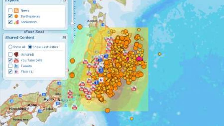
An Esri-generated social media mapping application is available for both the media and public. People can follow events in near real time using the application to gain a greater understanding of the situation. It includes links to news reports as well as Tweets, YouTube videos, and Flickr photos. It also gives people the ability to view streets, satellite imagery, and topographic maps as part of the map overlay.
Agencies assisting in the disaster response effort can take advantage of maps, data, software, and web services available online through the Esri website. Organisations can request software or assistance through this website.


