Evolution in Nautical Charting
Toward Convergence of Paradigms
For all their difficulty to learn, implement, fix, re-learn, and keep trying to fix, data standards have become essential to many aspects of our modern world. For almost 90 years, the International Hydrographic Organization (IHO) has provided international standards for nautical charting and hydrography. This in itself was a paradigm shift compared with previous centuries of ocean navigation, in which nautical charts were carefully guarded as state and industry secrets. The next great paradigm shift began when the IHO’s S-57 Transfer Standard for Digital Hydrographic Data was introduced in 1992 to enable nautical chart data to be transferred digitally and in a standardised form for the first time. Together with S-52 symbology definitions and Electronic Navigation Charts (ENC) product specifications for the Electronic Chart Display and Information System (ECDIS), ISO 8211 data encoding specifications, and what is now a mature set of operational procedures, the ocean navigation community has evolved a complete solution for production and delivery of digital datasets and incremental updates for ENCs shared around the world. This family of specifications and practices provide digital datasets that are compact, reliable, tolerant of low-bandwidth communications and widely implemented.
It is worth noting that S-57 came on the scene just a couple of years before the World Wide Web. Many people equate the Web with the Internet, but it wasn't until the Web appeared as a simple set of conventions for describing and linking resources, along with a windowed browser interface, that the whole world suddenly had access to the Internet, which had begun decades earlier. Remarkably, several geospatial data standards initiatives started about the same time. ISO Technical Committee 211 (ISO TC/211) had just been formed and began developing the ISO 19100 family of standards for geospatial information. The OpenGIS Consortium (OGC) was founded in 1994, later changing its name to Open Geospatial Consortium to reflect broader concern for interoperability of any data with location content. Since many of the key developers of ISO 19100 standards were also members of OGC, these two standards organisations developed close co-ordination from early on, to develop the core information models, the means of describing and transforming them, and various protocols for data exchange over the Web. ISO TC/211 focuses more on the core principles and foundations of geospatial information and exchange, while OGC focuses more on practical implementations of encodings and web services based on these foundations. Some of the ISO 19100 standards have originated and matured within OGC, and most of the OGC standards are in turn based on the foundations developed by the ISO TC/211 work programme.
This development has been important to the evolution of S-57, because the ISO 19100 family of standards provides a more expressive information model for representing the hydrographic and nautical features in charts. This expressiveness is important for understanding and improving data quality, and for developing potentially new feature types that address current shortcomings in the S-57 / S-52 / ISO 8211 data content.
Modernisation of S-57
In January 2010, the IHO introduced a new, contemporary hydrographic geospatial standard, the Universal Hydrographic Data Model, known as S-100. S-100 does not replace S-57, but it is an important evolutionary step in that direction. S-100 is essentially a hydrographic profile of multiple ISO TC/211 standards for defining, describing and managing geographic information.
The next ENC chart product specification will be S-101, currently under development by the IHO Transfer Standard Maintenance and Application Development (TSMAD) Working Group. S-101 builds upon the concepts of S-100 such as exchangeable and dynamic feature and portrayal catalogues, with richer geometry models, information types and complex attributes. The use of these new feature types will allow ENC producers to:
- Overcome a number of known encoding shortcomings in S-57 based ENCs
- Lead to more efficient data handling and better portrayal definition within ECDIS equipment
- Provide the ability to introduce additional functionality.
One thing it does NOT mean is that the S-57 delivery system is being discarded. One key encoding used with S-100 is a modified version of the ISO 8211 standard. IHO is extending ISO 8211 for S-100 to handle new feature types for S-101. Among the virtues of ISO 8211 is its compact format which works well for data transmissions over low-bandwidth or intermittent satellite communications. S-101 will replace S-57 over time, but both S-57 and S-100 based ENCs will live side by side for quite a long period of time. The first S-101 ENCs are not expected to be produced for a few years yet.
This is significant at many levels. Fundamentally, it reflects a growing convergence of the means of describing information around an interdisciplinary and international model. This in turn enables the broader maritime-related community, as well as academia and industry, to integrate and reuse tools already developed for working with the ISO 19100 standards in other applications. Over time, this also means increased mobility of hard-earned expertise across disciplines and disparate systems. S-100, because it is based on the ISO 19100 family of geospatial standards, is now more likely to be extended and used by other data providers for non-ENC/ECDIS uses, such as integration with ‘back of bridge' data sources and applications. OGC's Role
This is where OGC would like to contribute. Since 1994, OGC has developed international standards for general-purpose geoprocessing interfaces and encodings. These standards, designed for flexibility, minimal cost to implement, and widest possible use, have made geographic information and geoprocessing services an integral part of virtually everyone's information environment. OGC standards provide much of the platform for a dynamic and growing market in geospatial data and services.
Keep in mind: I'm not talking about trying to use OGC standards to address ‘front of bridge' applications. For example, a watch officer on a ship's bridge must have regulated navigation information presented in traditional cartographic style, ‘without visual distractions' (navigators might agree that GIS is all about providing visual distractions!) However, integration of other geospatial data sources, delivered perhaps via the OGC's service interface and encoding standards, could be useful for other operations related or unrelated to navigation. As pointed out in a recent Hydro International white paper by Peter Thornton, Not just ECDIS problems, but solutions, ECDIS users would benefit from improvements such as the following:
1. Large planning or spatial awareness screens, available on the bridge and chart house if applicable.
2. Simple, swift methods of clearly cross checking the GPS by a variety of methods, simplifying visual and or radar use.
3. Planning functionality to be improved to enable voyage and pilotage plans to be quick and clear with the development of real-time tide and one-metre depth contours.
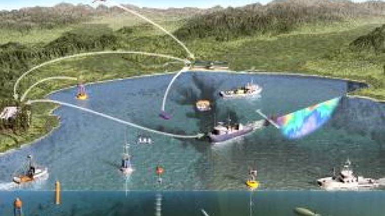
These are exactly the kinds of applications for which OGC standards could increase the leverage already gained by building on the ISO 19100 family. ‘Back of bridge' applications for fisheries, ocean observation, weather, harbour operations, science, pleasure boating, bathymetry, defence, coastal management, search and rescue, ocean energy, undersea resource exploration and other domains may further motivate expansion of S-100 to support OGC standards. These interface and encoding standards include the OGC Sensor Web Enablement (SWE) standards, which are already becoming widely used in ocean observation applications. The International Maritime Organization's emerging e-Navigation concept could be another important driver.
S-100 could be extended to include profiles of OGC standard web services and encodings of the OGC Geography Markup Language (GML) Encoding Standard, also called ISO 19136. GML is a core standard in the OGC and ISO TC/211 standards platform and it is by far the most important XML encoding standard for geospatial information. S-100 can be thought of as a kind of cookbook for defining hydrographic products. It is flexible enough to incorporate GML, and it is likely that a GML profile (and perhaps other XML profiles) of S-100 could be developed in the future, though not necessarily by IHO. Stakeholders having a need or desire for a GML profile in S-100 could work with the IHO and the OGC to help prepare a business case and arrange funding for this work. The IHO is responsive to such requests, but the organisation's mission is focused on nautical charting - meaning that additional non-charting applications will need to come with non-IHO resources - especially manpower.
As an industry standards organisation of technology users and providers, the OGC has an education, outreach and promotion mission. The OGC is available to help the nautical charting community understand the possibilities and uses of OGC standards. Also, the OGC provides a robust process for experimentation. Diverse organisations participate in OGC Interoperability Programme activities such as testbeds, pilot projects, research studies and interoperability experiments. These activities provide a way to prototype and try out standards and architectures, advancing the standards as well as advancing agencies' understanding of workflows and modern mainstream information technology practices.
Increasing Opportunities
Standards create a platform for product differentiation and economic development because they create larger markets that attract innovators and investors. They also create essential conditions for technology convergence. By sharing costs of standards development with other stakeholders in industry, government and academia, all of the stakeholders minimise their investment in producing long-lasting infrastructure that reduces costs and technology risks and increases opportunities for new market innovations. When standards organisations co-operate, as IHO has co-operated with the ISO TC/211 and as the OGC has co-operated with the WMO and others, everyone benefits through information sharing and through the many new personal and institutional connections that result.
We who concern ourselves with standards have a unique view of the richness of the domains we study within the information technology ecosystem. Each of these domains has many stakeholders bound together by interdependencies. Communicating about standards is perhaps the most effective way to achieve better communication systems that contribute to the success of all of the domain stakeholders.

Value staying current with hydrography?
Stay on the map with our expertly curated newsletters.
We provide educational insights, industry updates, and inspiring stories from the world of hydrography to help you learn, grow, and navigate your field with confidence. Don't miss out - subscribe today and ensure you're always informed, educated, and inspired by the latest in hydrographic technology and research.
Choose your newsletter(s)


