Fugro Expands High-resolution Subsea Laser Scanning
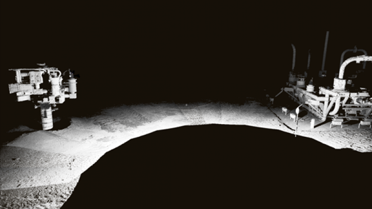
Fugro has expanded its services for the offshore oil & gas sector with the addition of high-resolution subsea laser scanning. This specialist technology can be applied to a wide range of subsea services including metrology, field mapping, structure mapping, change detection and integrity management.
Fugro’s Marine Construction Survey group based in Houston, Texas, USA, recently used subsea laser scanning in a number of successful projects in the Gulf of Mexico, including metrology and asset mapping. According to Fugro these projects delivered datasets that are un-matched by existing subsea technology. With subsea laser scanning, clients have an opportunity to gather high-resolution 3D point clouds of subsea assets which are used to obtain accurate point-to-point measurements and create highly detailed models to use in 3D GIS environments for asset management and operational simulations.
Fugro is very excited about the potential of this system and the increased value the company can offer their clients when collecting subsea datasets. The number of requests by operators for 3D visualisation of subsea assets has increased year-on-year and this system is proving to be one of the best on the market, said Dan Matthews, commercial manager at Fugro Chance, Houston.


