Fugro Partners on ‘4S’ Global Satellite Observation Seafloor Mapping Innovation
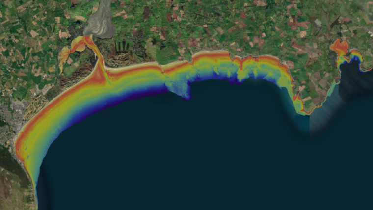
Fugro is participating in an EU co-funded research and innovation project to develop a remote solution for global satellite-derived seafloor mapping. The three-year project, named ‘4S’ (Satellite Seafloor Survey Suite), will develop an online cloud-based solution that will use highly automated earth observation algorithms and workflows to remotely map and monitor seafloor habitats, morphology and shallow water bathymetry.
Fugro will lead the project’s business and integration actions, and their hydrographers and geodata specialists will evaluate the solution via several use cases around the globe.
Integration of Satellite Data Analytics into Marine and Coastal Workflows
4S will leverage artificial intelligence, physics models, and satellite and airborne data to de-risk marine site characterization activities in the shallow water zone by quickly analysing seafloor properties using less personnel and equipment. The 4S consortium includes experts from the fields of satellite data analytics, hydrography and biology, and is being led by EOMAP, a leading company for optical remote sensing of aquatic environments. Other project partners include the Hellenic Centre for Marine Research, QPS, Länsstyrelsen Västerbotten, CNR ISMAR, the Hydrographic Institute and Smith Warner International Ltd.
Knut Hartmann, 4S project coordinator and COO of EOMAP, said: “The aim of 4S is to achieve a seamless integration of satellite data analytics into marine and coastal workflows. We’re combining recent advances in satellite sensors, data analytics and cloud infrastructure to benefit marine reporting, monitoring and surveying methods.”
Dhira Adhiwijna, Fugro’s 4S project manager, said: “Fugro is honoured to be part of an exciting EU innovation that could result in faster and safer geodata insights for our energy and infrastructure clients. Upon completion, 4S will be integrated into our high-speed hydrography offering, and provide innovative solutions that will also de-risk marine site characterization activities.”
This project has received funding from the European Union’s Horizon 2020 research and innovation programme under grant agreement No. 101004221.


