Fugro Starts NOAA Project to Update Florida’s Nautical Charts
Fugro has begun work on its first task order under a recently awarded multi-year hydrographic services contract with the US National Oceanic and Atmospheric Administration (NOAA). Located off the north-west coast of Florida, the project involves the acquisition of high-resolution bathymetry data over four sites totalling approximately 1,475 km2. Deliverables will be issued to NOAA by December and they will use this information to update charted depths and features in the region, many of which predate the 1950s.
To streamline the data collection, Fugro will deploy its new FAS-900 unmanned surface vessel (USV) as a force multiplier on the project. The fit-for-purpose USV is equipped with multibeam echosounder technology and is designed to increase the rate of data acquisition on medium- to large-scale mapping programmes. USVs reduce health and safety exposure and increase operational sustainability, all of which helps NOAA to achieve more efficient and effective nautical charting updates.
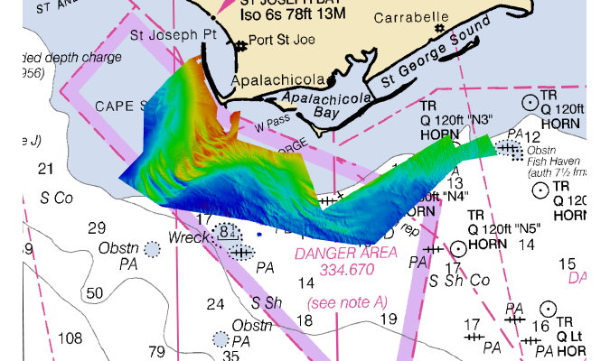
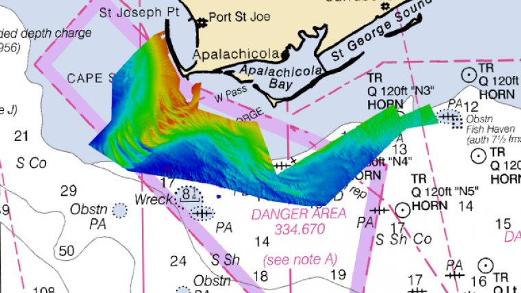
Big Bend Region
“We are pleased to continue working with NOAA to update nautical charts in Florida using our own industry-leading technology,” said Mark MacDonald, hydrography director for Fugro in the Americas. The company completed similar task orders in 2018 and 2019 under a previous hydrographic services contract with NOAA using crewed hydrographic survey vessels. “Deploying the FAS-900 on this year’s project will help ensure accurate and timely data collection ahead of peak hurricane season.”
In addition to addressing concerns related to migrating shoals in the region, Fugro’s 2020 task order will provide the first ever comprehensive mapping in the western portion of the Big Bend region, which is a priority of the Florida Coastal Mapping Program, a federal state initiative to collect modern high-resolution bathymetry for all of Florida’s coastal waters.