High-resolution Side-scan Processing
Chesapeake Technology has presented a high-resolution capability for SonarWiz 5 that doubles the resolution of the earlier version. The result for side-scan sonar data is crisper, sharper mosaics, waterfalls and sonar contact images. Christian Mueller, Humminbird’s SAR side-scan operator, said that on a recent search he was able to narrow down almost 70 targets in the survey area to just five, with the first one being a hit.
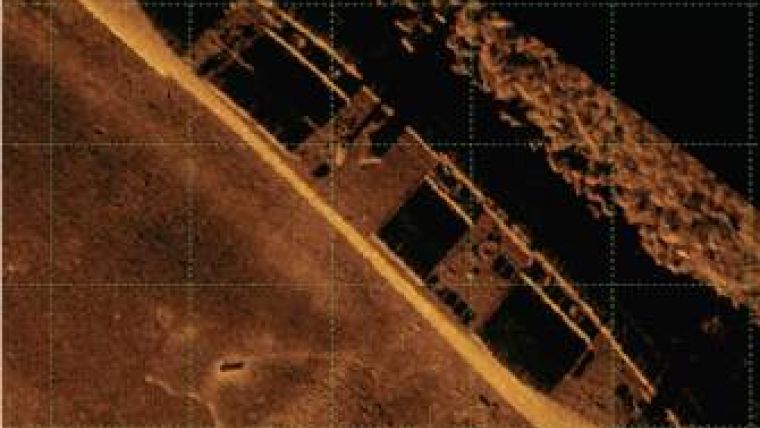
Surveyors in all types of industries can use high resolution to resolve smaller features and see finer detail to improve productivity, security and safety. For example, Navy Route Surveys can better detect and classify mine-like objects (MLOs). Fisheries researchers will better classify biological habitats. Archeologists will produce clearer images of shipwreck sites (such as the example on the right), and divers will get clearer maps of dive sites.


