Hydrography for Modern Water Management
Rijkswaterstaat Hydrographic Department
Dry feet, sufficient clean water and reliable and useful information. That is what integrated water management means to Rijkswaterstaat in the Netherlands. All measures are planned around the users, nature and the landscape and are carried out in close cooperation with water boards, other public authorities, NGOs and private organisations. Hydrography plays a major role in the work of Rijkswaterstaat. New demands from policymakers and the public as well as pressure on the budgets pose new challenges for the hydrographic department of Rijkswaterstaat.
The Netherlands has a love and hate relationship with water. First of all water is of major economic importance to the Netherlands for the transportation of goods from all over the world through the Port of Rotterdam to the European hinterland e.g. Germany. On the other hand, water forms a threat for flooding the low land.
Rijkswaterstaat is the Dutch government organisation responsible for the maintenance of the main water systems and main waterway network for shipping, flood conveyance and ecological purposes. Hydrographic information is essential for these tasks.
Rijkswaterstaat has made an inventory of all the uses of hydrographic information within the organisation, the most important being safety. The information is used to guarantee safe shipping to the major harbours of the North Sea as well as on the main inland waterways. The information is made available through port-ENCs and Inland ENCs.
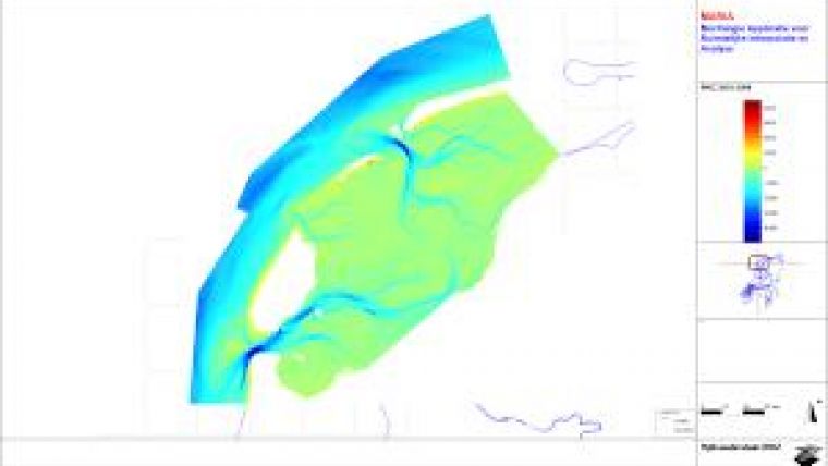
Another safety application is the defence against flooding. The coastal defence is based on the yearly measurement of the coastal zone and dunes. Numerical models, that need the bathymetry as input, are used to predict the water levels in case of high or extremely high river discharges.
Furthermore, hydrographic information is needed for the maintenance of the waterways by means of dredging and as a basis for different ecological information products. These products are required by various European directives.
Finally, some scientific studies (e.g. the Sandmotor project) make extensive use of all available hydrographic information.
The Hydrographic Department of Rijkswaterstaat
Rijkswaterstaat is one of major commissioning organisations for hydrographic work in the Netherlands. The other one is the Hydrographic Office, which is part of the Royal Netherlands Navy. Rijkswaterstaat and the Hydrographic Office plan their activities in close cooperation and exchange bathymetric and other hydrographic data.
Rijkswaterstaat has a department for data acquisition and processing. A total of about 50 employees work at the hydrographic branch and a fleet of 18 ships is available.
The Rijkswaterstaat organisation is rapidly changing. Whereas ten years ago almost all data acquisition and processing was performed by Rijkswaterstaat itself, most of the hydrographic work is now carried out by hydrographic contractors. Rijkswaterstaat is still responsible for contract management, quality assurance and data acquisition in special situations, like calamities.
A very recent development is the commissioning of hydrographic work in combination with major dredging contracts for the maintenance of the major shipping channels. More responsibility has been moved to the dredging contactors. This also means that extra attention needs to be paid to the data quality in the contracts.
These developments require a major change in the competence of the personnel. A strong focus is laid on quality assurance together with the contractors. A Dutch version of the IHO S-44 standard has been developed for very shallow water. These standards are imposed on all hydrographic work done on behalf of Rijkswaterstaat.
New Challenges
A new challenge for Rijkswaterstaat is the implementation of risk-based monitoring. Hydrographic surveying is always aimed at reducing risks. Based on expert judgement for all waterways, a resurveying frequency has been defined, but a direct link to the risks involved is absent. Expert judgement is not sufficient to handle major changes in the system, like the development of the Maasvlakte 2 harbour near Rotterdam. Quantification of the risks and incorporation of risks in the monitoring planning is a major challenge for the coming years. It will require a flexible organisation to react to upcoming risks.
Another development is the implementation of good data management practices. Within Rijkswaterstaat 28 different applications of hydrographic data have been identified and the principle ‘capture once, use many times’ is embraced. Outside the organisation there is a demand for the data. Rijkswaterstaat is currently implementing the open data policy. All these developments require data management to be a specialised profession in the organisation. Information on the current state of the waterways as well as historic information should be available to all interested people.
The hydrographic role within the organisation is subject to constant change and always adopts the most advanced technology. Therefore, professionals, young and old, like Level A and B hydrographic surveyors as well as academically educated professionals, are needed for the challenges described above. Rijkswaterstaat, together with other hydrographic organisations and companies, should be able to offer good prospects for these professionals.

Value staying current with hydrography?
Stay on the map with our expertly curated newsletters.
We provide educational insights, industry updates, and inspiring stories from the world of hydrography to help you learn, grow, and navigate your field with confidence. Don't miss out - subscribe today and ensure you're always informed, educated, and inspired by the latest in hydrographic technology and research.
Choose your newsletter(s)


