Ice-jam Floods
River Ice-jams cause Severe Flooding in Tom River, Western Siberia
The large, poleward flowing rivers of Siberia, such as the Ob River, experience persistent and severe floods when river ice breaks up in the spring. Ice-jams are common on the Tom River, a tributary of the Ob, resulting in a rapid rise in water levels upstream of the jam and submergence of thousands of homes. Sudden failure of the ice-jam releases a flood wave that can cause extensive damage downstream.
Floods in large rivers are caused by a variety of processes. River flows may rise to flood levels at different rates, from a few minutes to several weeks, depending on the type of river and the source of the increased flow. Slow rising floods most commonly occur in large rivers where the increase in flow may be the result of sustained rainfall or rapid snowmelt. Localised flooding may be caused or enhanced by channel obstructions such as landslides or ice. Land use changes, such as urbanisation or deforestation, can exacerbate natural flooding.
Rivers that are frozen for part of the year may flood as a result of ice-jams in the channel. Ice-jam floods commonly occur during the transitional periods of freeze-up and break-up, which mark the beginning and the end of an ice cover season. There are several kinds of ice-jams, depending on their formation mode, season of occurrence, spatial extent and state of evolution. At freeze-up, cold weather cools the river water to produce slush and ice pans, while at break-up, warm weather and increased runoff lead to fracture of the winter ice cover. In both cases ice slush, ice pans and ice blocks are transported on or near the water surface. If the movement of ice stops because it encounters an existing ice cover, or the ice transport capacity of the river is reduced locally, an ice-jam may form. Once initiated, jams propagate upstream in ways that are dictated by flow and channel conditions as well as by internal strength of the accumulation of ice slush and floes. Owing to larger flows, break-up jams typically have greater flooding potential than freeze-up ones. Ice-jam floods are particularly destructive because they cause water levels to rise higher and more frequently upstream of the jam compared to floods under open-water conditions.
Tom River
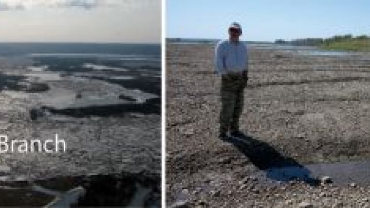
Persistent ice-jams occur in a reach of the Tom River approximately 15km upstream of the city of Tomsk (Figs. 1, 2). Scientists at the Hydrology Department of Tomsk State University have been monitoring this site and measuring stream flow since 1984, most recently using a standard, non-ruggedised Sontek 1000kHz acoustic Doppler current profiler (aDcp). The ADCP measures 3D current velocity by monitoring the Doppler shift of sound waves scattered from particles within the water. It is not possible to measure flow in the study reach during an ice-jam event so data are collected immediately after the area is clear of ice. Cross-sections of velocity and depth are routinely collected at the upstream and downstream ends of all of the channels. The measurements from 2009 that are reported here, however, focused on the confluences of the Svetlaya, Kaltaiskaya and Pankova branches (Fig. 2) where sediment waves, or gravel dunes are generated (Fig. 3).
Spring ice-jam floods at the study reach in the Tom River have occurred annually about 40% of the time over the period 1998-2011. Ice-jams in the reach follow three typical patterns (Fig. 1). Firstly, the obstruction occurs in the meander bend of the Tom River. The ice accumulates in the Tom and extends upstream to the entrance to the Svetlaya branch. Flow in the Tom is diverted primarily into the Svetlaya branch, which rejoins the main channel downstream of the bend. Secondly, ice accumulates at the downstream end of the Svetlaya branch, diverting flow into the Kaltaiskaya branch. Thirdly, ice accumulates in the Tom River and blocks the entrance to the Svetlaya, diverting flow into the Pankova branch and then the Kaltaiskaya branch. The ice is eventually flushed through the reach and all of the channels actively flow.
Flow measured with the ADCP in 2009 is largest in the Svetlaya, followed by Kaltaiskaya and Pankova. Channel width ranged from 117 to 330m, mean depth from 5 to 7.3m, velocity from 0.7 to 1.6m/s and discharge (width*mean depth*mean velocity) from 670 to 2966m3/s.
Gravel Dunes
Crestal areas of dunes often display scours caused by ice blocks. Measurements in 2009 showed that dunes were largest in the Pankova branch, followed by the Kaltaiskaya and the Svetlaya. Mean dune length at the sites ranged from 6 to 18m and mean height from 0.15 to 0.6m. Median sediment size was 0.01m in the gravel range at all sites. Simple, empirical dune models were used to estimate the flow conditions that created the dunes on the basis of dune and sediment properties measured at the three sites. Flow depth was estimated to be 0.9 to 2.4m, width from 118 to 463m, velocity from 1.7 to 2.4m/s and discharge from 670 to 711m3/s.
Flow depth is smaller and mean velocity is larger when estimated from the dune models compared to the ADCP measurements. Discharge estimated from the dune models is consistent for all three sites but is much less than the ADCP measurements.
These results indicate that the dunes measured in 2009 were generated by much shallower and faster flows than those measured with the ADCP. It therefore seems likely that the flows that created the dunes occurred during the falling stages of the flood when the depth was lower and the velocity higher.
Climate Change
The Centre for Climate Adaptation in Europe reports that the runoff of northern rivers in Russia, including the Ob, will increase significantly by the middle of the 21st Century. In particular, flows will be higher in the early spring due to more rapid snowmelt. This could lead to an increase in ice-jam floods and the duration of floodplain inundation may double by 2030. Observations from our study site on the Tom River support this scenario as ice-jam floods have become more frequent in the past decade, causing damage to local villages and engineering structures. An improved understanding of ice-jam flood characteristics is thus critical for planning.
Acknowledgements
We would like to thank the students and staff at the Department of Hydrology of Tomsk State University, particularly N. Inishev and Y. Korotkova for their able assistance. Funding was provided by the Russian Foundation for Basic Research (Grant 10-05-00625a) and the Natural Sciences and Engineering Research Council of Canada (Discovery Grant 400313).
More Information
Centre for Climate Adaptation in Europe).
Dobrovol’skii, S. G. and Istomina, M. N. (2009) Characteristics of Floods on the Territory of Russia with Regard to Their Natural and Socioeconomic Parameters. ISSN 0097-8078, Water Resources, 2009, Vol. 36, No. 5, pp. 491–506. © Pleiades Publishing, Ltd., 2009.
Papa, F., Prigent, C. and Rossow, W. B. (2007) Ob’ River flood inundations from satellite observations: A relationship with winter snow parameters and river runoff. Journal of Geophysical Research, Vol. 112, D18103, doi:10.1029/2007JD008451
Ray Kostachuk’s research focuses on collaborative field experiments on sedimentary processes in rivers, estuaries and lakes. He is currently working on sand and gravel dunes in rivers and density currents in glacial lakes, developing and applying instrumentation for fluvial research, including the acoustic Doppler current profiler (aDcp), acoustic Doppler velocimeter (aDv), laser in-situ sediment scattering transmissometer (LISST) and multibeam echo sounder (MBES).
Dmitry A. Vershinin is a head of the Research Laboratory of Hydrological and Ecological Problems and Associate Professor of the Department of Hydrology at Tomsk State University, Russia. He is an engineer/hydrologist and Candidate of Science (Geology). His research interests include fluvial processes, sediment transport, ice-jams, and modelling of hydrologic processes. He has more than 40 research publications and 20 reports.
Valery A. Zemtsov is the head of the Hydrology Department at Tomsk State University, Russia. He is an engineer/hydrologist, Doctor of Science (Hydrology), and Professor. His research interests include engineering and environmental hydrology, hydrological implications of climate change, modelling of hydrologic processes, hydraulic modelling, and management of water resources. He has more than 100 research publications and 5 monographs.

Value staying current with hydrography?
Stay on the map with our expertly curated newsletters.
We provide educational insights, industry updates, and inspiring stories from the world of hydrography to help you learn, grow, and navigate your field with confidence. Don't miss out - subscribe today and ensure you're always informed, educated, and inspired by the latest in hydrographic technology and research.
Choose your newsletter(s)


