Landsat Satellite Spots Shipwrecks
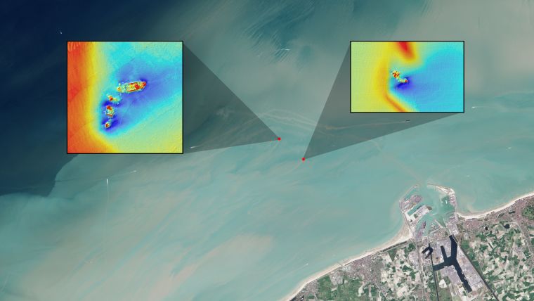
An estimated three million shipwrecks are scattered across the planet’s oceans. Most maritime mishaps occur close to shore where hazards to navigation — such as rocks, reefs, other submerged objects and vessel congestion — are abundant. It is desirable to know where they are located for many practical reasons. Streams around the wrecks create plumes that can be seen on satellite imagery in depths up to 15m, making wrecks easier to find as a recent test in Belgium showed.
Belgian scientists tested this using four wrecks near Zeebrugge. Their plumes were seen by Landsat-8; the trace was followed, leading to the wrecks. The ships may be of historical significance or, if the hard substrate of the ship has created a reef, of ecological significance. Modern-era shipwrecks are also commonly sources of pollution, leaking onboard fuel and corroded heavy metals. Near-shore shipwrecks can be navigational hazards themselves.


