Maiden Voyage Surveyor Interceptor Moved Traditional Boundaries
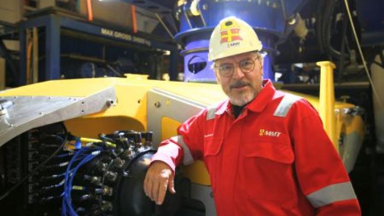
Hydro International Interviews Ola Oskarsson
You have heard of a remotely operated vehicle (ROV), but you might not have heard of the SROV yet. The S stands for Surveyor, meaning that the SROV Surveyor Interceptor is the first ROV built solely for subsea surveys, such as pipeline inspections, seabed mapping and environmental mapping. Compared to the techniques used to date, the outcome of the SROV’s first survey in March 2015 was much higher resolution imagery and multibeam data in less than half of the time, a world first. Hydro International interviews Ola Oskarsson, founder of marine surveying company MMT and project manager for the Surveyor Interceptor.
What made you think of developing the Surveyor Interceptor SROV?
After almost 40 years in the business I felt that there had to be a better way than using Work Class ROVs for advanced hydrographic surveys. A Work Class ROV is a machine constructed to replace divers underwater. It is equipped with videos, manipulators and mobility in all directions. When you equip it with survey equipment many problems arise: the hull is not hydrodynamic, the structure creates false echoes from the echo sounders side lobes, the vehicle is slow and noisy and the positioning struggles to get clear signals.
What did you consider to be important features of the SROV?
The SROV is designed to carry survey instrumentation to perform pipeline inspection, route surveys, subsea installation surveys and environmental surveys down to 2,000 metres water depth. By combining a hydrodynamic favourable hull, thin umbilical and extreme propulsion with the latest sensors the vehicle was developed to deliver never before seen ultra high-resolution data at a substantial lower cost per kilometre.
Where did you look for the specific technical expertise?
When I met the Norwegian ROV experts Jostein Alendal, Sven Magne Storsund and Erik Kold Backevig in 2010, the journey of developing the Surveyor Interceptor began. With a mutual vision of what was needed to perform high class hydrographic surveys MMT Sweden AB and Reach Subsea ASA jointly developed the Surveyor Interceptor for seabed mapping and pipeline inspection with the Norwegian ROV manufacturer Kystdesign AS.
Even with such a team, what did you consider to be the major challenges?
The project was initially met by much scepticism. The industry doubted that the Surveyor Interceptor and DP vessel would be able to move at 8 knots on autopilot. The idea of still imagery and laser replacing video and that laser would be able to detect ovality or damage of pipes accurately was also doubted. The industry did not think it was possible to solve the issues with umbilical and winch tension. But MMT, Reach Subsea and Kystdesign proved the naysayers wrong. There was no money available from industrial funds. So eventually we had to make our own investments with the help of bank loans. In the end we were given a development project from Gassco, which made the extensive sea trials possible.
Can you elaborate on the construction and test procedures?
The building of the SROV started in January of 2013. I commuted between Gothenburg, Sweden and Haugesund, Norway weekly until the building and testing was finished, and still make the long trip frequently. In August of 2014, factory acceptance tests were carried out in the harbour of Haugesund. Shortly after they were finished a mobile crane fell over and damaged the Launch And Recovery System (LARS) when the team was spooling the umbilical to the winch. It took until December to repair the damage. In December, the weather on the North Sea was so unforgiving that the testing had to be done in a Norwegian fjord instead of offshore, as originally planned. Finally, there was a weather window allowing the vessel Edda Fonn to get out offshore and work on Europipe 2. Due to a fire in one of the engines of the vessel, final testing was eventually done in January of 2015, six months later than planned.
After these tests, the concept had to be proven in a commercial setting. Did Surveyor Interceptor meet its ambitions?
In 17 hours and four minutes the Surveyor Interceptor inspected 105 kilometres of Gassco’s Knarr gas pipeline in the North Sea from the Knarr gas field, tied to the FLAGS pipeline system on the UK Continental Shelf, a world record. The pipeline lies at water depths between 140 and 400 metres in the northern parts of the North Sea. The inspection aimed to check the external condition of the pipeline and rock berm protection after pipe lying. I call the results astounding. The resolution of the still photography and the laser bathymetry renders unsurpassed detail and accuracy that allows 3D visualisation of the seafloor sub centimetre resolution. We can zoom in on tiny features and identify very small anomalies or identify marine life.
How did you achieve the accuracy of the SROV?
The SROV is equipped with an inverted Ultra Short Base Line (USBL) positioning system from Sonardyne in addition to Kongsberg Hipap transponders to achieve accuracy and ensure redundancy. Also the positioning is supported by 2 inertial navigation systems and a Doppler Velocity Log. The inverted USBL is placed on the front of the SROV, where there is minimum noise interfering with the survey. As the Surveyor Interceptor generates less noise and travel in a more stable water environment we achieve better positioning accuracy on our surveys. We use two underwater positioning systems - the SROV is positioned from the vessel and the vessel from the SROV.
How do survey operations relate to a comparable survey with an ROV?
The average speed was 3.33 knots and the SROV was operated at a top speed of 4.5 knots. This is about three times the speed normally achieved by a traditional ROV inspection at these depths. The Surveyor Interceptor also performed with high stability and reliability and the data acquired was of superb quality. It was processed and analysed continuously on the support vessel so that the reporting team was able to provide a field report to Gassco on demobilisation. The inspection was performed from MV Edda Fonn and manned by survey specialists from MMT Sweden and ROV specialists from Reach Subsea. Presently we are surveying the world’s longest HVDC route from Iceland to UK, the Atlantic Super Connector, with the SROV. 1,500km with water depths from 40m to 1,200m. The work is to be finished in July 2015.
One of the aims was to reduce the cost of a survey. Are there more lessons learned from a business perspective?
Most of the gas pipelines lie on the seabed, and ROVs controlled from surface vessels must therefore be used for maintenance and monitoring work. Such operations are basically expensive. Factors affecting the price include the offshore vessel, the ROV’s efficiency and the choice of inspection technology. That is where the SROV brings serious cost savings based on the reduced time spent; crew change, transit and other fixed costs remain. Apart from being fast and cost effective, another important aspect of the SROV is that it has a smaller environmental impact than other ROVs. The fewer hours you spend at sea, the smaller the environmental impact you make. If you work faster and more exact, you can cut back on vessel time and therefore the emissions.
What other survey types can you envisage for the Surveyor Interceptor?
I am passionate about mapping the seafloor in the most exact manner possible. A major part of the surface of the Earth has not yet been surveyed, and that is the oceans. We are still using ineffective methods, but by increasing the accuracy we can discover a lot of things on the seafloor that are still unknown. That is my driving force. I am interested in high resolution, high accuracy and the possibilities to deliver the same mapping accuracy under the sea as on dry land. I think of mapping of the seafloor, environmental impact assessment and habitat and geological research. The increased photo quality is a valuable tool for environmental investigations and geohabitat classification.
What made you choose still photography rather than videos?
Three machine vision cameras are synchronised with powerful strobe lights, taking 3D, stereo and geocorrected photos of the pipe to produce high-resolution GIS data of pipe status and possible third party intervention. The exposure time for the still photography cameras is down to milliseconds to avoid motion blur and ensure crisp colour seafloor imagery. The quality of these georeferenced pictures is approximately eight to ten times higher than that of standard HD video. From a video you can tell that a thing is round and that a fish was moving, but from a high-resolution still you can make exact measurements and quantify. These pictures are part of a mapping system where stereo and 3D images can be presented in true scale and position. Using still photography instead of video also saves a lot of storage space as every camera on the Surveyor Interceptor takes three pictures per second compared to 60 pictures per second on HD video camera.
Does the multibeam data quality meet your initial expectations?
As a result of the silent environment and the SROV being a very stable survey platform the multibeam data has less than 0.5 % outliers. The data is less noisy and more reliable than data acquired by a typical ROV. Less automatic and manual processing is required, resulting in less time and resources are spent on processing the data from the SROV. The possibility to map the seafloor with high accuracy at a lower cost will lead to increased safety for the environment and subsea installations.

Value staying current with hydrography?
Stay on the map with our expertly curated newsletters.
We provide educational insights, industry updates, and inspiring stories from the world of hydrography to help you learn, grow, and navigate your field with confidence. Don't miss out - subscribe today and ensure you're always informed, educated, and inspired by the latest in hydrographic technology and research.
Choose your newsletter(s)


