Map the Spill with Mobile App
Trimble has launched Map the Spill, a mobile app and website that empowers Gulf Coast residents and the public to report on the oil spill. Map the Spill allows those directly and indirectly impacted by the spill to capture and chronicle what they see happening to the land, sea and wildlife in their areas. Using rich media and Global Positioning System (GPS) technology, citizens can be part of a mass data collection process. The free app is currently available on Android and BlackBerry mobile phones and will be available soon on the iPhone.
Scientists, government agencies and non-governmental agencies (NGOs) that are taking part in clean-up efforts can use the data and content created and shared by Map the Spill users to assist in their efforts.
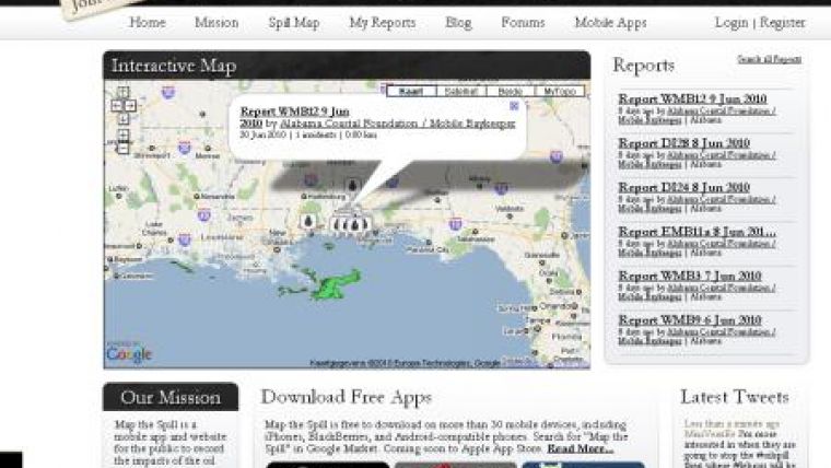
Focused on helping to capture the impacts and clean-up efforts of the largest oil disaster in U.S. history, Map the Spill allows users to log reports, upload photos, map their locations and share updates with other users. Mapthespill.org will serve as a content repository as well as a source for the latest news and tweets on the oil spill.
"Map the Spill provides an opportunity for individuals who are being affected by the oil spill to get the word out on the real-time repercussions as well as the collective clean-up efforts," said Rich Rudow, general manager of Trimble Outdoors. "Map the Spill empowers citizens in a way never done before, so entire communities can be a part of the reporting and clean up. Now individuals in the Gulf Coast can have an opportunity to take part in the oil spill story as it unfolds."
Map the Spill is collaborating with response teams and non-profit groups-such as the Alabama Coastal Foundation and Mobile Bay Keepers-to ensure the most helpful and relevant data is being collected by the public and volunteers.
"This application will be an invaluable tool for citizens in coastal areas affected by the oil release. The geographic scope of the spill as well as the nature of the oil coming onshore makes tracking and identifying oil impacted areas a monumental task; having so many sets of eyes on the coast will be an incredible asset," said Bethany Kraft, executive director of the Alabama Coastal Foundation. "Our own volunteer field observers will be able to migrate their data collection capabilities online and the mapping feature will allow the Alabama Coastal Foundation and our partners to identify areas that are not being covered so that we can direct volunteers to those locations that need special attention."
The app is designed for public use and serves as a repository for important scientific detail that will be utilized by a variety of organizations dealing with the spill. The app is designed to work in both land and sea areas even without cell coverage.
Map the Spill runs on Android-compatible phones and is free for download in the Android Marketplace. The app also runs on 16 BlackBerry devices and is free for download at MapTheSpill.org. It will be available soon in the BlackBerry App World and iTunes App Store for Apple iPhones.


