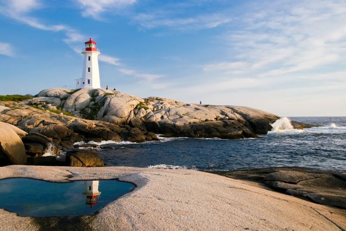
High-resolution bathymetric surveys support aquaculture research and increase navigational safety. In a case study, Tim Webster reports how this is done at Cape John Peninsula in Canada. In a second case study, Carol Lockhart describes a project in the Kingdom of Tonga, a Polynesian archipelago comprising 169 islands that stretches across approximately 800 kilometres in the South Pacific Ocean.
Measuring water depth for nautical purposes dates back to ancient civilizations. As technology has evolved through the centuries, besides ship-based echo sounding, remote monitoring and mapping of water bodies has become increasingly available via Lidar bathymetric surveys conducted by airborne systems.
New coastal survey sensors combining topographic and bathymetric Lidar are designed to offer more accurate data for environmental monitoring, research and surveying both below and above sea level. Bathymetric surveys allow professionals to measure water depth, map the underwater terrain, classify submerged vegetation and habitat as well as study marine ecology, water quality, contaminant spills and hydrodynamics.
The following two case studies describe instances of how bathymetric and topographic Lidar systems allowed researchers from the Nova Scotia Community College, led by Dr Tim Webster, to map Cape John peninsula in Canada and how Carol Lockhart from Geomatics Data Solutions (now Woolpert, Inc.) captured a 633-square-kilometre area over the South Pacific Ocean.
Mapping Cape John peninsula
Mapping shallow water and coastal areas using traditional aerial photography or boat-based echo sounder methods can be costly, time consuming and challenging due to water clarity and unforeseen weather conditions. To overcome these challenges and increase productivity and data accuracy, the research team from the Nova Scotia Community College decided to use the Leica Chiroptera 4X bathymetric and topographic Lidar for its geomatics research to survey the coastal zone of Cape John peninsula in Canada.
The purpose of the geomatics research was twofold. First, the team mapped the benthic habitat and the existing aquaculture in the bay, including the mapping of the shellfish infrastructure and the buoys to estimate how much biomass is being grown.
The second goal of the research was to develop a hydrodynamic model to help the lease of new oyster farms and propose the appropriate locations around the bay, without damaging the sensitive Zostera marinaor so-called eelgrass. The eelgrass beds are important for sediment deposition and nursery grounds for many species of fish and shellfish; thus it is used as an ecosystem health indicator by Fisheries and Oceans Canada (DFO).
The team carried out similar research in the Maritime Canada region in 2014 on how to optimize data collection and post-processing of shallow water topographic-bathymetric Lidar survey using the Leica Chiroptera II. This time, the researchers had the chance to deploy the new Chiroptera 4X and compare the captured data with results from 2014. To quantify the improvement of the point cloud density and target identification of the new Chiroptera 4X, the team compared the captured data of three surveying instruments: Chiroptera II, Chiroptera 4X and a multibeam echosounder.
This geomatics experiment involved the target surveying of four one-cubic-metre cubes at different water depths to determine the level of detail and data provided by the three different sensors.
Flying the Chiroptera 4X over the bay, the research team collected information on the surveying targets and compared the captured data of the terrain and seabed from 2014 with the data from this experiment carried out in 2018. Using the four cubes and other flat targets captured with the three different survey methods, researchers compared point cloud density, orthophoto mosaics, Digital Elevation Model and Lidar amplitude.
The analysis of the captured data was completed using the discrete points derived from the waveform data in Leica Lidar Survey Studio post-processing software for point cloud generation and cleaning of raw Lidar data.
Taking advantage of the Chiroptera 4X’s near-infrared laser for topographic data collection, combined with a green laser for bathymetric data collection, the research team precisely captured underwater features and generated virtual reality elevation models to study the benthic habitat. Additionally, researchers proposed sustainable locations for oyster farming without damaging the eelgrass habitat.
Safe passage through Pacific waters
The Pacific is an extremely culturally diverse region, as exemplified by the more than 1,000 languages spoken and, yet, what connects them is the water. The ocean and coastal seas have long been integral to the Pacific way of life. The economy, transportation and culture of those sharing the Pacific waters is based on the naval and marine infrastructure and ecosystem this ocean provides. Even though marine navigation plays a key role in the archipelago, the South Pacific is inadequately charted.
Shallow water depth range data is critical for safe marine navigation and for the construction of harbours, pipelines and any other infrastructure in the coastal area or shallow offshore zones. Without precise information on water depth and the exact location of underwater features and submarine canyons, economic and sustainable development is negatively impacted.
iXBlue together with project partners Geomatics Data Solutions (now Woolpert, Inc.) and EOMAP Australia were requested to map the Tongan archipelago and surrounding areas to provide the 3D water depth information and improve the nautical chart of the region.
The project was part of the Pacific Regional Navigation Initiative (PRNI), an overarching programme geared towards the safe and reliable passage through the Pacific Ocean while protecting the environment and allowing Pacific island economies to develop. The project was sponsored by the New Zealand Ministry of Foreign Affairs and Trade (MFAT) in partnership with Land Information New Zealand (LINZ).
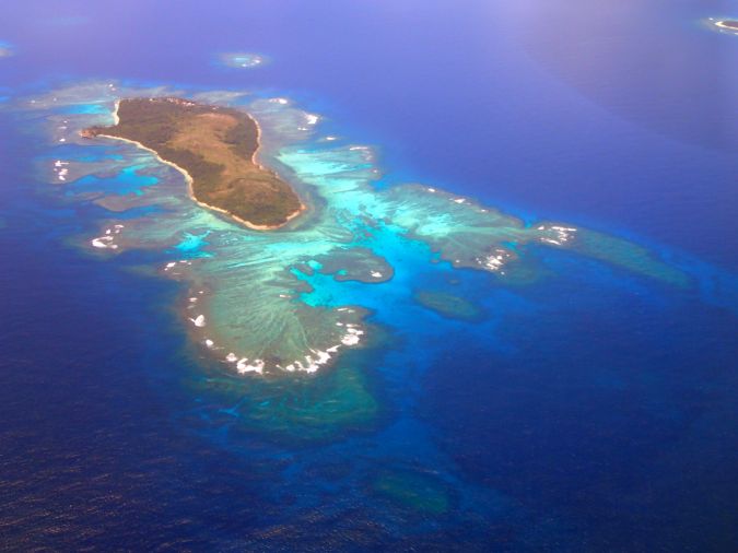
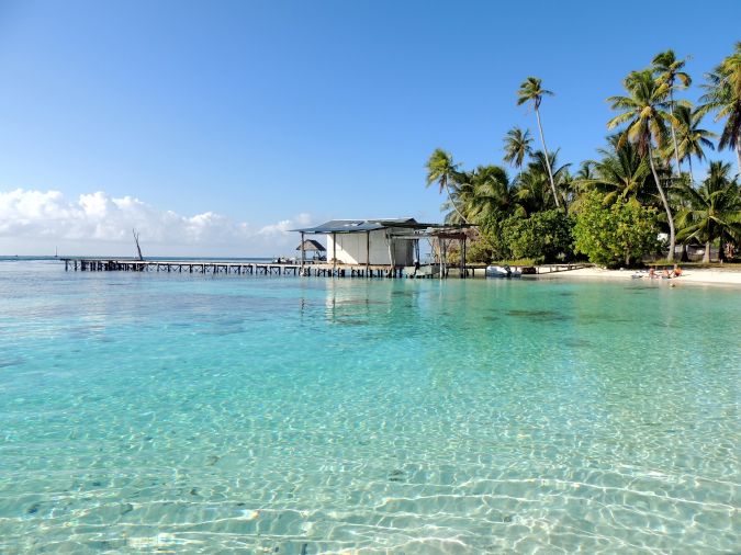
The Kingdom of Tonga, a Polynesian archipelago comprising 169 islands, stretches across approximately 800 kilometres in the South Pacific Ocean. In Tonga, agriculture, fishing and forestry provide the most employment. For this reason, detailed data on both land and shallow water features can support the sustainable development of the island group.
Considering the relatively large area in need of high-resolution survey and charting, LINZ required a smart solution to bring the most out of the tight budget. iXBlue, together with EOMAP Australia and Geomatics Data Solutions, applied a multi-sensor approach to collect topographic and bathymetric data, including Satellite-Derived Bathymetry (SDB), Airborne Laser Bathymetry (ABL), Multibeam Echosounder (MBES) and tide gauge install and datum computations.
SDB surveys are very effective tools in mapping large areas to the visible water depth. However, to capture high-resolution data on land and under water the Chiroptera 4X ALB was used.
The Chiroptera 4X was installed in a Cessna 441 to acquire data for Tonga and Niue, including Beveridge Reef, covering approximately a 633-square-kilometre area. Geomatics Data Solutions experts collected both high-resolution bathymetric and topographic data on- and offshore and compared the results of the Chiroptera 4X to SDB.
Besides the bathymetric data of the seafloor, one of the unexpected benefits Geomatics Data Solutions gained from using Chiroptera 4X was the improved penetration of the denser bathymetric laser data on land, providing full coverage even on dense vegetation where the topo laser did not penetrate.
Local stakeholders will receive full imagery and the topo-bathy dataset, so they can also benefit from the high-resolution data provided with the new Chiroptera 4X, and can use the data for other purposes in addition to improving the nautical charts. The combined use of different surveying equipment provided complete knowledge of all navigational-significant features and additional topographic information of the islands.
Surveying coast and land seamlessly
Responding to the growing need for collecting high accuracy data for environmental monitoring and surveying of shallow water regions, innovative, high-resolution technology was developed to allow professionals to survey and map above and below sea level with survey depths down to 25m.
Thanks to the 4X technology of the recently released Chiroptera, experts surveyed at four times the sounding density than was previously possible.