MSI Provides Metocean Data to Support Construction of Breakwater
MSI, a company that provides meteorological and oceanographic (metocean) measurement services, was recently contracted to install a range of equipment for a period of between 2 and 4 months in the Moroccan port of Laayoune. The city of Laayoune is a hub for fishing and for phosphate mining in the region.As part of port expansion plans, contracting company Archirodon was awarded an EPC contract which includes the construction of a new 950m breakwater.
Part of the breakwater will act as a quay structure for the berthing of vessels to provide loading/unloading facilities of solid and liquid bulk. Other infrastructure that will be built includes a 3.2km access bridge, aids to navigation and seawater intake and supply structures.
Metocean Data
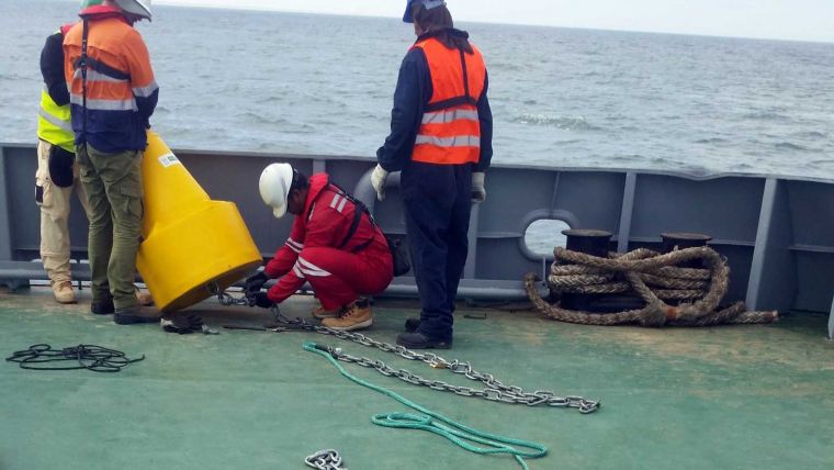
With any such marine construction, quality metocean data is required to assist with engineering design and this project is no different. The engineers require local measurements of waves (normal and infra-gravity), current profiles, water levels and meteorology and to this end, Metocean Services International (MSI) was contracted to install a range of equipment for a period of between 2 and 4 months.
In July 2019 they mobilized equipment from their offices in South Africa and Australia, as well as new equipment purchased for the project from the USA and the UK. Two seabed frames were deployed in 8m and 24m water depths, fitted with current profilers, satellite beacons and acoustic releases. The locations of the seabed frames are marked with surface buoys, also fitted with satellite beacons which provide MSI with regular position updates.
Onshore Weather Station
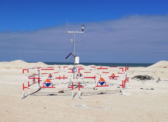
An onshore weather station was installed to measure wind speed/direction, air temperature, air pressure and relative humidity and data is being transmitted via GSM in real-time to a website for the client to access. The website presents present conditions, a 7-day time series, a daily report and also allows the data to be downloaded by the engineers.


