Technology in Focus: Multi-beam Echosounders
New Technology, New Capabilities and New Markets
The evolution of multi-beam echo sounders (MBES) is leading to systems with enhanced capabilities in their traditional markets, but also provides features to allow the expansion of their use into new areas and applications. This short review highlights some of the features of the latest generation of systems. The attributes of an MBES system are traditionally described by technical specifications, such as operating frequency, pulse length, beamwidth, number of beams and coverage. These technical parameters define the nature of the system, but the fundamental characteristics of greatest interest.
By Dave Mann, Gardline Geosurvey, UK.
Just as technological advances mean there are potential new market areas in what may be described as the higher end of the market, it is also apparent that potentially cost-effective systems are now available to users who may previously have only considered a single beam echo sounder (SBES) solution.
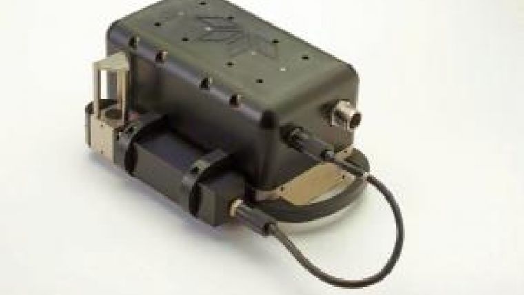
A further design influence for MBES systems is a requirement for compact systems with lower power consumption for installation on remotely operated or autonomous vehicles (ROV or AUV).
Multi-frequency
The quest for higher quality systems is primarily realised by increases in system resolution. These advances are largely achieved by producing systems of smaller beamwidths and reduced pulse lengths. Thus, it is now quite common to find systems with half-degree beamwidths, and beams of 0.3 and 0.4 degrees are available.
These specifications are to be found in systems catering for the shallow-water markets, which operate in the higher frequency range. Naturally, there is a trade-off between frequency and range. In order to achieve the highest resolution, a high frequency is necessary but useable range will then be compromised. Manufacturers are overcoming range limitations by introducing a frequency modulated (FM) sweep, in addition to the traditional continuous wave (CW) pulse. This feature allows greater energy in the pulse, providing enhanced range.
In order to allow some flexibility in operations, systems are now available that allow a selection of frequencies, typically in the 200 – 400kHz range for shallow-water operations, although at least one manufacturer has a system available with the additional option of 700kHz. At this frequency, the systems are approaching the same band occupied by scanners and imaging sonar systems, and it is evident that the technologies are converging around certain applications in the survey and inspection markets. In the medium and deepwater sectors various manufacturers also offer dual frequency capability.
Multi-transmission
As the MBES systems have been developed to offer narrower beamwidths, there has also been a complementary increase in the number of beams provided. This development has become necessary in order to retain the ability for full ensonification of the seabed. Although this term is no longer recommended for use in hydrographic standards, the implicit principle remains valid in specifications that are described in terms of size of detectable features.
Other enhancements have been made to improve the density of data provided by MBES. In a dual-head configuration systems are able to provide simultaneous ‘pings’ on both heads, rather than alternate transmissions. This has the obvious benefit of doubling the density of collected soundings. Further, systems are now available that provide the option of dual-swathe, which simultaneously provides two transmissions at each ping, even when operating in a dual-head configuration. The purpose of this facility is to provide double the along-track density of soundings, thus the second swathe is positioned slightly ahead of the first swathe. This feature complements the increase in (across-track) number of beams, but also has the advantage of allowing greater survey speeds for a given ping spacing, thus potentially increasing the efficiency of acquisition.
Beams or Soundings
Applying some numbers to this scenario quantifies the tremendous increase in the quantity of soundings that can now be acquired. Older generations of MBES may have typically produced between 100 and 200 soundings per ping. Modern systems may produce up to 400 or 500 soundings for a single head. Systems operating in a dual-head configuration and with dual-swathe capability may produce more than 1500 soundings per ping.
Progress in the provision of greater numbers of soundings has been allied to advances in beam-forming technology, so the user has much greater control over the distribution and application of those soundings. Beam-forming has advanced from the traditional equal-angle geometry, whereby most soundings were compressed within the centre of the swathe, and equal-distance beam spacing now provides soundings with an even distribution on the seabed, frequently available as a user-selectable alternative. Further, it is also possible to reduce the angular swathe coverage and maintain the same number of soundings, thus increasing the density further (at the expense of coverage). Alternatively some systems allow the swathe to be steered to one side or the other, which is a feature particularly useful for inspection work.
Other innovations allow for hybrid settings, whereby a specified sector of interest may retain a high density of soundings whilst the rest of the swathe is relatively low density, but still provides good coverage. This feature is aimed particularly at the pipeline inspection market and similar fields.
It should also be noted that the traditional association between number of beams and soundings is becoming less distinct. Some systems are capable of producing more than one sounding from a beam, and retain independence of the soundings by using a limited subset of samples within the beam.
Beam-forming technology is also better able to fully compensate for vessel motion, not just to correctly locate a sounding, but to ensure an even coverage is maintained regardless of sea state. Increasingly, systems are able to apply pitch compensation on
transmission, thus providing constant along-track spacing, and roll compensation on receive to ensure constant coverage to port and starboard. Some medium and deepwater systems also use multi-sector transmissions to additionally compensate for vessel yaw.
Bottom Detection
Much of the progress that has been made in the development of MBES systems has been enabled through general advancements in computer processor technology. This technology provides the raw power to enable more sophisticated processing of the sonar data. The benefit of this is most evident in the improvement of bottom detection algorithms. Systems now deliver impressively clean datasets even in traditionally challenging environments around structures and quay headings.
As development of MBES systems continues to deliver greater quantities of raw soundings, the ability to process and manage such datasets becomes a concern - during survey acquisition and subsequently during the processing, delivery and archiving of data. The ability to provide cleaner datasets, minimising the processing stage, is of great benefit.
In conjunction with these developments, MBES manufacturers and software developers are investigating the integration of echo sounder and processing software, allowing the real-time generation of bathymetry surfaces (within the processing software) as the survey progresses.
Backscatter and Water column
Discussion thus far has focused on the bathymetric capability of the echo sounder, but increasingly the ability to supply backscatter imagery and water-column data is of importance. The delivery of spatially registered backscatter from the beam-forming process has been an enhancement to the multi-beam in recent years. Improvement in the resolution of the MBES bathymetry has resulted in similar developments in the quality of the delivered backscatter.
Much research has been devoted to the analysis of MBES backscatter, with the goal of improving the ability to use this information in automated or semi-automated processes for the classification of seabed sediments and habitats. The ability to produce high-resolution, clean, calibrated and geo-referenced backscatter is essential to further this research.
There is interest in the acquisition of water-column (also referred to as mid-water) data for further analysis - recent research and development has focused on this data to assist in reporting the least depths above wrecks and other hazards to shipping. Another application is the detection of seeps and gases from existing infrastructure or natural features. There are many other potential applications related to the nature of the water mass and anomalies within it.
Many MBES systems are able to deliver the raw data for analysis. Further development is ongoing as the quality of the product is strongly influenced by ambient noise in the water, particularly outside the central sector.
Presentation and Exchange of Water-column Information
The presentation and exchange of water-column information is an area which remains largely unregulated by any standards. No longer is the interest confined to a surface, whether portrayed in 2D or 3D, but we are potentially modelling the 3D volume. A volume is impossible to render as a single static view, unlike the traditional bathymetry or backscatter chart. Sections through the volume along a plane of interest are useful snapshots, however new techniques and procedures are sought to fully exploit the potential of this data.
The hydrographic and offshore surveying community is moving closer to integrating and delivering products in a GIS environment, with raw data available for re-use in a range of other applications. The challenge of delivering new types of information presents an exciting opportunity for the developers and integrators.
Dave Mann is a graduate of the University of Nottingham with a Masters degree in Geodesy. For most of his career he has been employed by Gardline, initially as a field surveyor, later as assistant chief surveyor, survey support manager, and now head of Geomatics, with responsibility for survey, vessel, and IT systems.

Value staying current with hydrography?
Stay on the map with our expertly curated newsletters.
We provide educational insights, industry updates, and inspiring stories from the world of hydrography to help you learn, grow, and navigate your field with confidence. Don't miss out - subscribe today and ensure you're always informed, educated, and inspired by the latest in hydrographic technology and research.
Choose your newsletter(s)


