New Challenges for Digital Chart Production
Advanced Technical Solutions Need to Be Implemented
Hydrographic Offices have realised that bathymetric data is not sufficiently represented in Electronic Navigational Charts (ENCs). A few aspects of this topic have already been touched upon in the presentation called ‘Innovative approach in automated contour generation’ that was presented at Hydro 2017. This article focuses on the challenges of high-density bathymetry chart production and introduces a new approach to cope with it.
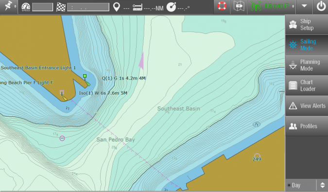
In the past, ECDIS users have repeatedly complained about the lack of bathymetric detail in Electronic Navigational Charts. The resolution of depth information is too coarse to adequately display the extent of areas that are safe for navigation.
The article Bathymetric ENCs in Confined Waters [2] that featured in Hydro International (June 2018) explains this in an excellent manner.
Recent Initiatives by IHO and Hydrographic Offices (HOs)
In the last few years the topic has been discussed at various IHO meetings (HSSC, ENCWG, etc.). Most HOs supported the initiative for High Density Bathymetry ENC production, but concerns were expressed, including additional manual effort, 5MB file size limit for ENCs, and new ENC layout.
In February 2018, UKHO announced [3] that it had issued a High Density ENC. The ENC covers a small area of the Bristol Channel (2.2 by 1.3km). To confirm accuracy the results were checked manually. In addition, the Australian Hydrographic Office published a paper [4] describing their successful experiences with the production of High Density ENCs. The article Bathymetric ENCs in Confined Waters [2] mentioned earlier describes the long way AHO had to go until they were in a position to successfully produce High Density Bathymetry ENCs.
The transition from a proof of concept to the implementation of an operational service is the next big challenge.
Existing Solutions for the Production of High Density Bathymetry ENCs
Solutions for the automated production of High Density Bathymetry ENCs have existed for many years. Despite the fact that the data is usually technically correct and standard compliant it misses the cartographic ’touch’. All solutions have in common that the main focus was given to automation and efficient processing of large data volumes. Often the resulting contours are jagged, not generalised to scale and prone to clutter. Some manufacturers use ’cookie cutter’ methods to update ENC depth information. Hence the resulting ENC bathymetry is not smoothly integrated and resembles a single bathymetry patch. Other manufactures have come up with solutions where high density bathymetry is maintained and provided in separate S-57 layers complementing the regular ENCs.
Nevertheless, all of these manufacturer-specific solutions have been implemented successfully on a regional basis in close cooperation with local stakeholders and authorities (ports, waterway authorities, pilots). They have not been designed to be used in ECDIS at all. The data is mainly used in portable navigation systems for pilots. However, from an HO perspective it may not fulfil all quality standards.
A New Approach to High Density Bathymetry ENCs
More recently an approach has been introduced that provides an improved solution for the production of High Density Bathymetry ENCs. It reduces the amount of manual work required for the creation of contours and selected soundings, supports automation and honours cartographic principles. Ideally the workflow should start where the underlying source datasets are managed. In this respect, the ‘Seamless Point Surface’ concept that was also introduced in the Hydro 2017 presentation [1] fits perfectly.
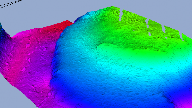
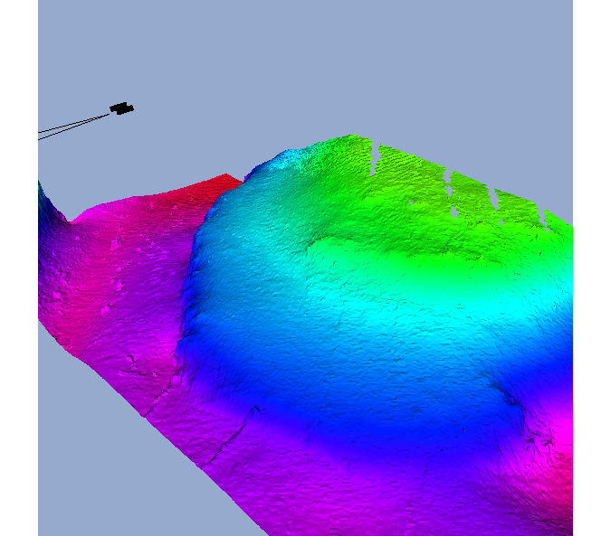
The new approach derives contour lines from a Nautical Elevation Model (NEM). A NEM is a shoal-biased smoothed-out and generalised underwater terrain model. It can be imagined as a draped sheet over rough bottom topography. If a little bit of tension is applied to this sheet it will form a smooth surface. This new surface touches the original model at shallow peaks and bumps and smoothes out noisy terrain and deeper holes.
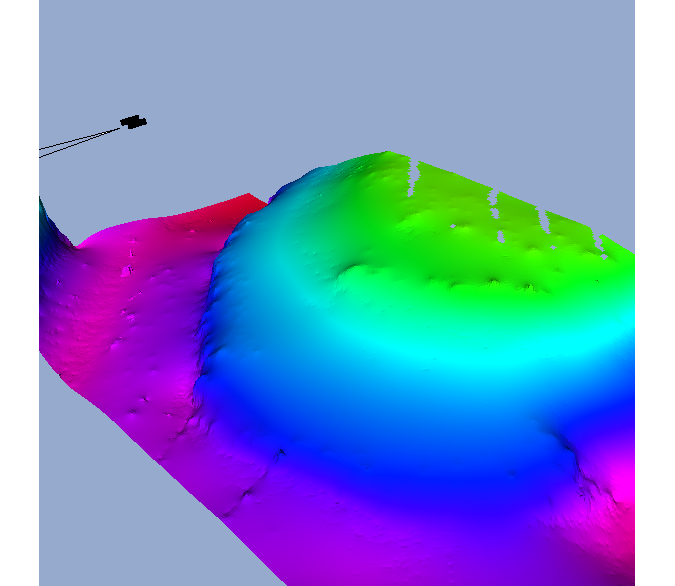
Creating the contours directly from a rough source terrain model would result in ‘noisy’ and jagged contour lines. Usually line smoothing algorithms are not shoal-biased. This is why a Nautical Elevation Model is used instead. If derived from a smooth surface the resulting contours have a smooth appearance as well. This is not only an aesthetic aspect but contributes to better chart readability and overall acceptance. The shoal-biased character guarantees that the resulting contours correctly represent the minimum depth.
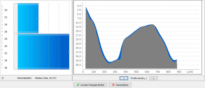
The Nautical Elevation Model can be generalised to a distinct product scale. The degree of generalisation is controlled by means of a parameter set that is used by the processing algorithms.
Some aspects of the Nautical Elevation Model are similar to the cartographic extraction methods of the Navigation Surface approach [4]. Both use a kind of sheet model for generalisation and smoothing of gridded bathymetry. Such sheet models, however, tend to ’over-generalise’ steep terrains and features like edges of dredged or natural channels. This is why the Nautical Elevation Model integrates methods to dynamically configure the degree of generalisation at different vertical levels.
Once the appropriate generalisation parameters have been defined and the Nautical Elevation Model has been generated contours can be created. An additional process automatically creates the area-polygons of the depth areas between the contour lines.
The proposed solution can be used to generate contours at much denser intervals than usually found in traditional ENCs. Special effort was made to make sure that the results comply with the strict topology rules for ENCs (IHO S-57, ENC Product Specification, and S-58 Validation Checks).
When contours are created at metre or sub-metre intervals not all contouring algorithms achieve error-free results. This is especially true in terrains where contours are getting pushed very closely to each other. It might be worth mentioning that we are not only talking about obvious errors that are visible to the human eye. Even visually insignificant errors can be the reason for erroneous S-57 topology and must be avoided.
Once automated production workflows for the generation of High Density Bathymetry Charts are in place it is no longer practical to check and validate the results visually/manually. Solutions that allow for automated validation are required. To confirm the reliability of the new contour generation methods, S-58 validation software was extended and improved to be able to handle the large number of lines and areas.
Dozens of high density S-57 datasets were created and repeatedly tested with the new S-58 validation software in order to fine-tune the contour generation process. Finally a no-error quota of 99% was achieved. This means 1 dataset out of 100 would require manual corrections.
How S-100 Deals with High Density Bathymetry
IHO’s S-100 is the framework for the definition of multiple future digital products required by the hydrographic and maritime community. Within the S-100 family S-101 is the new specification for ENCs, and S-102 describes a gridded representation for high density bathymetry.
S-101 ENCs can include high density contours in the same way as S-57 ENCs. Both represent depth information by means of soundings, depth contours and depth areas. Hence the production procedures described above are suitable for both S-57 ENCs and S-101 ENCs.
S-102 uses a completely different model for depth information. It is based on a gridded structure and does not use line or area features. In a high-resolution S-102 grid (e.g. 1m x 1m) each 1 by 1m grid node represents a single depth value.
S-102 is seen as bathymetric complement to ENCs in ECDIS. It has some advantages over the line and area bathymetry of ENCs: it allows for 3D display of depth information, it is suitable for applying advanced water level correction models (e.g. to show real water depths) and it can represent bathymetry close to survey resolution.
However, since S-102 has some disadvantages as well (large file size, too much detail and tendency to cause clutter), high density bathymetry in S-101 ENCs and S-102 gridded bathymetry should complement each other.
Up to defined depths, larger scale ENCs could contain high density bathymetry where they cover channels and fairways. The data should be complemented by S-102 gridded bathymetry in congested or extremely shallow waters and areas where safe navigation is affected by strong variances of water level.
Conclusion
HOs will face new challenges if they decide to take the step into regular production of High Density Bathymetry ENCs. Advanced technical solutions are available and will have to be implemented to cope with the new challenges. The introduction of S-100 based digital products will provide additional options.
References
[1] Uitentuis, Moggert-Kägeler, November 2017, Innovative approach in automated contour generation and sounding selection based on the Seamless Point Surface concept, Hydro17 Conference Handbook, 42, https://hydro17.com/doc/Hydro17_Conference_Handbook.pdf, [visited April 2018]
[2] Antonio Di Lieto, Mike Prince, Alvaro Sanchez ,Hydro International, June 2018, Bathymetric ENCs in Confined Waters, https://www.hydro-international.com/content/article/bathymetric-encs-in-confined-waters, [visited June 2018]
[3] Admiralty Press Release, February 2018, UKHO produces ENC with one-metre depth contours to support navigation in the Bristol Channel, https://www.admiralty.co.uk/AdmiraltyPressReleasesLibrary/UKHO%20produces%20high%20density%20ENCs%20of%20the%20Bristol%20Channel.pdf, [visited April 2018]
[4] Australian Hydrographic Office, 2018, AHO’s experience producing High Density (HD) bathymetric ENCs”, Paper for Consideration by ENCWG3, https://www.iho.int/mtg_docs/com_wg/ENCWG/ENCWG3/ENCWG3-5.2.1_AHO_experience_producing_HD_Bathymetric_ENCs.pdf, [visited April 2018]
[5] Shep M. Smith LT, Lee Alexander, Andy Armstrong, 2002, The Navigation Surface: A New Database Approach to Creating Multiple Products from High-Density Surveys, 20, https://scholars.unh.edu/cgi/viewcontent.cgi?article=1976&context=ccom, [visited April 2018]

Value staying current with hydrography?
Stay on the map with our expertly curated newsletters.
We provide educational insights, industry updates, and inspiring stories from the world of hydrography to help you learn, grow, and navigate your field with confidence. Don't miss out - subscribe today and ensure you're always informed, educated, and inspired by the latest in hydrographic technology and research.
Choose your newsletter(s)


