New Robotic Survey Techniques to Monitor Changes in the Port
Hayle Harbour Authority has partnered with Unmanned Survey Solutions (USS) to help with the development of robotic vessels in performing hydrographic surveys in Hayle Harbour, Cornwall, England.
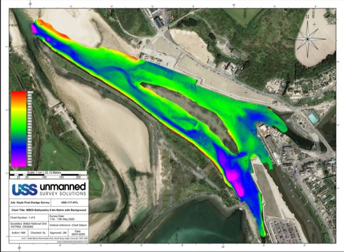
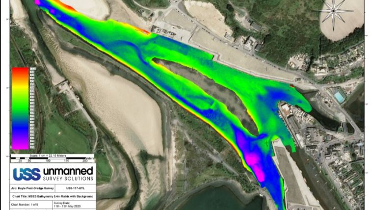
The aim is to monitor the effects of dredging, sluicing and periodic natural changes to the depths of the harbour in fulfilment of its conservancy requirements, and to ensure safe operation for harbour users.
Unmanned Survey Solutions (USS) are based on North Quay, Hayle. They design, build and operate Unmanned Surface Vessels (USVs) or ‘robotic boats’ and are often out testing new systems in local waters with permission from the Harbour Authority. During these trials, hydrographic data is collected, which provides the Authority with updated charts.
USV Operations in Busy Waters
Hayle Harbour Master, Peter Haddock explains: “Regular surveying of the harbour helps us to fulfil our conservancy duties, but also to closely monitor our dredge operations. By using the data gathered by USS, we can direct that operation and reduce any risk to harbour users.’’
James Williams, director of USS, commented: “USV operations in busy waters can be challenging, especially during the tourist season. This is exacerbated with high tidal ranges and areas of shoaling throughout the harbour at low water.
“By working closely with Peter and his team, we have been able to develop safe working procedures for our vessels. We also manage to time our testing activities to coincide with pre- and post-dredging operations, so that we can effectively inform the Authority on the effects these dredging activities are having on the environment.”
Hayle Harbour Authority and USS intend to map the harbour every three months throughout 2020 to gain detailed insights into how the harbour changes throughout the seasons. USS are developing larger USVs, and they plan to monitor dynamic changes to the entrance channel and the shallow outer sand bar over the next 12 months.